THE KITCHEN SINK...
- Mar 30, 2022
- 3 min read
A complex interaction of energy will drive the development of a strong midweek storm the next 24 hours. The system is complex in that multiple pieces of energy will consolidate in such a way as to transfer (or hand-off energy) from an initial wave to a secondary one that becomes the alpha storm later Wednesday or Wednesday night. The end result is a deep low pressure that brings a wide variety of weather to the Midwest the next 24 hours (what I would call the kitchen sink).

The satellite image above from Tuesday night shows the classic mid level cyclone with the trough emerging from the southwest. The warm sector is lighting up with showers and thunderstorms while snow is found in the cold sector from the Rockies into the upper Midwest. It's the age old battle of spring warmth butting heads with the remnants of winter.
The initial onslaught of warm advection in advance of the storm has brought showers and even some thunderstorms to the region overnight. Temperatures have also been on the rise as a warm front slowly advances into my northern counties. Thursday morning my area enters the warm sector for a short period of time and highs should reach the mid 50s north to the low 60s south (perhaps mid 60s in the far southeast). The EURO is very aggressive on the warmth showing all of my area reaching 60-65 before a cold front sweeps the region early in the afternoon.

Showers and thunderstorms on a scattered basis are still likely Wednesday ahead of the cold front. These should wane as the cold front advances east during the late morning and afternoon. Eventually energy is transferred to a new center of low pressure that forms in WC Illinois along the cold front in the afternoon. This reinvigorates precipitation by allowing the development of a deformation band on its backside. By this time temperatures are beginning to trend downward as strong cold air advection develops.
Precipitation begins to fill in again by Wednesday evening and eventually lows dip into the low to mid 30s by daybreak as the low deepens to the east. That allows rain to mix with or change to snow before it ends Thursday. More on that in a minute.
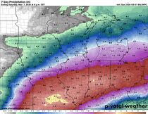
With regards to total precipitation, the general idea is that most areas will see a good 3/4 to 1.25 inches of rainfall with localized spots with up to 2 inches in the southeast. There is a dry slot issue that remains a challenge to forecast and where it occurs, right under the track of the surface low, is where the lower 3/4 inch amounts are expected to be found. Here's what the latest models are indicating for liquid precipitation. Everybody should see a good soaker.
THE GFS

The EURO

The 12K NAM

The 3k NAM

THE HRRR

The snow forecast is a difficult one to be sure with marginal temperatures and a high degree of difficulty determining when the transition from rain to snow takes place. If the switch occurs early 1-2 inch accumulations are possible in my northern counties, mainly on grassy and elevated surfaces late Wednesday night and Thursday morning. Some models are even more aggressive with totals with up to 4 inches. Needless to say confidence is very low on snow accumulations but I do expect areas north of I-80 will see at least a dusting with totals increasing as you go north from there. Hopefully things are a little clearer Wednesday as the storm shows its hand. Here's the raw output of what models are currently depicting. Again, these are not forecasts, just a sampling of the options available to choose from.
The GFS

The EURO

The 12K NAM

The 3k NAM

The HRRR

No doubt Thursday with brisk NW winds and snow or snow showers will be a very raw day as March goes out like a lion. Highs will remain in the 30s with wind chills in the low to mid 20s much of the day. The HRRR shows this for wind chills at noon Thursday.

Friday things calm down and temperatures moderate but remain far below normal. Highs will only reach the mid to upper 40s but at least there should be sunshine.
The weekend sees another system (fortunately much weaker). Rain (or snow north) looks likely along with chilly highs in the upper 30s north to the mid 40s south. Enjoy Wednesday's brief period of warmth, it won't last long and then things could get flaky, especially for those north of I-80 by Thursday! Roll weather...TS


Comments