TRANSITION DAY...
- Jan 9
- 3 min read
We had ourselves an eventful day of weather Thursday with active showers and a few thunderstorms and temperatures that were at the highest levels of the new year. Keokuk soared to 61 degrees and Ft. Madison was right behind at 59. Readings at 6:00 in the evening were still as warm as 52 as far north as Dubuque.

Dew points were exceptionally high in southeast Iowa and WC Illinois, at one point reaching the upper 50s. That's not a common sight to see January 8th.

My climate GURU Steve Gottschalk tells me he had over half an inch of rain. With minimal frost in the ground, much of it soaked in, making it very beneficial considering many areas are still considered to be in drought. Steve also told me the dew worms were out exploring Thursday evening, which is more typical of March than the dead of winter.
As for rainfall, everybody picked up some beneficial amounts thanks to the strength of the system and the vast amounts of moisture it contained. In the animation, you can see the well-defined comma head representing the deformation zone, the dry slot in yellow, and thunderstorms erupting over Illinois in the warm sector. We had a few storms of our own and several thunderstorm warnings were issued for eastern Iowa, but at last check, I have not seen any reports of severe weather.

At the time of this radar image around 6:45pm Thursday, the dry slot was readily evident over my area, with the surface low tugging dry air into its center as it advanced into NE Iowa.

Doppler indicates the heavier rains in my area fell from roughly the Quad Cities NW where 1/2 to 1 inch amounts were common, with the higher 1 inch totals NW of a line from Cedar Rapids to west of Dubuque.

Friday’s weather will be dominated by weak high pressure and a much drier air mass. Clouds are expected to depart in the morning, allowing some welcome sunshine to break through by afternoon. Temperatures will be cooler than Thursday, but still well above normal, in the range of 42 north to 47 south.
HOT DEALS IN JANUARY....
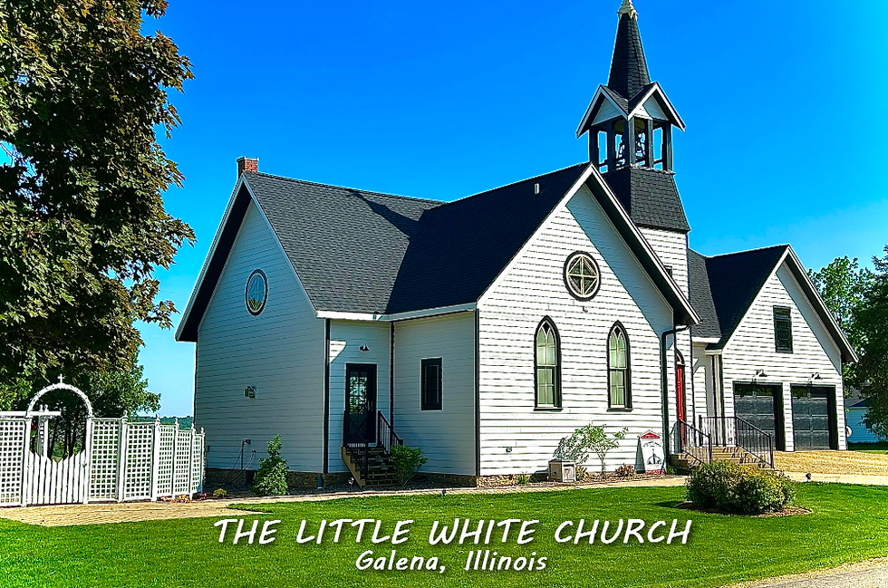
A January weekend, (4 GUESTS FOR $499 total) My AIRBNB outside of Galena is ready and waiting. Enjoy our unique, fully renovated church. It's an AIRBNB guest favorite with 5-star reviews. Warm and cozy, even in the winter. Minutes from Galena. Call or text Carolyn at 563-676-3320 for details about this very special deal. https://www.littlewhitechurchgalena.com/
STORM NUMBER 2...
Friday night, colder air filters into the region, allowing whatever precipitation falls to come in the form of snow. This disturbance is far weaker than Thursday's, and really doesn't get its act together until it's east of my region Saturday night. Going into Friday, the energy involved is split, with one center in the four corners region and the other dropping south towards North Dakota. By the time these merge and develop an organized surface low, most of the moisture and forcing is aimed at the Great Lakes.

That said, there is a window for some light snow to sweep in and brush the region late Friday night into Saturday morning, especially east of the Mississippi. QPF is generally 1/10th of an inch or less. That and the fact snow ratios at best look to be 10:1 should keep most accumulations to 1/2 inch or less, although a few spots in NW Illinois could push an inch. With the ground and road surfaces as mild as they are, that should avert any serious travel impacts locally. Here's what the latest models suggest for accumulations.
The EURO

The GFS

The NBMv5 A blend of 30 models and ensembles.

The HRRR

The Canadian RDPS 10k

Some lingering snow showers may continue into Saturday evening in the north before ending. Then the focus turns to strong northwesterly winds and much colder temperatures. Strong cold air advection will drop lows into the upper teens to low 20s. Toss those winds into the fray, and wind chills in the single digits will greet you Sunday morning. Winds will back off later in the day and some sunshine should eventually get highs back to the upper 20s and low 30s, about 30 degrees cold than what we saw Thursday.

Northwest flow sets up next week, with disturbances rippling southeast on a regular basis. At this point, none of them are expected to produce much if any precipitation. However, after a nice warm-up Monday, another stout cold front Tuesday brings a healthy shot of wind driven Arctic air midweek. One down, one weaker one to go. Roll weather...TS
TSWAILS.COM expert weather consulting services (CLICK FOR MORE)
Private consulting
Legal forensic services as an expert witness
Public speaking engagements for groups or individuals
Post storm analysis
A private day-long weather school class
Specialized events forecasts
Severe weather seminars
Lectures and training
Climatological services
Meteorological workshops.


Comments