


WEATHER ROLLER COASTER WEEK AHEAD
- Oct 12, 2025
- 2 min read

After some relief from the heat, we are warming up this weekend once again before we enter a bit of an active week with ups and downs, a potential strong weekend storm, but overall low confidence in any beneficial rainfall as the drought continues to get worse locally.
Looking towards the weekend, the European ensembles show a storm system in the central US with a wide range of potential outcomes with a storm tracking from eastern Iowa to potentially as far south as the Dallas/Fort Worth metro. This highlights the high amount of uncertainty with this system in the longer range that could bring some heavier rain and even strong storms.

A cold front Monday/Tuesday will send temperatures down midweek with another warmup ahead of the next weekend storm system. Mid-70s are looking increasingly likely by the end of the work week before we likely see a stretch of weather near-normal for a change. Autumn is coming, a signal we have been hinting at for nearly two weeks now!

The pattern should be rather amplified with this storm system with a strong trough expected to eject across the Midwest. Ahead of this, there will likely be strong southwest flow pumping in some moisture that could generate some beneficial rain for some, but where the heaviest rain falls is too early to tell.

Friday afternoon to Saturday afternoon ensemble mean shows 0.25" across eastern Iowa, northwest Illinois and northern Missouri. This is at least a sign that locally could benefit from heaviest precipitation this system could provide. 'When in drought, have some doubt' continues to be something to keep in mind, but at least in the extended forecast, the trend so far is favorable. I am far from "lock it in" territory.

Guidance indicates the moisture levels of the atmosphere will likely be on the higher side of climatology for this system, with precipitable water potentially being in the 90th percentile. If we see rain and storms, given this it could be on the heavier side of things.

One-week rainfall probabilities of 0.5" of rain is sitting around 60-70% locally - not amazing, but if we can somehow pull that off, it would make a small dent into the drought conditions.
SHORT-TERM FORECAST
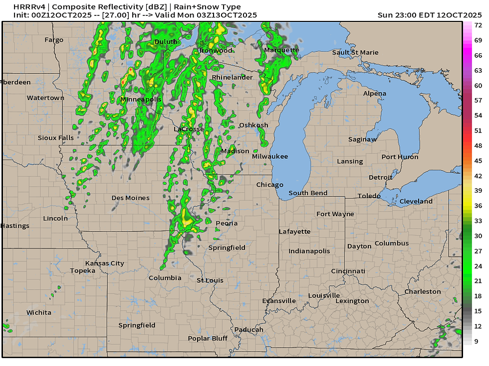
In the short term there are a few things to watch - the radar might look active late Sunday afternoon and evening however much of this rain will likely not reach the ground. The HRRR indicates scattered like showers ahead of a weak cold front Monday.

Forecast soundings indicate some rather stout dry air near the surface that will likely prevent much of this rain activity from reaching the ground. You might see some virga in the sky. With this evaporative process, some stronger wind gusts could potentially mix down to the surface reaching 25-35mph in the late afternoon and evening. If you have any inflatable Halloween decorations on the front lawn, make sure they are secure or there might be pumpkins flying down the streets!

Tuesday and Tuesday night there will be another chance for light showers in the area, but again this will be quite minimal in terms of accumulation if any at all. Increasing cloudiness would be the most notable thing.
Have a great rest of the weekend everyone!
-Meteorologist Nick Stewart


Comments