STILL A GO FOR SNOW...SUNDAY UPDATE!
- terryswails1
- Feb 4, 2018
- 2 min read
The morning data push is complete and I've not seen anything dramatically different. That means it's still a go for a moderate strength snow system for Monday and Monday evening. The Weather Prediction Center has 70-90% odds of at least 2" of snow for the heart of my area.

The NWS in the Quad Cities put this experimental snowfall forecast graphic out earlier Sunday.

The NWS also put this story board out regarding the event.

So far the NWS has not issue any advisories which is a bit surprising since the event is less than 24 hours away. I assume those will come in the afternoon update package. For most areas this will be a high end winter weather advisory event. Most models indicate snow ratios of at least 15:1 with 3-4 tenths liquid equivalent. If the forcing comes together right in the dendritic growth zone some isolated 7-8" totals could occur. That would elevate the event to warning status but I doubt warnings will be issued, at least initially.
You can see below the snow edging into my western counties by late Monday morning on its way to Illinois.

Here are the latest snowfall forecasts available from the morning models.
The EURO

The regional perspective of the EURO.

The GFS:

The regional perspective of the GFS

THE NAM.

The regional perspective of the NAM.

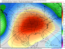
In passing, I will also say both the EURO and GFS paint a very snow picture with 2 more systems between Tuesday and the coming weekend. It's too early to get into amounts but it seems possible that some part of my area could pick up an additional foot of snow during that period. I'm seeing numbers that I haven't seen in a long long time. Very exciting! Roll weather...TS


Comments