TALKING TURKEY AND PERHAPS A BIG STORM....
- terryswails1
- Nov 19, 2018
- 2 min read
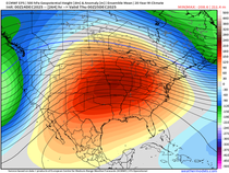
No doubt about it, November has not been kind to the Midwest (or North America as a whole) this fall. Look at the monthly temperature departures so far for the month.

Here in Cedar Rapids the average temperature of 31.4 degrees is nearly 9 degrees below normal. That makes this the 4th coldest November to date.

On a positive note, there is a small but welcome warming trend coming. Highs should approach 40 in much of the area Thanksgiving and remain there into Saturday. If we can get above 43 Saturday that would be the first above normal high the entire month of November. One issue that concerns me regarding the warm-up is a potential temperature inversion. If it's strong enough low clouds and stratus can develop which are notoriously tough to burn off this time of year. It can keep temperatures as much as 10 degrees colder than forecast. That's what's known as a bust and this potential detriment to our warm-up is being mentioned as a cautionary concern.
At least there is no precipitation to deal with until Black Friday. That day a disturbance is likely to bring showers to the Midwest. Temperatures should be just warm enough to keep snow out of the forecast. Here's the precipitation outlook through Thanksgiving. Dry traveling conditions Tuesday-Thursday.

Here's the precipitation totals forecast for Black Friday.

After a break Saturday winter weather is likely to return Sunday. As you would expect with a storm at this distance models are divergent on many key details. However, there is agreement on a storm system that could start as rain (or a rain snow mix) and then change to snow before ending.
The ensembles of both the GEFS and EURO EPS are pointing to a storm of significant magnitude. To give you an idea of what's on the table here's the Monday night operational GFS for this coming Sunday night. A powerful 983mb surface low just SE of St. Louis. Howling winds along with rain and snow are pounding much of the Midwest. This is the type of storm that could deposit up to a foot of snow.

Since we are 6 days away from the event it's pointless to speculate where the big snows would fall, if they even develop. All I will say at this point is that there is significant potential for a high impact winter storm in some part of the Midwest. I'll be watching this one closely in coming days. Roll weather...TS.


Comments