WHAT GOES UP, MUST GO DOWN...
- terryswails1
- May 27, 2020
- 2 min read
Despite the rain that's fallen the past couple of weeks, May is running near to slightly below normal in terms of precipitation over eastern Iowa. East of the Mississippi in Illinois, its a different story where most spots are 1 to 5 inches above normal, far too wet for many farmers. These are the mean departures over the past 30 days.

Here's a specific look at May rainfall totals. The area around Chicago has been drenched by 6-9 inch amounts.

Another look at specific departures around the central Midwest.

After another day of scattered showers and storms Thursday (some heavy rain producers) a much needed period of rain free weather will come to the wettest regions over the weekend. This is due in large part to a large Canadian high that brings cool dry air out of the prairies north of the border. What goes up must go down!
This is the available water vapor (PWAT's) Saturday night. Very meager amounts, more than an inch lower than where we currently stand.

In some parts of the upper Midwest the PWAT's are only about 20 percent of normal.

Under the high the dry air will quickly radiate out the days heat and lows both Saturday and Sunday will have the potential to be in the 40s over much of my area. These are the projected lows on the GFS.
Saturday lows

Sunday lows

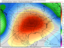
That brings me to next week where there are two issues to talk about. First is the strength of the ridge that is to bring more summery weather back to the Midwest next week. Yesterday this was projected to be further east and stronger allowing some very warm temperatures to dominate the pattern. The latest trends are now showing more troughing over the Great Lakes and New England that leads to more of a NW flow over my local area. That would keep the heat at bay until mid to late week. Instead a more pleasant seasonal brand of weather would prevail until the eastern trough is flattened. You can see the difference at 500mb. More time is needed to ascertain a true trend.
Wednesday

Thursday

This is the change in predicted temperatures on the EURO meteograms from yesterday to today. Not a big change but one that is a few degrees more comfortable.
Wednesday

Thursday

The other contradictory issue is precipitation. As you can see below The Madden Julien Oscillation is projected to rapidly transition into phases 1 and 2 next week (follow the dotted green lines).

Looking at the phase analogs for June that swing through 1 and 2 they are wet over the central Midwest, especially in Illinois.

However, both the EURO and GFS show below normal precipitation totals in the majority of my area, the opposite of the MJO teleconnection. Take a look.
The EURO 15 day rainfall departures.

The GFS 16 day precipitation totals.

I suspect the deterministic models such as the GFS and EURO have not caught the trend yet and eventually will go to a more widespread wetter solution in coming days.
Meantime, we dodge more raindrops today before a cooler and drier regime is established over the weekend. Have a fine day and roll weather...


Comments