SUMMER COMES IN WITH A BANG....
- May 31, 2020
- 2 min read
Meteorological summer that is -- it runs June through August during when we typically have our warmest temperatures. The summer solstice will be on June 20th. Regardless it's going to feel like summer this week.
Here's the set up -- a big ridge of high pressure builds in the upper levels of the atmosphere. It is strong and will pump in a lot of heat and humidity. On the edge of the heat will be the focus for showers and thunderstorms, and at times strong storms. This is known as "the ring of fire."

To begin there will be a warm front at the surface which lifts north Monday morning. This will lead to a few showers and thunderstorms early Monday.

Then the south winds take over and temperatures will warm up Monday afternoon --

The heat builds even more on Tuesday ---

And it will feel even hotter with the high humidity expected Tuesday afternoon --

The heat during the day will create a ton of instability for strong storms to form. Due to how hot it will be the atmosphere will likely be capped and thunderstorm activity will be suppressed until the evening/overnight hours. Here's a look at the instability with surface CAPE (convective available potential energy) on Tuesday evening

And where the instability is greatest is where the Storm Prediction Center has outlined a "slight" risk for severe weather --

Strong winds and hail will be the biggest threats as storms move out of south Dakota and into southern Minnesota and northern Iowa late Tuesday into early Wednesday

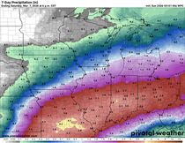
Rain chances will be lower for the remainder of the week but there will be some scattered thunderstorms as the heat and humidity persists.
Here comes summer!
RK


Comments