A LONG, STRANGE SPRING...
- May 27, 2025
- 3 min read
It's been a long, strange spring for weather here in the Midwest. For the past two months, blocking patterns have dominated the North American storm tracks. Slow moving upper air lows have been the rule at mid-latitudes that tend to move at a snails pace. With the westerlies displaced, winds aloft that would normally act as kickers and move systems progressively along have been consistently weak or absent. More often than not, a trough as been situated over the east with a ridge over the west. That's kept the sensible weather pretty benign, with minimal storminess and precipitation until last week when we finally struck gold with beneficial rains.
While we've had a few toasty days, the warm, humid weather typical of mid to late May has had difficulty gaining traction with northwest flow prevailing. Limited moisture has resulted in cool nights and mild days. Although recently, we've crossed over into the cool side of average, even with daytime temperatures.
As we close out the month of May, I don't see much that will change the big picture. The next 6 days, ending Saturday at 500mb, models show another closed low developing over the Midwest that will keep things unsettled at least through Wednesday, perhaps even Thursday. Later in the week, our system joins forces with another slug of energy to create an even stronger trough over the east coast. That amplifies northwest flow and pretty much plays into the recent spring trend of spotty showers and temperatures that will continue below average due to clouds and rain cooled air.

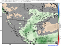
The showers themselves look to be largely diurnal and tied to the formation of the upper air low, which doesn't really get fully established until Wednesday and Thursday afternoon. At that time, temperatures aloft will be significantly cooler than what's seen at the surface, especially during peak heating in the afternoon. That produces lapse rates that are steep enough to generate hit-and-miss showers. So, while a few light showers or sprinkles are possible Tuesday morning, chances are better Wednesday and Thursday, particularly in the afternoon and evening. Even then, coverage looks scattered and amounts light. It's possible some areas may see little more than a trace to .05". Here's what models are indicating for rainfall through Saturday, with most of what falls shown through Thursday.
The EURO

The GFS, as usual, is looking way overdone due to phasing issues. Don't count on it.

The Canadian GEM

SPRING FLING, 3 BIG WEEKENDS IN JUNE, SAVE UP TO $400
My 5-STAR AIRBNB just outside of Galena has 3 weekend openings in June. All of our ratings are 5 star! We take pride in the amenities and the cleanliness. If you book now, we'll take off $200, and we can eliminate AIRBNB fees and additional costs that will save you big bucks. Call or text Carolyn at 563-676-3320 to get our best deal of summer. See more at https://www.littlewhitechurchgalena.com/
JUNE TO BRING A WARMER BRAND OF WEATHER
Temperatures the remainder of the week will likely be in the range of 65-70 for highs. Just a splash of sun this time of year will get you close to 70, and I expect that's a reasonable expectation. However, a day with more cloud cover or scattered showers could hold maximums more to the 66-68 degree range. Over the next three days, normal highs range from 73 to 77 from north to south. We should be at least 5 degrees short of that.
It does appear that the trough over the east should weaken some this weekend, allowing warmer air a pathway to inch into the region. I would think readings by Saturday would be in the upper 70s, and 80 or so is possible Sunday, the start of June (and the beginning of meteorological summer).
If the EURO is correct, much warmer temperatures more typical of summer are on the way next week, with the meteogram showing 87-90 for 5 consecutive days in the Quad Cities. While I like the idea of 81-85, I'm not ready to bite on readings as warm as what the EURO is depicting. Numerous times this year, models have shown the trough in the east flattening, allowing much warmer air access to the Midwest. In the end, they back down and temperatures end up far more conservative. At least until I feel more certain, I'm more comfortable with that 81-85 degree potential.

At least for now, I'm not seeing much for rain chances after Thursday until next week at the earliest. Hope you all had a great holiday weekend. Time to get back into the grind. Roll weather....TS.


Comments