A MONKEY WRENCH...
- May 2, 2025
- 3 min read
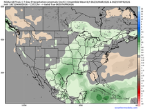
The latest figures are in on April precipitation across the nation, which allows us to see where individual states ranked compared to 133 years of records. It's very obvious that a persistent storm track ran from Oklahoma and Texas right up through the Ohio and Tennessee Valleys. Multiple heavy rain events produced the 2nd wettest April on record in Oklahoma and Kentucky, with Missouri and Arkansas ranking 5th. Totals dropped off significantly northwest of that area, where Nebraska and Colorado were extremely dry and Iowa wasn't far from normal.

Here are some of the April rainfall numbers across the central U.S.

There was a 16" rain differential from Beloit, Wisconsin (1.31") to Mayfield, Kentucky (17.36"), a distance of 450 miles. Notice how dramatically, amounts taper off from central Missouri and Illinois north.

Thursday, the month of May opened the door for a good rain in my area, with many locations seeing at least 1/2 inch. A couple of heavier bands were noted from the Quad Cities west, where 1.0 to 1.5 inches was common. De Witt, Iowa reported 1.8 inches and Keokuk 1.65.

We still have one more disturbance to ride out Friday, but it looks less organized and scattered than 24 hours ago. Just the same, broken clouds and spotty showers will be a possibility. Amounts should be .05" or less where the showers show up, most likely in the south. Many areas will miss them altogether. Another cool day is anticipated, with highs of 60-65.
AN UNWANTED MONKEY WRENCH
Some disappointing news is that Friday's energy is expected to close off at 500mb and become slightly stronger. This development causes a slower ejection of the energy Saturday. As a result, clouds look to be more prevalent and there could even be a brief shower or sprinkle. The best chances for the more significant clouds and any stray showers should be near and east of the Mississippi. The additional cloud cover could put a real dent in temperatures. It looks cooler than was anticipated yesterday, and readings may not make it out of the 50s. The GFS shows this.

The EURO is slightly more generous with sunshine and a bit warmer, but still holds highs in the range of 57 to 62.

A recent trend is for the 500mb low and its energy to get trapped by blocking in southern Canada. Notice how the circulation drifts into Kentucky, hits the block and twists back into Indiana and EC Illinois before finally lifting out late Tuesday night. That's a tad too close for comfort, and the cold core may still be able to spin some clouds and perhaps a few hit-and-miss showers into my Illinois counties, especially Monday

It's possible a tight temperature gradient sets-up depending on where the upper air low ends up. A smidgen further east and we are golden, with some sun and highs in the 60s. A bit further west and some spots may find it difficult to get out of the 50s with mostly cloudy skies. At least for now, the EURO is not optimistic showing clouds rotating around the circulation Sunday through Tuesday and that throws a monkey wrench in what was a promising period of weather just 24 hours ago.
The simulated Satellite shows the extent of the clouds Monday and Tuesday is not any better.

Notice how highs under the clouds are only in the 50s, Monday. Just to our west in central Iowa where the May sunshine is out, readings are right around 70 and it's beautiful. Hopefully, later trends are a bit further east with the system, and we can turn this into a more positive outcome.

If not, I think that we get back on track Wednesday and with the addition of May sunshine, highs should easily pop into the 60s and 70s going forward after that. Here's what the GFS is showing through next weekend.

These are strange times in our world, and I guess the weather decided it was time to get weird as well. This is an unusual pattern that didn't give us much lead time. Sorry to be the one to break the news. Actually, there won't be much (if any in the way of rain), but the clouds and cool temperatures won't be good for the constitution at least through Monday. Happy weekend anyhow. Roll weather...TS.


Comments