A SHORT BREATHER...
- Feb 18, 2023
- 3 min read
I STILL NEED A BIT MORE HELP TO MEET MY FUNDRASING GOALS...
THE FUTURE OF THE SITE DEPENDS ON YOU.
Hi everyone, as you know, TSwails.com is a no-pay site; we exist on what I call voluntary subscriptions or personal donations. Every year I ask those of you who find value in the site to make the financial donation you feel is worthy. Your contribution, whatever you can swing, supports the content, infrastructure, and operational costs of TSwails.com. To read more about my story and make a donation, CLICK HERE Thanks, it's a pleasure to serve you!
A SHORT BREATHER...
The sun was out and all was right with the weather world Friday, outside of the fact it was a tad on the cold side. The storm that's produced the chill also delivered some impressive snowfall amounts across the NW half of my area. Here's a final assesment of accumulations from the Iowa Mesonet. My southeast counties were once again on the outside looking in.

The snow band shows up nicely on Friday's high resolution GOES satellite imagery.

Compare that image to the one below taken Monday

Seasonal snow totals have gone up significant in the past month NW of the Quad Cities. Here in Dubuque I've had 25.2 inches since January 18th. In just the past 8 days 16 inches have fallen. For the year I'm at 36 inches which has us above normal. These are snow totals since November 1st.

You can see NW of the Quad Cities much of Iowa now has above normal snowfall while southeast of there, significant deficits are found.

Seasonal snowfall to date around the nation looks like this.

One things for sure, it looks like the upper Midwest will be adding to their snow totals next week as a large western trough ejects energy into the Midwest. It will produce a very active mid-week period of weather with my area situated close to the southern flank of the expected heavy snow. Here's what guidance is suggesting for snowfall through next week. Lots of fun up north!
The EURO

The GFS

The GEM

Assuming, we don't see any southward shift in coming days (which is not completely out of the question, the concern in my area is the potential for freezing rain in my northern counties. A nearly sationary boundary just to the south (reinforced by the recent snow cover) will be over-run by wam moist air pumped out of the SW trough. The east southeast winds at ground level will limit surface heating keeping temperatures below freezing in the northern third of the region, especially north of HWY 30. Aloft, southwest flow will force temperatures above the freezing mark 5,000 feet up (creating what's known as an inversion-cold below, warm above). That's the set-up for freezing rain. Today, all guidance indicates that potential in my northern counties starting next Tuesday night or Wednesday. Take a look.
The EURO

The GFS

The Canadain GEM

A compounding factor to any ice accumulations would be wind. Gusts over 30mph could spell trouble for trees or power lines loaded with ice. Now, I don't want to get too far ahead of myself and will stress, we are 4-5 days out and what I'm pointing out is the worst case scenario. Things are going to wobble around in coming days meaning the threat could ease or move north or south. That said, at least for now there is good agreement among models the greatest potential exists in the northern 1/2 to 1/3 of my area.
Here's the 500mb flow bringing warm moist air out of the SW.

Below, you can see the surface winds blowing from the east/southeast serving to hold cold air in at ground level. The warm moist air overruns the denser cold air at the surface and is lifted, setting up the inversion and ice potential.

Once this mess gets out of the Midwest next week, the EURO ensemble control indicates colder weather to close out February. It's temperature departures for the week two period February 25-March 4 look like this.

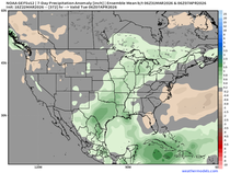
For the same period the control shows above normal precipitation. By all accounts the active weather pattern should continue into at least early March.

That's enough for this post. It's been an active week and I need to recharge the batteries. This is my kind of weather and I don't want to miss a minute of a pattern this energetic and active. Have a great weekend everybody and roll weather...TS


Comments