A SMALL STEP BACK...
- May 7, 2025
- 3 min read
Tuesday was a number 10 day! Considering all the various elements of weather, it doesn't get much better here in the central Midwest. I rest my case with the following facts.
SKY: Sunny
TEMPERATURE: Mild, 76-78
HUMIDITY: Low, Dew Points Mid-40s
Wind: Gentle East, 10 MPH
You can see on the late afternoon satellite how we were in the right spot to make it a special day.

TERRY'S LITTLE WHITE CHURCH, AIRBNB IN GALENA
Check out some of the ways you can save as much as $400 dollars on a stay at my AIRBNB, a renovated church in Galena. It's a most loved guest favorite with perfect 5-star ratings. https://www.littlewhitechurchgalena.com/
A SMALL STEP BACK...
The chamber of commerce weather takes a step back for a day Wednesday as a southern stream disturbance combines with the remnants of a retreating system to the east, to create a narrow band of convergence. This should result in enough forcing for a few showers and maybe a couple thunderstorms around 3:00 PM or later when the convective temperature is met. You can see how the sunny skies of Tuesday have given way to clouds on the simulated mid-afternoon satellite.

The simulated water vapor imagery shows the swath of moisture pooled north of I-80.

Finally, the simulated radar of the 3k NAM shows a narrow line of showers and perhaps a few embedded thunderstorms by 4:00 PM near HWY 30.

The simulated radar of the HRRR shows a similar development.

Disagreement takes place in the amount of rain that's produced. The 3k NAM shows dew points pooling near 60 in the late afternoon.

Along with that, water vapor is projected to reach 1 inch or more in a line from EC Iowa into NC Illinois. That certainly could lead to some downpours if we can saturate the atmosphere and tap into it.

The EURO is not that enthused on that happening, keeping any totals to 1/10th of an inch or less.

The GFS is more bullish and has a couple pockets of 1/4 to 1/2 inch rains, no doubt some of that is convectively enhanced.

The 3k NAM, a convective allowing model (CAM), gets much more aggressive and blows up a small band of rain between HWY 30 and I-80 that produces spotty thunderstorms kicking out isolated pockets of 1 to 2 inch rains.

The new HRRR is more on the conservative side, resembling the EURO. Overall, I think the 3k and GFS are very much on the high side with amounts, and I would expect most spots will see amounts (where it rains) 1/10th of an inch or less. A few isolated spots north of I-80 could pick up 1/4 inch.

However it plays out, the instability quickly fades around sunset and any rain dies out shortly thereafter. After that, a back door high builds into the Great Lakes, delivering easterly winds and cooler temperatures to close out the week. Highs Wednesday will still be mild, in the low 70s north to the upper 70s south. Thursday and Friday, closer to the high, the north remains in the low to mid 60s. The south should fare better with upper 60s to low 70s. Both Thursday and Friday will see a fair amount of sunshine.
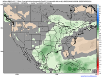
The coming weekend looks very, very nice, with comfortable temperatures (75-80) and dry conditions. In fact, after Wednesday's little event, rain prospects are low at best for the next 2 weeks. The EURO shows much of my area accumulating rainfall deficits of 1.5 to 2.0 inches over the next 15 days.

The dry weather (and most likely minimal humidity) should be favorable for above normal temperatures long range. These are the 7-day temperature departures on the EURO from this Sunday to next Sunday (May 18th). Lots of red!

Here's your 6-10 day outlook, (which generally fits my thinking), issued by the Climate Prediction Center. My only issue is that it might end up being drier in the central Midwest than CPC shows.

Well, that is all for now. Make it a solid day and roll weather...TS


Comments