


A SUMMER OF DISCONTENT. IT DEPENDS WHERE YOU LIVE...
- Jun 30, 2021
- 2 min read
While temperatures around the central Midwest have been running a little below normal lately, that's not been the case in the Pacific NW where a sizzling heat wave has been shattering records.

Monday, Salem broke the all-time Oregon June record for a high temperature with a reading of 117 degrees. It also smashed the daily record by an unprecedented 16 degrees. Portland, Oregon was right behind with a 116 degree high which broke the previous record by 17 degrees. Even Seattle, Washington reached 108 breaking its record by 17 degrees.
You can see the massive heat dome creating the extreme heat centered over Washington State.

Meantime, downstream of the ridge a very moist but far cooler air mass is centered over the Midwest. With some form of ridging remaining in place over the west for the foreseeable future there is no sign of appreciable heat in our future. With NW flow over the next 10 days, temperature departures are expected to look like this. That's a real bonus considering this period is often one of the hottest of the entire summer. Not this year.

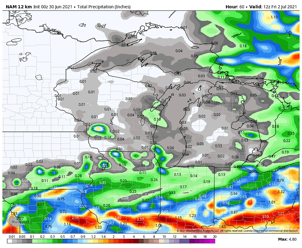
Our weather recently has been dominated by clouds and from time to time scattered showers and thunderstorms. A flash flood watch had been issued for the SE half of my area but that has been dropped as widespread heavy rains have not materialized and are not expected going forward. There may be a few hit and miss downpours but odds of any one place seeing them Wednesday are 30 percent and by Thursday they drop to less than 20 percent. These are the rainfall projections through Thursday night.
The EURO

The GFS

The 12K NAM
The 3K NAM

After that it appears as though high pressure will rule the roost and that means some very fine weather for the holiday weekend. With lower humidity and some sunshine, Friday and Saturday look downright pleasant with highs in the range of 80-85. Sunday and Monday we can expect an increase in both temperatures and humidity but nothing out of line and it will remain dry. Highs Sunday and Monday should be more in the category of 85-90.
In a nutshell, after Wednesday the overall pattern looks uneventful and certainly drier than most areas have witnessed the past 10 days. Is this a summer of discontent? It depends where you live and what you like. Roll weather...TS


Comments