AIN'T SHE A BEAUTY...
- May 10, 2025
- 3 min read
Before we get to the nitty-gritty of what's shaping up to be a sensational weekend. Jack Frost paid a fleeting visit to parts of the area early Friday. Lowden, Iowa dipped to 33, Clinton 35, and Dubuque and Sterling hit 36. Just cold enough for some patchy light frost. No harm, no foul!

The high pressure responsible for the crisp conditions was directly over the region Friday, leading to a day of full sunshine and light winds. The air was also dry, allowing temperatures to recover into the low 70s in most areas. A beautiful way to end the work week.
TERRY'S LITTLE WHITE CHURCH, AIRBNB IN GALENA
Check out some of the ways you can save as much as $400 dollars on a stay at my AIRBNB, a renovated church in Galena. It's a most loved guest favorite with perfect 5-star ratings. https://www.littlewhitechurchgalena.com/
A DELIGHTFUL WEEKEND AHEAD...
Mother's Day weekend promises to be outstanding. With ridging aloft, and strong subsidence it's a given dry conditions, mild temperatures, and abundant sunshine will prevail. Highs both days should range from 78 north to 82 south. Winds also look light in the 5-15 category. Make your plans outside.
Monday still looks on track to be dry and warm, with highs generally in the low 80s.
Tuesday, SW flow strengthens aloft and acts as a kicker, ejecting an upper air low over the lower Mississippi Valley northeast. We should be on the NW fringe of the system, just close enough for it to spin in some clouds and perhaps a few showers. Rain is not likely to amount to much, with the best forcing remaining further to the southeast. Even so, some diurnal showers and a few storms may be scattered about Tuesday afternoon and evening. A couple more are possible in a similar set-up Wednesday. All told, this is what the EURO and GFS show for total rainfall Tuesday and Wednesday.
The EURO

The GFS

Temperatures may be down a little bit Tuesday with the addition of cloud cover. Highs are shown slipping to the mid to upper 70s before rebounding again Wednesday.
Next Thursday, trends are indicting a toasty day with highs that should at least crack the low to mid 80s. A cold front approaching in the afternoon should provide a hefty dose of warm air advection that according to the EURO could provide the south with its first 90 degree plus highs of the year.

Along with the warmth, moisture levels increase as well. Notice the dew points hitting 68 to 70 across the majority of my area.

If achieved, that would be the first time this year we would have attained dew points of 68-70, a strong sign that summer is not far behind. That level of moisture and temperatures in the 80s to near 90 would also develop some strong instability. CAPE values are shown, reaching 3,000 j/kg in NE Iowa. Thunderstorms could thrive in that environment if the approaching cold front holds off until after peak heating Thursday evening. At this distance, timing remains uncertain, leading to low confidence regarding thunderstorm potential. No matter what, this is our next chance for any significant weather or rainfall.

By next weekend, the 500mb jet buckles and reverts to NW flow aloft. Such a pattern is favorable for below normal temperatures.

May 20th, the GFS does show temperature departures 12–14 degrees below normal.

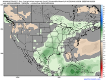
Many spots are showing the dryness of such a pattern, with rainfall deficits of 2 to 2.5 inches over the next 2 weeks ending May 25th

So while the GFS shows below normal temperatures and precipitation in the 8-14 day period, the Climate Prediction Center is the opposite, showing above normal odds of temperatures and precipitation. Hmmm, something's got to give.

That's where I will leave it on a Friday night. Here's hoping you all have a chance to enjoy the exceptional weekend ahead. Roll weather...TS


Comments