ALL "FIRED" UP...
- May 31, 2025
- 4 min read
Smoke from forest fires in Canada (especially Manitoba) had our weather all fired up Friday. Very hazy, milky like conditions resulted in reduced visibilities and in some cases even produced the smell of fire where it was able to mix down to the surface. The smoke locally has traveled a distance of more than 1,000 miles to get here.

22 fires are ongoing in the Province of Manitoba, with 4 indicated to be out of control. The entire town of Flin Flon (5,000) people has been evacuated due to the extreme danger there. Below, you can see the extent of the smoke that encompassed much of the North Central United States Friday.

Hot, dry weather with very low humidity is responsible for the extreme fire conditions.

Some of the worst smoke in our country Friday was seen from Iowa and NW Illinois into eastern Wisconsin and Michigan, no where close to the fires.

Saturday, upper level winds at 500mb will continue to have a NW component, delivering additional smoke.

Mid-morning Saturday, the vertically integrated smoke pattern on the HRRR still shows a significant smoke plume covering much of the central Midwest.

NOW IS THE TIME, 3 BIG WEEKENDS IN GALENA, SAVE UP TO $400
My 5-STAR AIRBNB just outside of Galena has 3 weekend openings in June. All of our ratings are 5 star! We take pride in the amenities and the cleanliness. If you book now, we'll take off $200, and we can eliminate AIRBNB fees and additional costs that will save you big bucks. Other discounts apply. Call or text Carolyn at 563-676-3320 for our best deal of summer. See more at https://www.littlewhitechurchgalena.com/
WARMER WEATHER ON THE BURNER...
Other than the smoke, another issue that needs to be watched Saturday is the position of a back door front pushing southwest out of the Great Lakes. It's expected to turn stationary from eastern Iowa into WC Illinois, where it could become the convergence focus for a narrow band of showers and storms Saturday afternoon or evening. The simulated radar of the 3k NAM shows scattered development in my southwest counties around 6:00 p.m. Coverage should be low and confined to the area west and south of the Quad Cities. A couple of the stronger updrafts could dump a quick 1/2 to 1 inch of rain, but I need to stress, they would be very isolated and the majority of my area will see no rain at all. What develops moves quickly southeast and dissipates towards sunset.

Here's what models are showing for potential rainfall totals later Saturday.
The 3k NAM

the EURO

The GFS

Weekend temperatures will be impacted by the position of the boundary, which holds pretty tight through Sunday. The EURO shows this for highs Saturday. Some of my northeastern counties are only in the low to mid 70s, while my far southwest counties west of the front are up in the low to mid 80s.

Sunday on the EURO, readings appears similar, perhaps a couple degrees warmer.

Monday we open the door to a healthy burst of heat areawide. 850 temperatures up to +20 C will provide the warmth while at the same time create a healthy CAP, limiting any thunderstorm development. The bulk of the Midwest is looking at highs of 85-92, and a 90 is possible in my far southern counties.

Tuesday we remain in the warm sector ahead of our next cold front. Highs should remain up in that range of 87 north to 92 south. Humidity levels will be up, especially late in the day when dew points are nearing 70 in my western counties.

With the warmth and increased moisture ahead of an approaching cold front, the stage is set for a round of showers and thunderstorms with CAPE (instability) building ahead of it.

By early evening Tuesday, storms enter my western counties and press east along with the front overnight. A couple of strong storms are possible early, but the threat should wane around sunset. Rain could be plentiful, especially in the more potent storms where 1-2 inch amounts are possible. Both the EURO and GFS are showing generous amounts of an inch in quite a few spots.
The EURO

The GFS

After a short break Wednesday, some additional rain is possible with a quick moving disturbance Thursday. I mentioned a trend towards a progressive NW flow in the week 2 period yesterday, and models seem to be converging on that idea. One way to see it is with temperatures. Close to the storm track, maybe even north of it at times, heat is restricted and rain cooled air is evident. Here's the meteorgrams of both the EURO and GFS.
The EURO is less amplified and warmer, but far from hot after Tuesday.

The GFS is considerably cooler, and it seems to be reverting to the eastern tough that's dominated the nation's weather since early April.

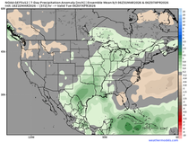
Look what it shows at 500mb, June 15th. I dislike that blocky pattern, and I'm very tired of seeing it the last 2 months. I hope it's overdone.

Well then, my work is done for now. Here's wishing you all a fabulous weekend. Roll weather...TS


drift boss possesses a simple beauty, from lovely graphics to easy-to-grasp gameplay. but don't let that appearance fool you, to master it, you need more than luck.