


ANOTHER ROUND OF SNOW SUNDAY...
- Oct 24, 2020
- 1 min read
Cold air has settled back in and now another system will roll through and bring the chance for a wintry mix and accumulating snow on Sunday. Sunday afternoon will be another chilly one with temperatures in the 30s and 40s:

Precipitation will be most likely in the late afternoon/evening and continue into early Monday.

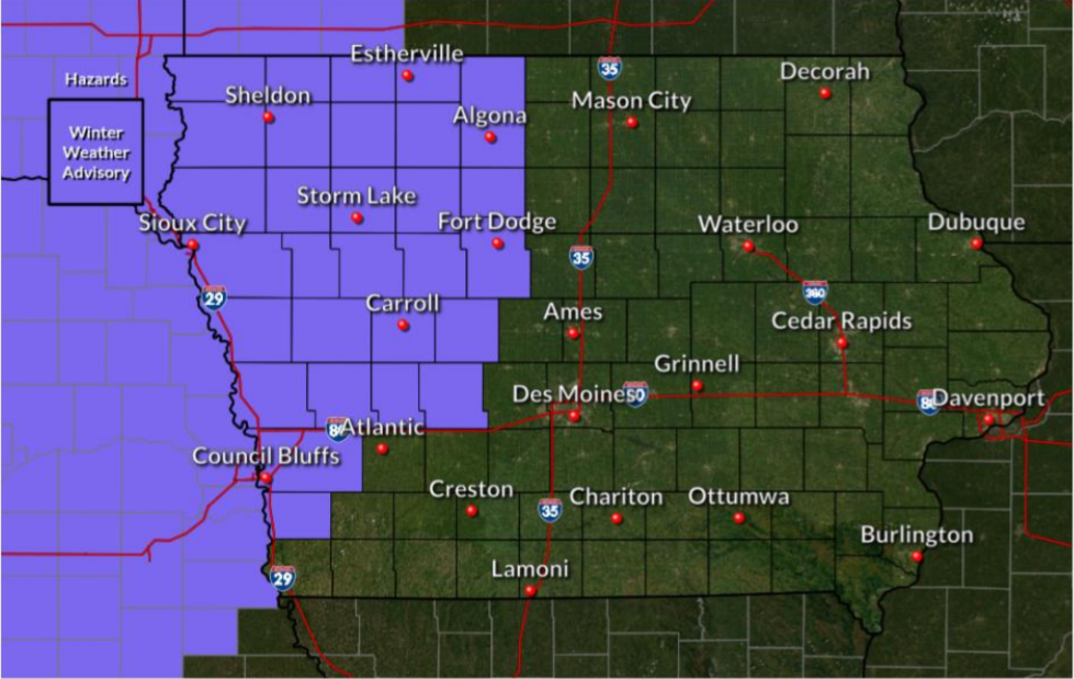
Winter Weather Advisories haven been posted in portions of Nebraska and Iowa:
The National Weather Service in Des Moines says this is the third earliest they've ever issued a Winter Weather Advisory. Here's a look at the snowfall totals on the GFS:

EURO:

NAM:

The forecast for heavier snow will be in north/west Iowa, but it does look like most of Iowa will see some snow by the time Monday is over. Here's a look at the forecast from the National Weather Service:

This would be the third accumulating snow this October in Iowa.. if there is accumulation in Cedar Rapids it would be the most snow days in October on record, tied with 2019...
Behind this system some even colder air moves in. Temperatures will drop into the teens and 20s Monday night into Tuesday morning, likely closing in on records:

Winter in October continues...
Oh and if you haven't already, pre-order Derecho 911 -- a comprehensive look at the historic derecho that devastated Iowa and caused damage across over 700 miles in the Midwest. Take advantage of a special price when you pre-order the book by clicking on the picture below:

RK


Comments