BREATHING RARE AIR...
- Nov 14, 2025
- 4 min read
FOOD FOR THOUGHT
Let's begin today's blog with some food for thought. My climate guy, Steve Gottschalk was poking around yesterday and came up with something I deemed interesting. He decided to look at his 10 coldest Decembers to see what the previous month's temperatures were like in the hopes of coming up with some analogs that might give us a clue as to what to expect this December.
His initial conclusions indicated that in the 10 coldest winters:
60% of the time July was warmer
80% of the time August was warmer
70% of the time October was warmer
This year, all of those months were warmer than normal, which implies a strong chance this December will be colder. Then, he decided to see what years stood out if warmer than normal temperatures were also found in November, which most likely will end up being the case, with 10 day temperature departures (up to November 24th) looking like this on the EURO.

The only years leading up to December with above normal temperatures July through November were 1983 and 2010. So what was December like those years? Feast your eyes in this. (By the way, the data was observed and reported by Steve, who is a cooperative observer, and has been for 60 years for the NWS in Davenport).
December 1983
The average temperature was 9.6 degrees, the coldest December Steve has records for. Snowfall amounted to 16.3 inches. A Christmas Eve blizzard with wind chills up to 80 below on the old scale (more like 60 below today) shut down roads and stranded many travelers, me being one of them.

December 2010
The average temperature for the month was 16.1 and snowfall amounted to 25.2 inches. A large chunk of that fell Christmas Eve day.

Nobody is saying this December will be anything like those two winters, but the evidence is compelling, and analogs like 1983 and 2010 can be quite helpful in making broad brush assessments. This December has the "potential" to be the toughest since 2013.
Meantime, the EURO MJO continues to show a progression from phase 6 into 7 and 8 between November 25th and December 12th. Both 7 and 8 are cold phases in December. So is 1, which would be a logical progression of the cycle after phase 8.

These are the 30-day temperature departures on the EURO weeklies ensemble mean for November 29th through December 29th.

32 day snowfall on the ensemble mean November 25th through December 26th looks like this. Amazingly, we've seen similar trends now for 4 consecutive days. No guarantee, but at least there's some consistency.

GIVE THE GIFT OF MY 5 STAR AIRBNB IN GALENA
Holiday and winter specials are now in effect through March. Let us help you set up a personalized gift certificate that's sure to create a lifetime of memories! Santa Claus approved. Call or text Carolyn at 563-676-3320 for details and our best pricing. https://www.littlewhitechurchgalena.com/
By now, most of you are aware that we have two more days with temperatures that are expected to be near records. Friday, the HRRR shows highs ranging from 67 north to 74 in the far south, probably just short of records.

Saturday looks similar, except in the far NW, where a front arrives soon enough to snip off daytime heating by noon. Elsewhere, upper 60s to low 70s appear reasonable before much cooler (although seasonal) temperatures settle in for Sunday. A lack of moisture should mean a dry frontal passage Saturday.

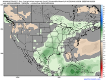
The next chance of wet weather comes late Monday into early Tuesday. Guidance today seems more organized, with better moisture and higher rain totals across the SW half of my area. The GFS is now indicating amounts like this.

Here's what the EURO shows.

A little twist is the fact the GFS is trying to show a band of wet snow developing Monday night, with some accumulations. I'm not seeing much support for enough cold air to support snow that far south.

Neither does the EURO, although it does indicate some very minor amounts near the Minnesota border. That makes far more sense to me. We'll see which way the wind is blowing tomorrow.

As for long term temperatures, there is a significant difference between what the EURO and GFS are showing. It appears the GFS is trending the way of the MJO with its cooler look. However, it's a week ahead of when the MJO indicates the cold arrives and chances are it is too fast with its arrival and I suspect it ends up much warmer.

The EURO is significantly warmer and may be too warm, but is a better fit for what the MJO implies. This part of the forecast remains low confidence. Until we can get a more unified solution, I'm still on the fence. That said, I'm leaning more toward the warmer look of the EURO.

Okay, I've said my piece. Enjoy the day and its temperatures that could hit 70 in the south. Day's like this are a real bonus in mid-November. Roll weather...TS

TSWAILS.COM is now proud to offer expert weather consulting services, including:
Private consulting
Legal forensic services as an expert witness
Public speaking engagements for groups or individuals
Post storm analysis
A private day-long weather school class session
Specialized meteorological needs
Severe weather seminars
Call 563-676-3377 or email terryswails1@gmail.com


Comments