DANCE WITH WHO BRUNG YA
- May 3, 2025
- 4 min read
There's an old saying that you dance with who "brung ya". It might not be the gal or guy you want, but at least you're dancing. The weather analogy this weekend, is that we'll be slow dancing with a storm that has a sprained ankle. It won't move much, and when it does, it won't be fancy. I'll go so far to say he or she won't be much to look at, either. It is what is, and we'll make the most of it until things improve next week.
Before I get to that, I live in a spot where I can see the Mississippi, and I've noticed it's been up a bit the past few weeks. There was a small snow melt crest from the spring thaw in northern Minnesota and Wisconsin around April 7-9th. A dip ensued as it passed, and then heavy rains in the period surrounding Easter sent another surge of water that is just about to move out. The stage plots on the Mississippi at Rock Island reflect the two surges, with the current high point of 12.20 feet, 5.38 feet higher than the low point of 6.82 April 2nd.

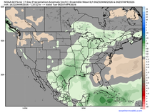
A quick look at precipitation since March first shows much of NE Iowa with 9–10 inches of rain in that 2-month period. That, combined with the melting snow and similar rain totals up north, have created the rise. Nothing at all unusual about it.

With only 19 hours of combined precipitation in the Quad Cities (15 in January, 4 in February), the river was quite low to begin with. However, that number jumped to 90 hours in March and February and fueled the rise.

11 of the past 16 days, at least a trace of rain has fallen in Dubuque. Many parts of my area saw a brief shower or sprinkle Friday. Amounts were a bit more substantial over parts of EC Iowa,as well as SC Iowa and WC Illinois, where some locations picked up 1 to 2 tenths of an inch.

Yesterday I mentioned a cut-off off low was set to form over Illinois. This development has caused a slower ejection of its energy this weekend. As a result, clouds look to be more prevalent and there could even be a brief shower or sprinkle. The best chances for the more significant clouds and any stray showers looks to be the best nearand west of the Mississippi. The additional cloud cover is going to negatively impact temperatures.
The latest trends still indicate the 500mb low and its energy will get trapped by blocking in southern Canada. Due to the block, the circulation only moves from SC Illinois to EC Indiana between now and Tuesday night.

The cold pocket of air beneath the upper air low is quite significant, with temperatures at 850mb (a mile up) not much above freezing at 0-3 degrees C.

The cold temperatures aloft will generate steep lapse rates, which is a recipe for clouds. Additionally, a few hit-and-miss showers could creep into the area Saturday afternoon. These should be brief, widely scattered, and light. Not everybody will see them. The hope is Sunday the system will be just far enough away that a bit more sunshine will get into the pattern allowing temperature to warm slightly.
You can see much of the area is under clouds Saturday afternoon.

That puts a clamp on heating Saturday, and the 3K shows highs only in the mid to upper 50s (a good 10–12 degrees below normal). That could be low if we can manage a break or two for sunshine.

Sunday, a bit more sunshine is expected, especially west of the Mississippi. Just a few hours of that would get readings into the low to perhaps mid 60s, where it's more abundant. If not, cool again. Notice NW Minnesota with full sunshine and dry air is into the mid to upper 70s. That's the power of May sun, and we'll get into some of that next week. Sunday's highs on the 3k NAM.

After Saturday, rain chances appear minimal until Monday afternoon, when the EURO indicates a few showers could catch my counties in Illinois with the upper air wobbling west. The GFS is further southeast and keeps it dry. Either way, Monday will likely remain cool in the upper 50s to low 60s depending on cloud cover.
Tuesday we should get far enough away from the circulation to see a return of partial sunshine, hence warmer highs in the upper 60s to low 70s. Wednesday is trending very nice, mostly sunny and highs in the mid 70s.
If you are looking for a more summery brand of weather, there are promising signs it's developing. This is the 500mb flow showing a building ridge in the center of the nation, signaling warm and potentially muggier conditions in about a week.

Look at what the EURO is pointing to for highs in mid-May

The GFS is in good agreement.

To complete the sweep, the Climate Prediction Center is on the bandwagon too, with warm and generally dry weather in its 8-14 day outlook. I would not bet the farm just yet, as this is a newer trend. However, confidence is growing in some version of a summery preview in the long range period.

Hopefully, that eases the pain of this weekend's less than perfect weather. Start the band, it's time to dance! Roll weather...TS


Comments