ENOUGH TO BE A NUISANCE
- May 26, 2025
- 3 min read

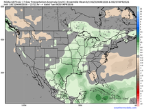
Memorial Day will be a dry one across the region with increasing clouds through the day as we will turn to a cooler and active mid-week. The overall rain totals will be rather minimal. General model guidance shows widespread 0.25" across eastern Iowa into northern Illinois as showers develop late Monday night and continues into Wednesday.

Overall shower activity will be quite light with mainly cloudy skies. High resolution models show the rain developing as early as sunset Monday with on and off rain activity through Tuesday. Generally the rain will be quite light and barely enough to wet the pavement at times. A few showers may be enough to give the plants a light watering, but the rain otherwise is more of a nuisance for plans than anything.

An Upper Level Low is progged to sit around the region through Thursday keeping unseasonably cool temperatures and spotty showers in play. Northwest flow aloft will contribute to the cooldown across for the Great Lakes region.

Temperature anomalies Wednesday will be as low as -15° to -20°. Not really pleasant that is for certain! That translates to temperatures in the 60s for the Quad Cities region. A normal high for Moline is 78° for some perspective.

Stepping forward from the upcoming weekend into early next week, ridging is forecast to return to the central United States. This will bring warmer and drier conditions for the Midwest. Low to mid 80s are increasingly likely Saturday and Sunday.

Climate Prediction Center forecasts show a trend to above-normal temperatures during this period from the end of May into early June. The probabilities of above-normal temperatures are pushing 40-60%.
ON THE TORNADO HUNT

Day 3 of my Chasecation trip took us to the Texas Panhandle. We started the morning in Clinton, Oklahoma where at least I saw a tornado to start the day! This is one of the better murals I have seen! Chickens are riding slices of bacon, I have no idea why, but I love it.

The forecast itself was incredibly straight forward as models show a high confidence in a supercell forming near the town of Matador, Texas around 2 p.m. Myself and hundreds of my closest friends arrived packing town gas stations in Childress and Paducah.

Satellite data was critical in indicating where precisely the storms were going to form. Sure enough, near Matador, clouds were getting more dense and growing vertically. After topping off on gas and grabbing lunch in Childress, it was go time.

By 2:15 p.m. we had a robust supercell with a strong wall cloud. All the features were there for destructive hail and possibly a tornado or two. The storm would go on to produce hail of 5" and 6" in diameter. That's about the size of a DVD!

After a long stretch of this supercell struggling to produce a tornado, we decided to drop south onto another developing supercell. Once we got on it, the storm was showing some incredible structure.

We had the storm structure in place and the storm was still in a favorable environment. All we needed now was a tornado, and this storm finally gave it up for us.

Around 7 p.m., a monster wall cloud formed with a strong inflow tail getting larger and larger. Moments later, lightning began shooting out all around the wall cloud. These lightning jumps have an immense amount of research done on their ability to predict high end severe weather and tornadoes.

The first tornado would drop at about 7:35 p.m. north of Stamford, TX. It was quick! Only lasted about 30 seconds but it was a fully-condensed funnel all the way to the ground. Finally we were getting somewhere.

A second brief tornado would drop about a minute later. While not fully visible, it had a clear dust swirl kicking up into the wall cloud that was rapidly rotating aloft.

Our third and final tornado for this storm would come about another minute later. A broader circulation with multiple vortices was clearly visible from our view. Other chasers much closer to this circulation would confirm this as a tornado as well, sustaining damage to their vehicle in the tornadic winds. Thankfully all these tornadoes were brief and did not impact nearby towns.

Following the tornadoes the supercell continued to put on a clinic. The storm featured incredible structure with some beautifully, vivid lightning. We ended the chase at sunset as the storms congealed into a big line and the tornado threat shifted to more of a wind threat.
We will likely head deeper into the heart of Texas for chasing on Monday! I'll be back with any adventures we have. Until then, have a great week everyone!
-Meteorologist Nick Stewart


Comments