GET IT BEHIND US...
- May 29, 2025
- 4 min read
At least where I was in lovely Dubuque, Iowa, Wednesday was a bit of a dog day. By that I mean the day was dominated by clouds, cool temperatures, and even some rain to kick off the morning. The high temperature of 63 was more typical of April 29th. That's pretty dismal and, yeah, what I would call a "dog" by seasonal standards.
The rain that that fell into early Wednesday was mainly light, however a narrow band of moderate showers near and east of the spine of the Mississippi produced 1/4 to 1/2 inch totals. Moline picked up 1/3 of an inch.

The rains were drawn east and then north around the circulation of an upper air low at 500mb centered in southern Minnesota. You can actually see on the Doppler estimates how the rains wrapped into the storm center. The two primary branches of the jet (the polar and subtropical streams) are well to the north or south. Thus, the system was only slowly drifting east due to a lack of upper level wind support to force it east.

The satellite shows the vast amount of cloudiness that encircles the system from the Atlantic to the Rockies and back south to the Gulf of Mexico. With the circulation center expected to only inch into Wisconsin Thursday, passing clouds could once again play a role in how warm temperatures get.

The clouds are hard evidence that enough moisture remains for the possibility of a few widely scattered showers Thursday, especially in the afternoon, when peak heating and proximity to the cold pool aloft might be the trigger. Overall, though, forcing appears weak, and I do not expect to see more than a handful of showers. Most spots will likely stay dry.
Another positive that I like is that the HRRR shows a small streak of drier air advecting over all but the far south Thursday afternoon. It's very evident on this simulated water vapor product in blue.

Assuming that's correct, it should allow most areas at least several hours of productive sunshine. As powerful as it is, that should give temperatures a nice boost. Below, you can see the percentage of cloud cover expected on the simulated satellite imagery at 2:00 p.m.

With some sun, the HRRR has readings in most areas around 69 to perhaps 74. If more clouds win out, that would lead to cooler readings, mainly in the 60s, as shown in northern Iowa and southern Wisconsin. Hopefully the HRRR has the right idea. The far south has the best chance of remaining cooler due to a more extensive cloud canopy.

NOW IS THE TIME, 3 BIG WEEKENDS IN GALENA, SAVE UP TO $400
My 5-STAR AIRBNB just outside of Galena has 3 weekend openings in June. All of our ratings are 5 star! We take pride in the amenities and the cleanliness. If you book now, we'll take off $200, and we can eliminate AIRBNB fees and additional costs that will save you big bucks. Book this coming weekend and I'll knock off another $100. Call or text Carolyn at 563-676-3320 to get our best deal of summer. See more at https://www.littlewhitechurchgalena.com/
SUMMERY TO START NEXT WEEK...
The upper air low is shown edging east Friday where it phases with additional energy diving south out of Canada. That carves out a deep northerly flow in the jet at 500mb just to our east.

The implications are that this will allow a back door front to enter the region Saturday morning. Ahead of it we should see a day of strong warming Friday with highs in the upper 70s, perhaps lower 80s in the southwest half of the area under partly sunny skies.
Saturday, the back door front should sit north to south somewhere over central or eastern Iowa. Delineating the baroclinic boundary, it very well could be the focus for at least a few scattered showers and storms later Saturday afternoon or evening, particularly west of the Mississippi. Another effect of the front is to bring slightly cooler air back in for Saturday and Sunday. You can see the downturn from Friday of several degrees on the EURO meteogram. I'm seeing a lot of forecasts right now that have highs in the low to mid 80s Saturday and Sunday. I am leaning to the cooler side of the ledger, in the 70s.

As I mentioned yesterday, much warmer weather is in our future, at least for a few days next week. Delayed, not denied, is the way I see it. It is interesting to note though that the EURO out 15 days is far less emphatic about any heat sticking around for more than 2–3 days. It has readings back down around 70 June 9th and 10th.

The GFS is also down from yesterday but still significantly warmer than the EURO in the week 2 period.

Personally, I would like to see the warmer version of the GFS. However, the trough that's dominated over the east the past 2 months may actually retrograde west, setting the table for a more modified Midwest temperature regime like the EURO is indicating. I really can't say yet, but I am seriously considering the possibility. The two scenarios would also have an impact on longer range precipitation.
The EURO is below normal on rainfall in the 10-day period ending June 12th.

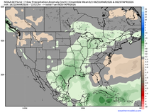
The GFS is near to well above normal for the same period.

At least for now, the week 2 period is far lower confidence on both temperatures and precipitation than it appeared 24 hours ago. We'll let that simmer for a while. With that, I'll call it a post. Roll weather...TS


Comments