


IT'S GETTING DRIER AND DRIER
- Sep 14, 2025
- 2 min read

September has been off to a brutally dry start across the region with little to no measurable rain. The lack of rain has been accompanied by some hot, sunny and breezy conditions which has allows soils to really start to dry out after a very wet summer. Soil moisture change from the start of the month is down more than 1" across eastern Iowa and northwest Illinois.

An experimental product from the University of North Dakota valid Sept. 8 shows rapid drying of the soils and conditions becoming favorable for flash drought. This is especially the case in northeast Missouri to central Illinois. Thankfully we are in harvest period as opposed to planting, however this rapid drying could have other impacts to leaf color this autumn. You may notice leaves already changing a bit earlier than normal due to this.

A very large portion of the area has seen less than about 10% of normal precipitation through the first half of September. So, what's ahead? Well, I wish I had wonderful news. The phrase, "when in drought, have some doubt" comes to mind as rain chances are not looking as optimistic as it was yesterday.

The next seven days of precipitation anomalies show near to below normal potential through early next week. The storm system late this week appears to shifting a bit farther west with the more beneficial rainfall.

The European Ensemble for the Quad Cities does show some increased confidence in about a quarter of an inch of rainfall centered this upcoming weekend. Most members show that, with a few on the higher side approaching 0.50"+. However, there are a few members with little if any, which is always a concern.
GFS

EURO

The operational, deterministic models have a pretty big spread in the magnitude and coverage of the storms Friday and Saturday. They both show.... something.... but at this range the spread is uncomfortably large and the timing is also off by 24 hours. We will keep the rain chances as a watch item late this week.

The European ensemble has certainly pushed the most likely period of rain to the right, likely now Friday/Saturday.
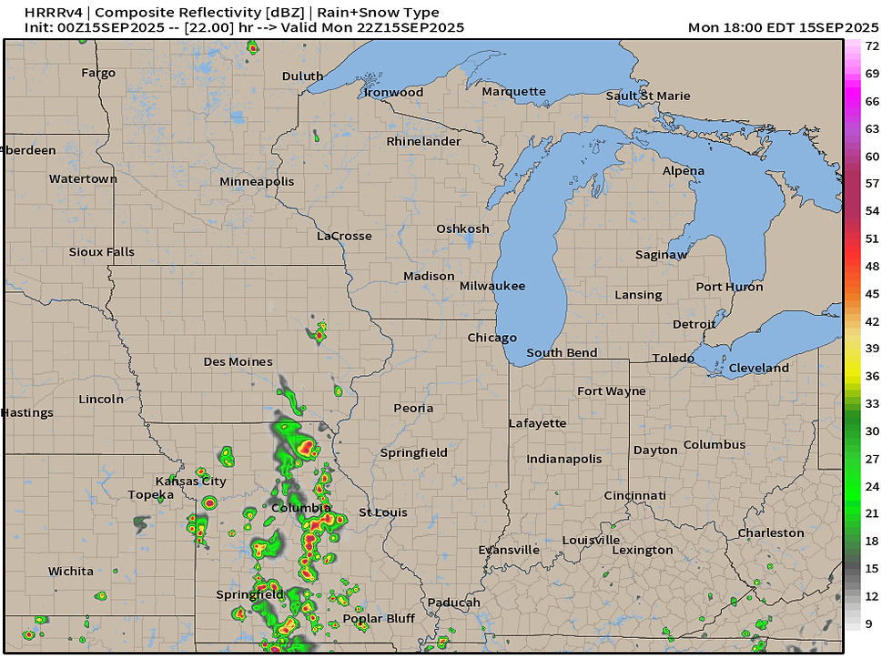
Now, in the short term, there will be a chance for a few isolated showers and storms Monday, especially in eastern Iowa and northern Missouri, particularly along and west of the Mississippi River. This will be driven by the heat and humidity that continues to affect the area.

European ensemble guidance continues to indicate near-90-degree temperatures Sunday for the Quad Cities region through Tuesday with a downward trend late week into next week. While cooler, notice the green line (the model average) remains above the red line (normal for the date) going towards the end of the month. Some outlier solutions keep potential for temperatures back near 90, however the mean is closer to 80. Very hopeful for the cooler side!
More to come on the chances for rain this week and the cooler temperatures down the road. Have a great week friends!
-Meteorologist Nick Stewart


Comments