MENTAL TOUGHNESS
- Nov 21, 2025
- 4 min read
I haven't seen the sun all week long, and chances are it won't be with us again Friday. A stagnant weather pattern remains entrenched that's trapping low level moisture, converting it to clouds. I'm seeing signs we should get some breaks for sunshine over the weekend, but Friday brings the need for more mental toughness as we deal with one more dark dreary day, and one that starts with patchy fog and drizzle. Be strong, it's a Friday.
If there is one bit of positive news to pass along, it's that outside of a few showers or sprinkles in the far south, a wet weather system keeps the bulk of its precipitation Friday in Missouri. However, it's easterly winds and the clouds surrounding it, will restrict temperatures to the upper 40s and low 50s. Enough of that.
Saturday, there is hope that drier air on the backside of the disturbance will lift cloud bases and perhaps allow some filtered sunshine. That should be enough to boost Saturday's highs into the low to mid 50s, a few degrees above normal.
FINALLY, SOME SUN!
Sunday, should be just that, a "SUN-DAY". Partly cloudy skies and the return of southerly winds should send temperatures into the mid 50s, perhaps even 60 in the south. Pretty good for November 23rd. It looks like a fine day to finish up yard work or even string up a few Christmas lights. A good way to end the weekend. Here's how much highs should be above normal.

GIVE THE GIFT OF MY 5 STAR AIRBNB IN GALENA

Holiday and winter specials are now in effect through March. Let us help you set up a personalized gift certificate that's sure to create a lifetime of memories! Santa Claus approved. Call or text Carolyn at 563-676-3320 for details and our very best pricing. https://www.littlewhitechurchgalena.com/
A LOT OF WEATHER NEXT WEEK
Monday, a storm system comes together that brings a nice slug of warm air advection that promises more clouds and a respectable rain. The rain arrives in the afternoon and should largely be out of the area by Tuesday morning. The early rain numbers look like this.
The GFS

The EURO

Following the rain, a stout cold front is set to blast across the region Tuesday, with gusty winds and much colder temperatures Wednesday. This is the first phase of a pattern change that brings colder weather to the Midwest in successive waves come early December. Readings will fall from the 50s Monday and early Tuesday into the upper 30s to low 40s Wednesday. That leaves us with a cold, but dry Thanksgiving with highs relegated to the low to mid 30s.

After Thanksgiving, our weather has the potential to become unsettled, with hints of snow and another shot of cold air that has us dramatically colder by December 5th. How this unfolds is uncertain as the EURO and GFS handle energy and phasing differently. Notice the GFS kicks off December with highs in the upper 50s on the 1st. Then it deposits a hefty dump of polar air that reduces highs to the 20s.

The EURO on the other hand plays a different hand, eliminating the second warm-up and keeping readings cold before lowering the boom December 5th with a high of 22. Ironically, both models have the cold shot December 5th, but have an entirely different way of delivering it.

Not only that, they vary significantly with precipitation and snowfall potential. The deterministic run of the GFS shows no snow locally through December 6th.

The EURO on the other hand indicates snow as early as the 28th and by December 5th, shows 7-day total accumulations that look like this.

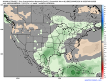
This is the point where ensemble means can come in handy. Instead of looking at a single outcome, ensembles are an average of many different solutions of an individual model run. Looking at the GFS ensemble mean (known as the GEFS), it shows several inches of snow compared to the snow free deterministic run. In other words, far more members of the GEFS are showing snow than are not, allowing it to come up with its snowier mean solution below. A pretty stark contrast from the GFS to the GEFS.

The EURO ensemble mean, while showing less snow than its deterministic run, still shows plenty. In fact, there's decent consistency between the ensemble means of the GEFS and the EURO in terms of what each shows for snow.

Based on that fact, I certainly can't discount the possibility that some snow could be found locally post Thanksgiving weekend and beyond. This being a new trend, I can only say confidence is low regarding if and when any snow enters the forecast. That said, confidence is moderate to high, that notable cold is coming by December 6th. Here's the GEFS 5 day temperature departures for the period December 1st through the 6th. Cold is pressing!

Not only that, the 500mb jet is poised to deliver far more in the way of cold if what it shows December 5th comes to pass. You can really see the negative EPO and WPO blowing up in red, indicating a strong ridge over the NE Pacific. That's a wide open door for polar and potentially Arctic air to enter the lower 48 the second week of December.

Changes are happening that could have big implications on our weather shortly after Thanksgiving. The game is on. Roll weather...TS

TSWAILS.COM is now proud to offer expert weather consulting services, including:
Private consulting
Legal forensic services as an expert witness
Public speaking engagements for groups or individuals
Post storm analysis
A private day-long weather school class session
Specialized meteorological needs
Severe weather seminars
Call 563-676-3377 or email terryswails1@gmail.com


Comments