MONSOON SEASON 2...
- Aug 7, 2025
- 3 min read
The past 7 days, we've enjoyed a break from the monsoon season that was the month of July. Regular rounds of showers and storms produced the second-wettest July in Iowa's history, with a statewide average of more than 9 inches. Des Moines had its all-time wettest July, with well over 10 inches of rain. You can clearly see Iowa was the epicenter of the heaviest precipitation, with some parts of the state topping the 15-inch mark.

Additionally, with all the rain, moisture laden tropical air and corn sweat, it was an exceptionally muggy month. This graphic from the NWS shows normal July dew points on the left and those found in 2025 on the right. Average dew points of 71-75 usually are not seen north of Arkansas. This year they made it all the way to southeast Iowa.

PLAN A VISIT TO MY 5 STAR GALENA AIRBNB
My 5-STAR AIRBNB just outside of Galena still has some openings this summer. All of our ratings are 5 star! We take pride in the amenities and the cleanliness. If you book now, we'll take off $200, and we can eliminate AIRBNB fees and additional costs that will save you big bucks. Other discounts apply. Call or text Carolyn at 563-676-3320 for our best deal of summer. See more at https://www.littlewhitechurchgalena.com/
MONSOONS AHEAD..
After a well deserved break from rain and humidity, we are headed for another active period of weather that will raise some steam and produce the threat of more storms and heavy rain.
One of the key ingredients in this next rainy period will be moisture. Dew points began to increase Wednesday and Thursday will see a spike that gets them back into the oppressive category of the low to mid 70s, where they will likely remain through next Monday. These levels will produce available water vapor of over 2 inches, the threshold where excessive rains of 1–2 inches can fall in short order.
In this 500mb jet stream depiction Saturday afternoon, you can see a strong short wave grinding across southern Canada with an amplified high pressure ridge over the east. That will channel and pool deep moisture over the Midwest for several days. Disturbances rippling along the southern edge of the trough in proximity to the instability axis will provide the lift for multiple periods of storms.

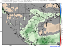
Over time, the individual rain events are shown adding up and the Weather Prediction Center does indicate a heavy rain threat in the period April 9th-13th that encompasses my area. The monsoon season is far from dead.

Amounts are very difficult to determine and pinpoint precisely at this distance, but models continue to show a strong signal for significant rains in some part of the region. Between now and next Tuesday, some are suggesting totals of 1 to 3 inches, potentially as much as 4. The NW half of my area, particularly from the Quad Cities NW, are most favored for the heaviest amounts.
The EURO

The GFS

Weather Prediction Center

While some scattered showers and storms are possible Thursday and Friday, the majority of the more significant rain is expected to fall Saturday night through Monday night along and near a stationary boundary that cuts through the heart of my region. It's conceivable, that some part of the region may go under a flood watch if trends continue in coming days.
As for temperatures, they should inch into the range of 84-89 Thursday and 85-90 Friday. Models have been really struggling with this aspect of the forecast due to debris clouds and scattered storms that are hard to foresee. The issues remain Saturday through Monday, and in general I like mid 80s north, to the upper 80s south, perhaps an afternoon around 90 in my far southern counties. I will say outflow from thunderstorms could toss a wrench into one of these days holding readings even cooler than what is shown, especially in the NW.
Once the system passes Tuesday, cooler, drier, and more comfortable weather settles in for the remainder of next week. It looks short-lived though, as another shot of heat appears destined to arrive in the period August 15th-20th. All in all, the pattern looks quite active the next 10 days considering we are in the midst of the dog days of summer, a time that's typically rather sluggish. Thanks for checking in and roll weather...TS


Students of today are aware that working hard and working smart are two different things. If a young person focuses on his studies and other things, he can achieve success. If you are naturally good at sports and other activities, you may not have enough time to complete your projects and homework. In such a situation, hiring someone to help you with "US economics assignment helper" can be important. While working and going to school, it can be difficult to maintain a routine of projects and assignments. If you do not vary your work, your grades may suffer. If you want to complete both your online course and your work, it is time to hire someone to do your homework.