MORE FLOODING RAINS
- Aug 10, 2025
- 4 min read

Late Saturday night into Sunday morning, as expected, the heavy rain machine was back in full effect across the region with flash flooding and some severe weather ongoing. Thankfully, however, the widespread nature of the torrential rain has seemed to not happened as models were indicating overnight, but I still anticipate heavy rain to continue through Monday morning, especially across eastern Iowa and far northwest Illinois. Pockets of 3-5" of rain are likely.
A few select areas including around the Quad Cities were hit hard already, however.
As of 6 a.m. a report near Muscatine, Iowa neared 4" of rain with reports of flooded roads in the area. A corridor from Cedar Rapids to Dubuque is also looking prime for heavy rain developing near sunrise.

As the rain and storms pull out this morning, many models are indicating a quieter Sunday than originally expected as the air will be more stable. The HRRR, for example, is completely rain-free following the morning batch of rain Sunday which could linger into the early afternoon. While I think the trend is favorable, I don't want to completely discount more rain Sunday, especially across far eastern Iowa into northern Illinois as the cold front makes its way through the region.

The HREF really keeps the instability limited for the area which cuts the fuel for thunderstorms, especially strong ones. Just need to watch the cold front as is passes through, but again it seems more widespread rain is more unlikely.

Sunday evening there is a pretty good signal for a more rigorous shortwave to slide through. This will likely assist in some shower and storm development to leaving the chance of rain in Sunday is wise just given the overall setup and meteorology in play. Given a very saturated atmosphere, any storm could produce heavy rainfall.

The RRFS model, for example, indicates at least an attempt at storm development Sunday evening as the cold front passes through.
MONDAY AND BEYOND

Following Sunday the models are a little, shall we say confused, about Monday. Once again the overall meteorological pattern will likely support showers and storms in the region especially in the afternoon and evening. The Euro is the most aggressive with rain Monday with the GFS and HRRR being more laid back with it.

For example, the Euro is slow with the boundary passage leading to more training storms Monday with 1"+ totals a possibility. This seems to be the outlier solution, but hard to ignore given moisture levels in the atmosphere running quite high for this time of year, upper air support in the region and a slow-moving boundary. The ingredients are all there, just hard to know if it ever gets in the oven to cook.

The HRRR for example is much for widely scattered with rain chances Monday afternoon and evening. Rain chances are there for certain, but I think the overall heavy rain threat is a little more unlikely at this point. Once the rain clears early Sunday morning the models will likely have a much better handle on things!

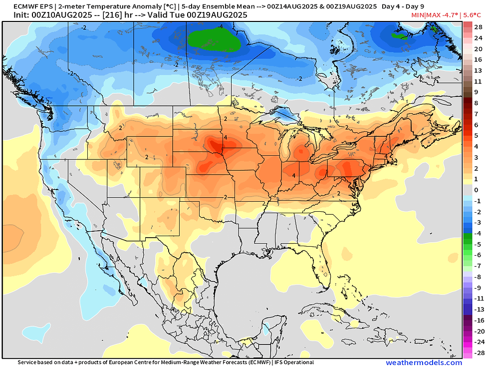
We anticipate the weather to quiet down Tuesday and onward, but it will be heating up as well. Temperature anomalies will be on the increase through the week into the weekend with well-above-normal temperatures once again taking over as the heat dome rebuilds across the central US.

Forecast temperatures will be climbing into the upper 80s to low 90s once again. Triple-digit heat indices will return with quite uncomfortable humidity building in. Summer is not over yet, friends. The warmer-side of normal is likely to continue through much of August towards the beginning of September as well with no real change building.
FIVE YEARS ALREADY

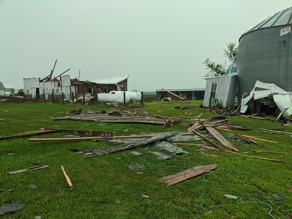
I'll end with a lookback at five years ago today, the Aug. 10, 2020 Derecho. The costliest thunderstorm disaster in US history remain the most incredible weather event I have ever personally experienced. I first got on the storm near Belle Plaine, Iowa and rode it right into hard-hit Cedar Rapids. We lost the windows of our storm chasing vehicle live on TV as it looked like the world was ending all around us.


All round where we rode out the storm was destruction. Corn fields were flattened, power poles were snapped and barns were obliterated. We stopped a few times for photos and videos before realizing this wasn't localized, but instead spread out across a huge area.

Once back in Cedar Rapids the destruction was unbelievable. Trees were on top of houses everywhere. More than sixty-percent of the tree canopy was wiped out by winds topping 140mph.

When I was finally able to get to my home, it became more personal. The roof of my apartment complex was ripped off letting water pouring in. The force of this also ruptured the fire suppression system sending water over much of my belongings. It was the first time I had to deal with a storm as a victim, but also a meteorologist covering the event.
If you have not seen the documentary I put together on the 2020 Derecho while working at Iowa's News Now, please give it a watch. It remains the project I put more work into than anything else. As true to the experience as it was for those that went through it.
Have a great rest of the weekend, friends.
-Meteorologist Nick Stewart


Comments