


NOW WE'RE TALKING...
- Aug 13, 2025
- 3 min read
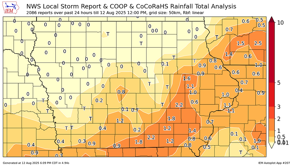
A cold front has managed to wiggle its way across the region, bringing a new look and feel to our weather. It's a welcome change too as we cool temperatures, lower the humidity, and end the monsoons that have plagued parts of the region. The last hurrah Monday night and early Tuesday dumped another 1/2 to 1.50 inches of rain to already soggy soils.
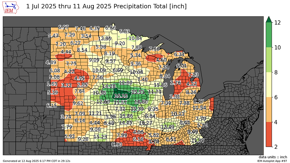
Since July 1st, many parts of my area have seen 10–12 inches of rain, with Manchester, Iowa racking up 15.51 inches with a whopping 17.53 falling just NE of Muscatine.

Two miles north of Muscatine, a coop observer has already measured 33.71 inches of rain in 2025, with 4.5 months still to go. Normal for the entire year at that specific site is 38.40 inches. A telling fact is that precipitation for the entire year at this location was below normal until the last few days of July, when the dam burst. Since roughly July 10th, 17 inches fell in just 32 days! Now yearly totals are about 8 inches above normal. That's making up for lost time!

Below you can see Midwest rain totals since July 1st, and you can't miss the big bullseye centered on Iowa
Obviously, a little dry weather would not be a problem in any way shape or form. Based on the latest guidance, that's what we're going to get short term. At least through Saturday, dry conditions are the order of the day. Expect pleasant temperatures too, with highs generally in the low 80s Wednesday and Thursday. Humidity will be significantly lower as well, with dew points dipping into the low to mid 60s.
PLAN A VISIT TO MY 5 STAR GALENA AIRBNB

My 5-STAR AIRBNB just outside of Galena still has some openings this summer. All of our ratings are 5 star! We take pride in the amenities and the cleanliness. If you book now, we'll take off $200, and we can eliminate AIRBNB fees and additional costs that will save you big bucks. Other discounts apply. Call or text Carolyn at 563-676-3320 for our best deal of summer. See more at https://www.littlewhitechurchgalena.com/
A FAMILIAR THEME AHEAD...
Friday and Saturday remain dry but return flow commences as a late summer heat dome expands over the Midwest. This is a familiar look, and it appears we are destined to see another round of steamy weather and most likely an active "ring of fire" pattern on the northern edge of the heat, which should be close by.
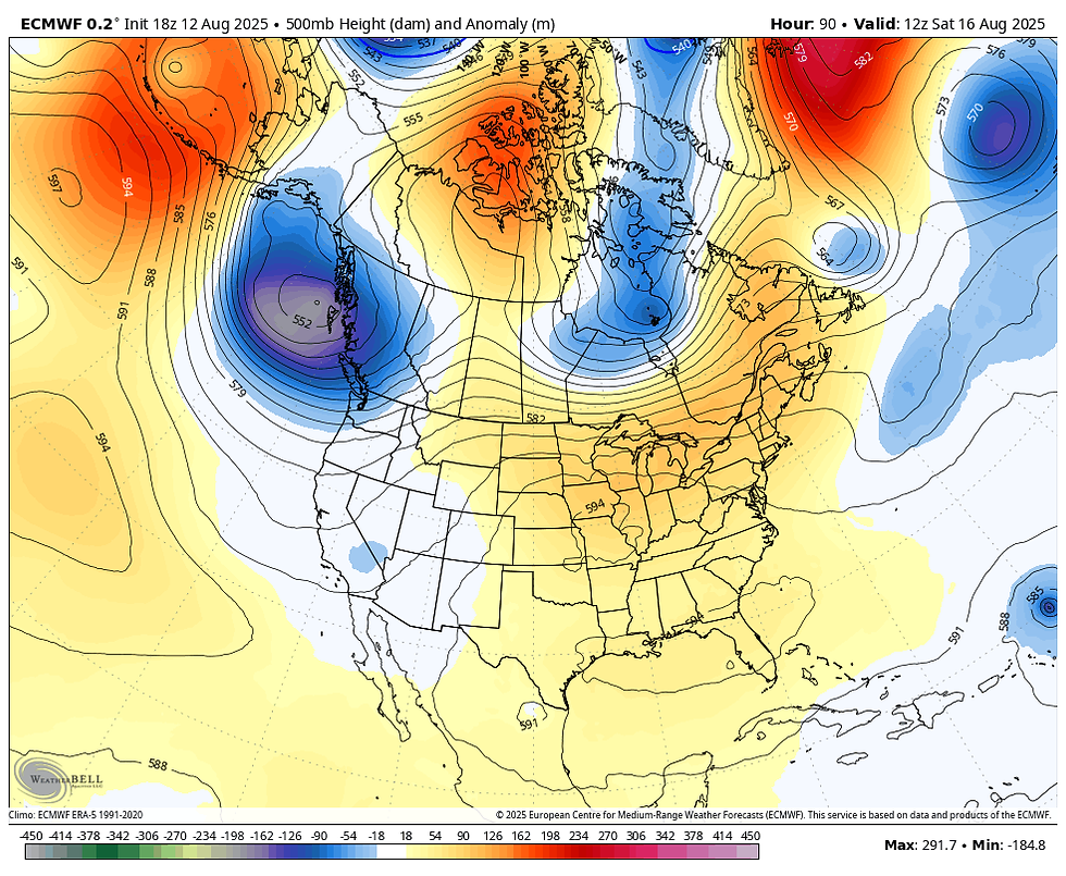
Friday, the next warm-up gets underway and come Saturday look at the above normal temperature departures that have developed over the central Midwest.

That leads to highs most areas near 90 Saturday and Sunday, with some low 90s likely across the south. Monday could be just as warm if we don't get into scattered thunderstorms and the rain cooled air they would produce.
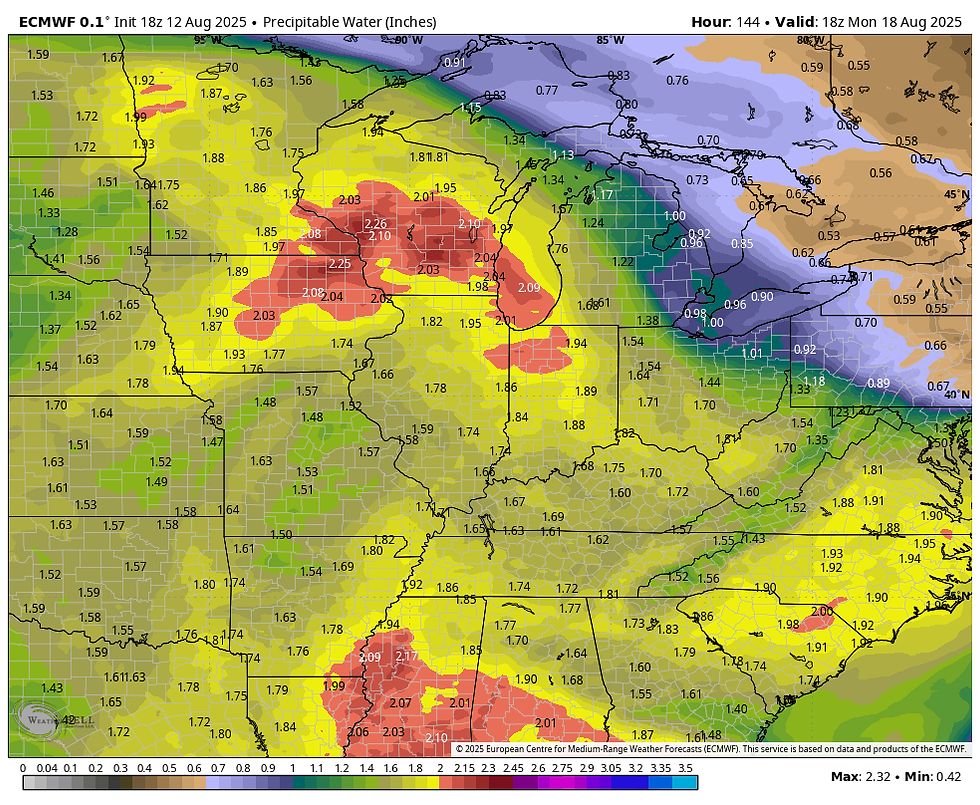
What is somewhat concerning from a rain standpoint is the deep tropical moisture that returns to the region. Notice water vapor Wednesday is well under an inch in my northern counties, close to, or even a bit below normal.
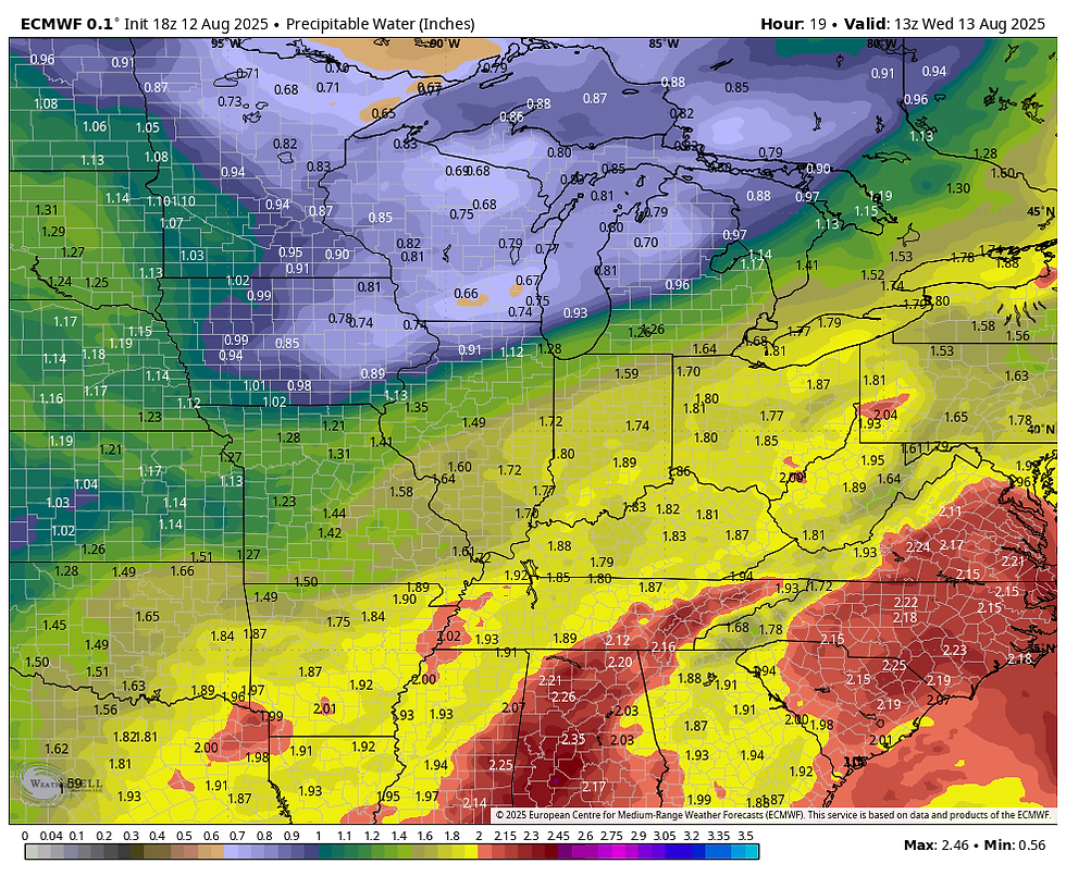
Later in the weekend and early next week, levels are again shown exceeding 2 inches in the north. It's this type of water laden air that can cause excessive rains like the ones seen recently.
The big question that remains to be answered is where we are in relation to the northern periphery of the heat dome. That is the favored spot for ridge riding storms to form and dump their payloads. I could see at least a couple of days starting Sunday when some part of the region would be under the gun for heavy thunderstorms. The north is most favored.
The GFS is well north of my area, with the boundary keeping the big rain producers confined to Minnesota and Wisconsin.

The EURO is perilously close, with heavier rains inching into my northern counties.
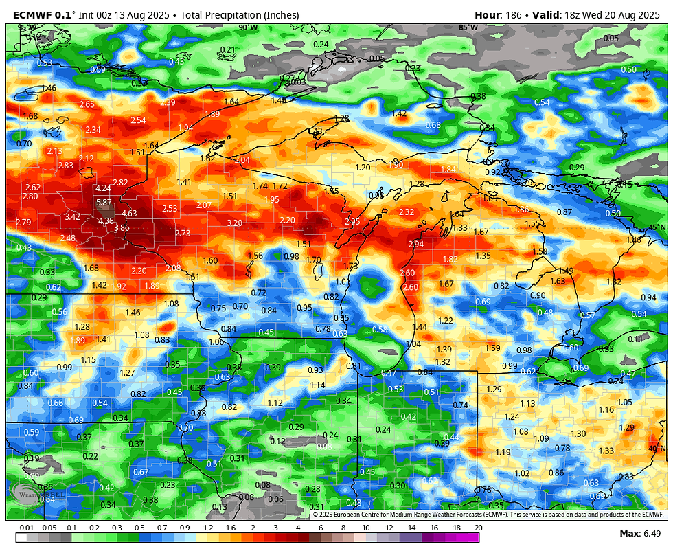
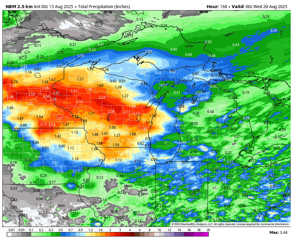
The National Model Blend gets 1 inch plus rain into the northern half of my area.
Often times when you get into wet cycles like we are currently in, the pattern reloads in repetitive fashion for extended periods. This is another situation that needs to be watched as we get closer to the weekend. In fact, the next 15 days, the GFS has some big rainfall numbers back on the board not far away.

Meantime, you can see the EURO has two nice days ahead before we pop back into the steam with 3 days of 90s in the Quad Cities Saturday through Monday.

Enjoy the peaceful and comfortable interlude, it's a short term visitor. Roll weather...TS


Comments