ON THE BOARD IN COLORADO
- May 24, 2025
- 4 min read

CHASECATION DAY 1 (May 23): We were off to the races early on our annual storm chasing trip. After landing in Garden City, Kansas around 3:30 p.m. we quickly ran to eastern Colorado which was the obvious severe weather target for the day. It was increasingly likely there would be multiple supercells capable of stunning structure, large hail and perhaps a few tornadoes.

High resolution modeling was indicating the potential for two supercells, one in far northeast Colorado with another to its south in east-central Colorado. Given the timing of my flight to Kansas we were forced to target farther south. Keep in mind this was supposed to just be a travel day, not an actual day of chasing. So we had no time to set the car up with cameras, laptops and internet (Starlink). We couldn't pass up the risk though.

A little after 5 p.m., with us still about an hour from our target storm, the Storm Prediction Center outlined two areas with the greatest severe potential. The southern storm, between Limon, CO and Goodland, KS was our target with a new storm developing just south of that.

The storm near Stratton, Colorado was a beautiful one. Classic low-precipitation supercell structure shape. Great stuff! The tornado threat was clearly limited at this point though as the storm was struggling, potentially in part due to storms forming to the south. Using satellite data, we quickly determined the best storm was one not severe warned yet, but a cell popping to our southwest. As we started to approach it, it went severe warned, turned southeast and quickly intensified.

For us, this is exactly what we want to see in front of us on the highway. For other drivers this was big problems. This supercell rapidly started flinging out tennis-ball-sized hail. As the storm turned more southeast, it tapped into better low-level wind shear and instability. We knew that it it was going to produce a tornado, it was soon. To avoid the hail, we turned south ahead of it to keep a safer distance. This would keep us far from a tornado, however give us a perfect shot of the full storm with one if we were to be so lucky.

Lucky we were. Shortly after 8:30 this gorgeous tornado dropped from the supercell right near sunset. It was basked in a beautiful orange color. Being this far we can see the full structure of the wall cloud and mesocyclone above it. Just perfect.

Here you can see the full storm structure with the tornado dropping on the lower-right side. I have seen lots of tornadoes close up, but this is one of the first I have seen with the amazing structure of the storm above it. Eastern Colorado rarely disappoints.

As the sun set the tornado threat diminished as well. However for the next hour we captured some amazing lightning shooting out of the storm. This is one of the few photos I have always wanted but never had the patience to really get. Welcome to Colorful Colorado.

That wrapped up Chasecation Day 1. Thanks for following along! I'll keep doing updated over the next week or so pending the outcome of our chasing. Saturday looks like a big-time threat in central and western Oklahoma with a hail and tornado threat. That is likely our plan of attack.
BACK AT HOME

Closer to home there is not too much to speak of. Memorial Day looks perfect to kick off any summer plans with sunny conditions and highs in the low 70s. The lone issue is a few light rain chances this week. Early Sunday morning, mainly before sunrise, there will be scattered showers in the region. This will generally be quite light and not meaningful. Clouds will stick around through much of the day, Sunday.

A more beneficial rain event is likely Tuesday for the area with model guidance painting a wider area of up to 0.25". The European Ensemble is notably wetter with totals more in the 0.50" range. This would be welcomed, but is a bit of an outlier.

The model blend, or average of lots of models, is considerably less with the storm track being well to the southeast of the region. We will likely see passing showers on and off Tuesday, but miss out on the heavier stuff.

The official forecast from the Weather Prediction Center is much closer to the "blend" of models with the storm track primarily farther south. This rain and northwesterly winds on the north side of the storm track will keep temperatures much cooler than normal headed through the week, but there are signs of warmth not too far away.

Looking at the forecast for the Quad Cities area there is quick cooldown with highs only in the 60s Tuesday and Wednesday but by next weekend into early June the 80s will return. This will be caused by ridging in the jet stream prompting warmer conditions.

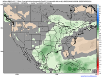
The ridging will prompt drier conditions across the Upper Midwest as well as well noted by analogs looking into the end of May and beginning of June. This appears to be quite likely based on model guidance and just looking at the pattern coming across the Pacific Ocean.

The official forecast from the Climate Prediction Center mimics this nearly perfectly - not surprising as we are pulling tools from the same toolbox.

The threat for severe weather remains quite abnormally low for Iowa and Illinois for the short term given this drier pattern. There are some hints that the first full week of June there will be a return to a more active severe pattern for the Central US, but overall there's nothing I am too excited about yet.
-Meteorologist Nick Stewart


Comments