


PASS THE PEAS PLEASE...
- Oct 21, 2020
- 2 min read
The snow season has come on like gang busters here in the Midwest. Tuesday was the 3rd consecutive day that measurable snow has been observed in some part of the region. The epicenter for Tuesday's accumulation was Minnesota and Wisconsin where up to 11" piled up west of St. Cloud. Most of the metro area surrounding Minneapolis managed 7-9" of heavy wet snow. Here's a few reports from that area.

Tuesday's snow band looked like this through late evening.

Here's what fell on Monday in Iowa. This band was much more narrow in nature.

Here's what your 72 hour totals look like.

As impressive as this is for October, there is more snow to come before the pattern breaks toward the end of the month. I will get to that in a bit but for the next 2 days the word warmer returns to the forecast. Unfortunately so does the word wetter.
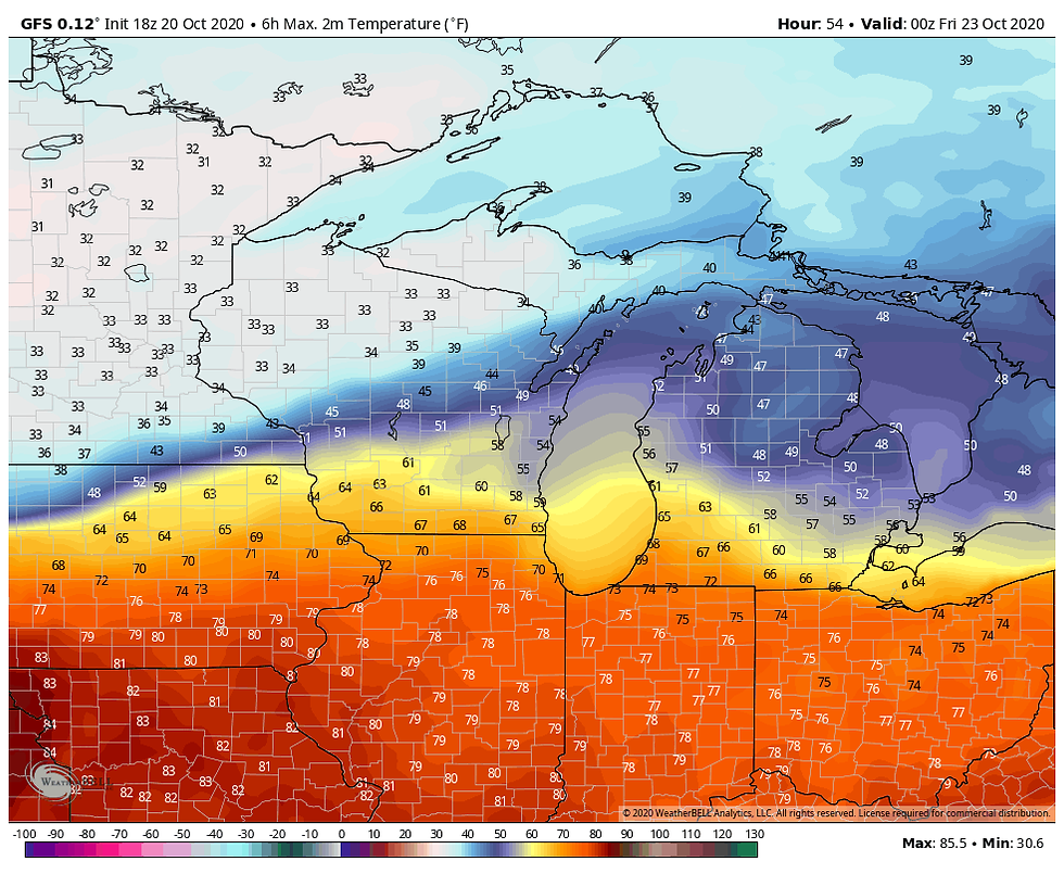
As for the warmth, while we will add about 10 degrees to the thermometer Wednesday but it will remain cool in the 50s. Thursday, following the passage of a warm front readings should really soar and we could see highs approach 80 in my far southern counties if we can manage enough sunshine. Mid 70s look likely to at least HWY 30. Here's what the EURO has.

The GFS is in good agreement.
With the strong warm advection showers and even thunderstorms are likely to develop Wednesday night and some soakers are expected. We will get a break much of Thursday allowing for the big warm-up later in the day. However, as a cold front slowly advances into the region Thursday night and Friday more showers and potentially a few thunderstorms will re-develop. That's followed by another precipitation threat Sunday. By the time it all comes to an end the EURO has this for total precipitation through noon Monday.

The GFS is not quite as wet but the placement is similar.

For my immediate area the next potential for any wintry precipitation comes with the system that arrives Sunday. Unfortunately in this set-up the GFS and EURO do not see eye to eye. The GFS shows a deeper push of cold air and that allows thermal profiles to be cold enough for some more snow in the NW half of my region. See below.

The EURO is much further north and keeps the fun away. I need a bit more time to weigh the situation but with all the snow on the ground in Minnesota that could give the cold air the density it needs to push like the GFS shows. It's a tough call at this distance. Hopefully the next 24 hours will bring some clarity. The EURO is clearly anti-snow.

During the interim today, we play the waiting game as the rain and ensuing warmth arrives tonight and Thursday. Needless to say there's lots of weather on the table and that's the way I like it. Pass the peas please! Roll weather...TS


Comments