SITTING ABOVE NORMAL, AT LEAST FOR NOW
- Nov 2, 2025
- 3 min read

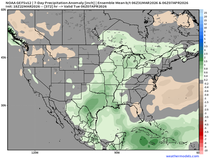
A cold and foggy start to your Sunday as we officially move into Standard Time across the region. Morning temperatures will be near to slightly below freezing locally, but with the growing season officially considered over, Freeze Warnings are not in effect locally. Percent chance of going above normal in the medium to extended period are looking rather high with analogs (above) hinting at 70-80% probabilities, but late this month the pattern could get a little more interesting. Terry covered it fantastically yesterday, but since the pattern is incredibly quiet, let's put a little context to some of our favorite teleconnections going forward.

I'll reiterate the medium/extended period warmth. The Climate Prediction Center Non. 9-15 is cooking up 50-60% likelihood of above-normal temperatures. This will likely increase somewhat in due time as confidence continues to increase.
ARCTIC OSCILLATION

One teleconnection I like to look at that has some pretty strong correlations in the month of November is the Arctic Oscillation. Once values start dipping to 1-2 or more standard deviations below, as the European Ensemble indicates by mid-November, this tends to lead to some cooling trends going forward.

Looking at Novembers since 1950 that have had a AO value of at least -1, the pattern tends to favor troughing over much of the CONUS, which is a rather strong cold signal. These values are somewhat high as well, pushing 30-40m anomalies. As you would expect, this is also colder.

The surface temperature anomalies do show greater than 1.5°C below normal with AO values of at least -1 once again across much of the CONUS, especially the Midwest and central US.
NORTH ATLANTIC OSCILLATION

Similarly the NAO takes a dive well into negative standard deviations with the European Ensemble mean right around -1. The control, for what it's worth, dips as low as -4 which is quite a strong signal. This follows the AO overall rather well in terms of timing.

The NAO is similarly showing a troughing signal across the CONUS, although not quite as potent as the signal on the AO.

The surface temperature anomalies show the colder signal as well given that flow of northwest flow takes over. Again this would likely be in the second half of November, especially late-month into early December.

The MJO is swinging into phases 6 to 7 late in the period (mid-November). You might have started to catch onto the trend by now, but as you head towards Phase 7-8, that is when things get cooler across the CONUS.

November temperature composites for the MJO show that cooler trend in phases 7 to 8 to 1.
So, again all the signals are pointing towards a cooler pattern later in the month that is backed up by many of the teleconnections I like to look at. This is simply pattern recognition. The details are too far out and too low confidence to go into much detail.

For what it's worth, commodity markets appear to have started moving on this colder signal in later November and early December. Natural Gas futures jumped 2.7% on Friday, and I suspect this was heavily due to a cooling signal deeper in the period. Given international affairs these have been less weather-focused as has been the case in the past, but long-range weather forecasts may be driving some movement. I'm very curious to see how it moves Monday.

Looking at the European Ensemble for the Quad Cities shows a bit of an up/down pattern with highs generally in the 50s and low 60s through the week into early next week. It is after this two-week forecast that things could potentially get a little more interesting. We'll have to see how the models start to handle these teleconnections going forward.
Have a great rest of the weekend everyone and enjoy that extra hour of sleep!
-Meteorologist Nick Stewart


Comments