SUMMER WARMTH RETURNS
- Sep 7, 2025
- 2 min read

Sunday morning saw near-record low temperatures across the region, generally within a few degrees of that mark. The signal going forward, however, is much warmer through mid-September. Analogs, for example, are well over 80% chance of above-normal temperatures Sept. 12-15 as a strong ridge is forecast to build.

The European Ensemble continues to drive in a significant ridge across the central US, pumping in summerlike temperatures with a notable lack of moisture. The good news is it will be warm without intense heat indices expected as of now given a strong lack of moisture return. This will also keep rain chances quite limited locally, with the storm threat being a bit higher in the Northern Plains.

Climatology says the 850mb temperatures next weekend will be in the 90th percentile. This is a pretty good indicator for surface temperatures and shows the expanse of the warmth expected across the Upper Midwest and Great Lakes region.
This warmth at 850mb is also going to act as a lid to prevent widespread storm coverage. This capping will keep much of the region dry over the extended period.

Meanwhile, the precipitable water values expected during the same time period are forecast to be near normal. This is, again, a pretty good indicator for lower humidity values. The higher values well to the northwest is where the rain chances will be the highest as well.

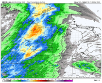
The American GEFS indicates seven-day precipitation anomalies through early next week are less 25% of expected totals for this time of year for much of Iowa, Illinois and Missouri. Prolonged dry weather continues to stick around with the warmth that is expected.

Worth noting, 25% of normal is a much lower number than 25% of normal in June or July. The month of September the seventh-driest on average in a year, so we are well off the active periods. Those rain events typically do not hit as hard this time of year.

For now, it's not a major concern locally as widespread drought is still not an issue, however with some significant warmth headed our way coupled with dry air, the ground will rapidly begin to dry out. I would not be shocked if we see a rather dramatically different drought map in two week's time. We did see an increase week-over-week in drought coverage across Missouri and the southern two-thirds of Illinois.
I hope you all had a great weekend and hope you have a great week!
-Meteorologist Nick Stewart


Comments