THAT WAS TOASTY...
- May 16, 2025
- 3 min read
Wow, summer made a grand entry Thursday with the year's first 90 degree temperatures, good enough for records in spots. Moline broke its mark with a reading of 93 degrees. Further east, it was even hotter with Peru, Illinois hitting 98, Rochelle 97, and Chicago 95!

Along with the heat, came a period of high humidity that had the air conditioners humming. Dew points reached the low 70s in many areas, also the first time for moisture levels of that caliber! The humidity was all gone by Thursday evening, thanks to a front known as a dry line. Ahead of it at 1:15 p.m. Steve Gottschalk in Lowden, Iowa measured 91 degrees with a dew point of 71, yielding a heat index (how it felt) of 100 degrees. By 5:00 p.m. the dew point had fallen 23 degrees to 48 in a matter of 3 hours time. By 10:00 p.m. Mason City, Iowa had plunged to 32!
The dry line also produced enough convergence to spark a few late day thunderstorms, mainly along and east of the Mississippi. However, the stronger storms with more substantial intensity and coverage remained to the northeast, where tornado watches were issued. Nonetheless, Yorktown, Illinois (in Bureau County) had 2" hail that broke windows and damaged siding. Most of the beneficial rain we could have used fell to the north and east, as expected. These are Doppler rainfall estimates through evening.

The Satellite imagery depicts nicely how the storms blew up in the tropical moisture ahead of the advancing dry line late in the afternoon Thursday.

Another big factor Thursday was the non-thunderstorm winds. Gusts of 42-50 mph were common. Thanks to recent dry weather and largely barren but tilled fields, blowing dust and haze reduced visibility in many areas. Sunset was abnormally orange as a result of the dust particles.
By the way, you can usually tell the strength of a storm by the speed of its winds. The lower a storm's pressure, the more intense it is and the greater the pressure gradient, (the creator of wind). This system is shown reaching 980mb (28.93 inches), very impressive by May standards. Below you can see the deep trough associated with the energy. It slowly spins out the next 24–48 hours, only to be replaced by another deep cut-off low early next week.

The new system takes a more favorable track for some much-needed precipitation. The EURO indicates this for amounts through next Wednesday.

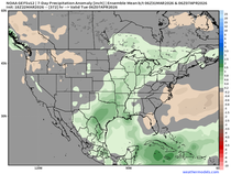
Most spots are above normal, some by over an inch. These are the rainfall departures Monday-Wednesday.

TERRY'S LITTLE WHITE CHURCH, A GALENA AIRBNB
Check out some of the ways you can save as much as $400 dollars on a stay at my AIRBNB, a renovated church in Galena. It's a most loved guest favorite with perfect 5-star ratings. https://www.littlewhitechurchgalena.com/
THE WEEKEND AHEAD..
Meantime Friday, we are still feeling the impacts of Thursday's storm inching through the upper Midwest. The strong pressure gradient remains in place, meaning westerly winds of 40-45 mph are again expected. There should be enough instability for a few brief passing showers or sprinkles under a mix of clouds and sun. Mild temperatures will continue for another day, with highs ranging from 77 north to 85 south.
Saturday, as the low moves slowly east, the area comes more under the influence of NW flow that brings a cooler air mass. Winds also remain fresh at speeds up to 30 mph. Highs could struggle to get out of the low 60s north, where some periods of clouds are possible. Readings in the far south should approach 70 where sunshine is likely to be more prevalent.
Sunday, the ingredients are there for a better day areawide. Winds will be down some, sunshine looks abundant, and highs of 70-75 are on the menu.
Next Monday, a few showers are possible, but they look light. The more substantial part of the system comes Tuesday and Wednesday, when heavier rain appears to be a good bet. The addition of clouds, precipitation, and easterly winds are certain to make next week significantly cooler than this week. These are the 5-day temperature departures for next Monday through Friday. Ick.

Happy Friday everybody and be sure to hold onto your hat! Roll weather...TS


Comments