


THEY CALL IT RAIN...
- Jun 25, 2022
- 3 min read
For some parts of my area, rain has been an unknown commodity the past 10 days. Some spots, particularly northwest of the Quad Cities have seen no more than sprinkles the past couple weeks. In Cedar Rapids, Friday was the 9th consecutive day with no measurable rain. Over the past 3 weeks, little more than 1/2 inch has fallen. a stretch which would typically average closer to 4 inches. Dubuque finds itself in a similar situation over that period. These are the rainfall deficits over the past 2 weeks. You can see large portions of the Midwest have been on the dry side.

Today however, the rain machine is up and running and most areas have a decent chance of seeing some beneficial amounts before it's over. What's fallen overnight (and continues in spots Saturday morning) is due to a disturbance riding a warm front that's been inching northward since Friday. A cluster of showers and thunderstorms fired up Friday night over western Iowa and what's left of that roams the region Saturday morning (albeit in a decaying state). The north will experience this the longest as the complex creeps northeast along the warm the first half of the day.
Temperatures Saturday will be dictated by the warm front and how soon any sunshine can break out. That's likely to happen in the south much earlier and that part of the region can expect a steamy afternoon with highs upper 80s to near 90. Here heat index values will approach 100 degrees. Further north it will be muggy but debris clouds and morning rains will keep highs in check. The far north may have trouble getting much above 80 if clouds hold for most of the day. The EURO shows this for highs.

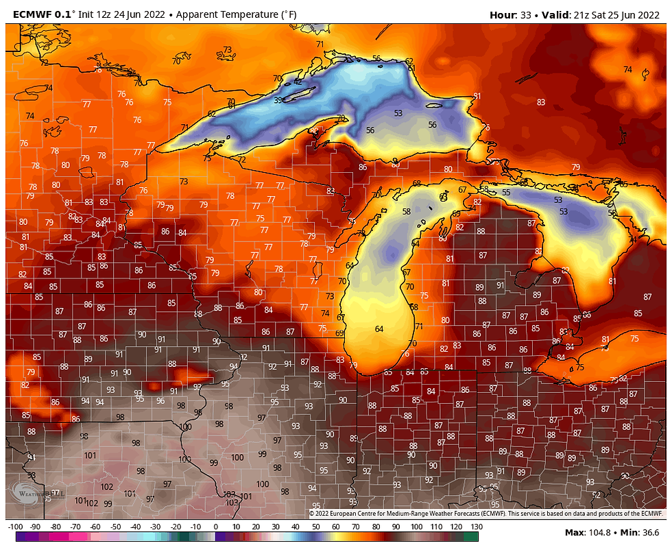
The EURO also depicts this for heat index values. It looks like a mean one in over far SE Iowa and WC Illinois.
One of the days challenges will be thunderstorm potential late Saturday afternoon or evening along a cold front arriving from the northwest. Surface CAPE (instability) does reach significant levels so storms could quickly fire out of the gate late in the day when the cap breaks and the convective temperature is reached. Shear is minimal but some strong updrafts are possible, mainly in the southeast half (especially from the Quad Cities southeast). Overall, severe weather should be limited and confined to some low end wind gusts of 50-60 mph in the strongest updrafts.

My feeling is that the NW half to 1/3rd of my area misses out on afternoon storms Saturday with the front arriving too early for storm initiation. What rain falls in this part of my area will be tied to Saturday morning convection. The latest trends are for most of the afternoon or evening storms to be concentrated over the area near and southeast of the Quad Cities. Even here, coverage looks scattered meaning rain totals could vary significantly over short distances.
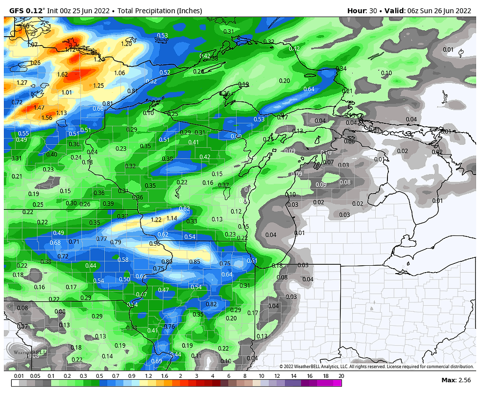
Here's what models are suggesting for rain totals through Saturday night. There is a tendency for the higher amounts to be north of I-80, especially near and north of HWY 30 north.
The EURO

The GFS
The 3K NAM

The 12k NAM

The HRRR

Behind the cold front Sunday and Monday, some fabulous weather returns to the region under a nice dome of high pressure. Pleasant temperatures, low humidity, and sunshine will abound. Highs should hold in the mid 70s to low 80s Sunday to the low to mid 80s Monday. Choice for late June!
By Tuesday of next week heat and humidity should make another run at the Midwest as return flow develops around the retreating high pressure. Readings will go from the mid 80s Tuesday to near or slightly above 90 Wednesday and Thursday. At this point, little if any rain is expected Sunday through Thursday of next week. If you are one of those who needs a good rain, hopefully you get it Saturday as the 5 days following that have the potential to be dry.
With that, I conclude this post hoping you all have a solid weekend despite what mother nature has up her sleeve. Roll weather...TS


Comments