


WINTER CALLING...
- Jan 10
- 4 min read
That big old rain system that plowed through the Midwest Thursday was out of character for early January. Moisture levels were off the chart, with dew points in the mid to upper 50s, close to all-time records for January 8th. Much of my area saw rains of 1/3 to slightly more than an inch. In this 3D perspective of rain totals, you can clearly see a feature known as a dry slot extending near and east of the Mississippi. Dry air drawn into the circulation center (common with storms of this magnitude) kept rain amounts lower in that specific part of my area. NW of the low pressure track the heaviest rains fell in the deformation zone NW of Ottumwa to Cedar Rapids and on to Dubuque where some 2 inch totals fell in WC Wisconsin. Further SE from central Illinois to Chicago, the warm sector produced another swath of heavier rains due to thunderstorms that formed in the instability found there. Being in the core of the dry slot is like being in the black hole of weather, nothing much happens in "the slot". My motto, stay the heck out of the dry slot!

This satellite shows the dry punch advancing into my area Thursday evening, with heavy rain (and some snow) to the west, and active thunderstorms further to the east. A pretty classic mid-latitude cyclone.

Despite our proximity to the dry slot Thursday, we did see some low topped thunderstorms in the high shear moisture rich environment. The NWS did issue a thunderstorm warning for a number of counties between 7 and 8:00pm.

The chart below, from the Iowa Mesonet, depicts the period each year between the first and last Severe Thunderstorm warnings for Iowa, with the number of events each day indicated by the red ticks within each bar. Only 4 other years since 1986 have we had such a warning during January, with the most recent occurring in 2013. In a typical Iowa year, the average first date of thunderstorm warning is March 7th and the ending date is October 29th. That puts us 2 months ahead of schedule!

By the way, the warmth and rain of Thursday finally took care of what was left of the snow on the ground here in Dubuque. Until now, we had at least a trace of snow on the ground since November 29th, a total of 41 consecutive days. It now appears that nowhere in Iowa or Illinois has more than a trace of snow. That's a monumental feat considering my area had 18–24 inches of snow in the period November 9th to December 15th. Gone like the wind. Easy come, easy go!

HOT DEALS IN JANUARY....
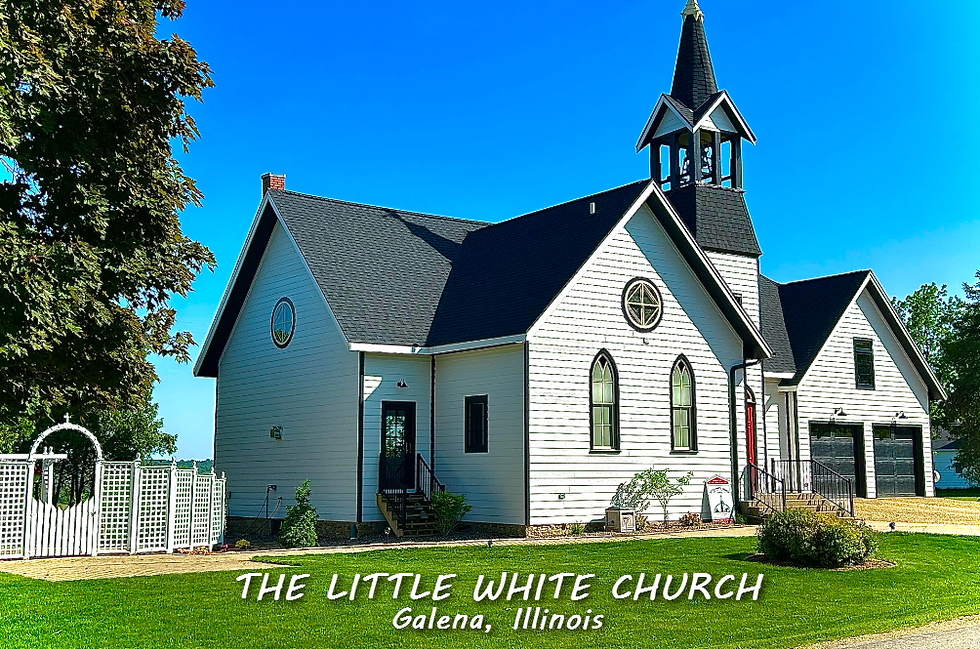
A January weekend, (4 GUESTS FOR $499 total) My AIRBNB outside of Galena is ready and waiting. Enjoy our unique, fully renovated church. It's an AIRBNB guest favorite with 5-star reviews. Warm and cozy, even in the winter. Minutes from Galena. Call or text Carolyn at 563-676-3320 for details about this very special deal. https://www.littlewhitechurchgalena.com/
A BRUSH WITH WINTER...
Things calmed down nicely Friday afternoon, with sunshine, diminishing winds, and temperatures in the 40s. Nice as it was, another system is set to eject from the SW and merge with a northern stream disturbance to create some light snow around the region Saturday. No rest for the weary.
In the end, this system pales in comparison to the previous one in terms of the amount of moisture available. On top of that, no real organized surface low takes shape until it phases over the Great Lakes Saturday night. Assessing the latest data, the majority of today's guidance keeps the best forcing and moisture just to the east of my area. The end result is a quick swath of light snow focused on the area from the Mississippi River east late Friday night and Saturday morning. After that, some wrap around snow showers are possible associated with a cold core 500mb low that forms in SW Wisconsin late Saturday afternoon or night.

Assembling all the new raw data Friday night, here's what models are suggesting for snow accumulations Saturday. My thoughts below.
The EURO

The GFS

The HRRR

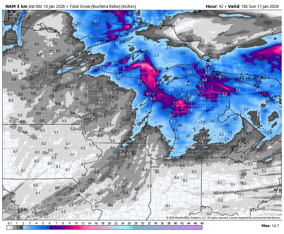
The 3K NAM
The 12K NAM

The official NWS snowfall forecast.

Using a blend of the model's total QPF of .03 to perhaps .13 inches from west to east late Friday night and Saturday morning, it suggests accumulations of 1/4 inch west to 1 inch E/NE of the Quad Cities. A few isolated spots in my far eastern counties in Illinois could see slightly more. With boundary layer temperatures near freezing, this looks to be a wet snow and with warm ground temperatures quite mild, travel impacts should be minimal with minor accumulations on grassy and elevated surfaces, especially from the Mississippi east.
As I mentioned earlier, late in the day Saturday, some snow showers are possibly associated with the cold core of the upper level low rotating southeast. These should be brief but in spots could produce some minor accumulations ranging from a dusting to 1/2 inch with short periods of low visibility. These bands will be narrow and most spots will not experience them.
After that, winds increase Saturday night out of the northwest, driving in much colder temperatures. Lows Sunday morning in the upper teens to low 20 will be accompanied by wind chills of 5–10 degrees Sunday morning.

Fortunately, the core of the cold lifts out quickly, allowing highs Sunday to reach the upper 20s to low 30s, close to seasonal levels. Monday and Tuesday expect enough warm air advection to get highs back in the low to mid 40s. However, a cold front sends the mild air packing, and Wednesday highs are back in the mid to upper 20s.
By then, the MJO is shown heading into phase 6 and 7 which strongly analogs to above normal temperatures much of the period January 15th through the 25th.

The temperature analogs for MJO phases 6 and 7 in January.

In all honesty, considering the time of year, I don't see anything that looks very concerning the next week regarding cold or snow. That gets us halfway through the winter, and it's all downhill from there. Roll weather...TS


Slope Game, the challenge's primary component, consistently promotes accuracy and composure under duress. The captivating music and eye-catching images will motivate you to start over and go even farther, even if you make a mistake and end up with nothing.