WARMING UP AND WATCHING STORMS
- May 10, 2025
- 2 min read

First and foremost, Happy Mother's Day to all the amazing moms out there! Hope you are enjoying the beautiful (albeit chilly in the morning) weather across the Midwest today. Warm weather will stick around to kick off the week with quiet weather in place as well. The warmth will only accelerate by mid-to-late week before changes are brewing. Five-day temperature anomalies will be surpassing 10-15° above normal.

Forecast highs will continue to climb this week with more widespread 80s likely by Monday and Tuesday, and potentially highs pushing near 90 on Thursday. A lot of sunshine will accompany the warm temperatures.

A few models are trying to spit out a few light showers and isolated storms Tuesday across eastern Iowa and northwest Illinois. This appears to be quite light and spotty in nature. Consider yourself lucky (or unlucky pending your view) if you end up under one of these. The bigger threat for storms comes on Thursday.

The Storm Prediction Center has already issued a Level 2 of 5 risk, a Slight Risk, for the area. I was a little surprised given some model disagreement they had the confidence to issue it, but I respect it and agree with it. As alluded to earlier Thursday will be a hot one with highs near 90. Instability will be plentiful.
The Euro

The GFS

Both the European and the American GFS models indicate rather high-end instability across the region. CAPE values are forecast to push over 2500-3000j/kg, with the Euro being more bullish ahead of an approaching cold low pressure center and trailing cold front.

The instability will reside below strong upper level support. A large upper-level low will have strong wind speeds and diffluence over the region. This puts far eastern Iowa, northern Illinois and southern Wisconsin in a rather favorable position relative to the trough in the jet stream for severe weather.

The European ensemble shows precipitation Thursday across the region as well, indicating the likelihood of storms forming in the Upper Midwest and Great Lakes being able to tap into the unstable and strongly-sheared environment. All that being said we will likely be tracking storms, some strong or severe, on Thursday.

Looking specifically at the Quad Cities area on Thursday, the European Ensemble has a higher confidence in precipitation with nearly half of the 50 members showing at least a tenth of an inch of precipitation. You can also see a much more active period of weather early next week.

Analogs are hinting at the severe weather threat quite well, although it appears to be more focused on Illinois and Missouri in the local area. There are higher tornado probabilities showing in the analogs as well in central Illinois. At this range from experience, analogs are best at showing potential impacts and not so much the exact locations as subtle timing differences are possible.

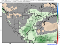
Thursday is just the beginning of a more active period of weather with above-normal precipitation in the forecast over the next week and a half. Climate Prediction Center outlooks have the entire region on watch, and as mentioned above, the ensembles are already quite active for early next week. This could potentially include severe weather but details are too low confidence at this point.
Have a great rest of the weekend!
-Meteorologist Nick Stewart


Comments