WEATHER IN GRIDLOCK
- May 3, 2025
- 3 min read

Happy weekend, friends! After a turbulent stretch of weather things are really starting to grind to a halt across the region as the weather goes into a bit of gridlock. A blocking pattern known as a Rex Block will transition into more of an Omega Block as we go through the first few days of May. The light rain, cloud cover and cooler temperatures Friday/Saturday under an upper-level low will transition more to a warmer and sunny stretch this upcoming week as High Pressure builds across the Northern Plains.
This blocking pattern will also keep the storms in check and bring the sun and warmth as it takes hold.

Stubborn cloud cover and perhaps a few spotty showers will continue locally Sunday as the upper-level low slowly meanders to the east. This will keep temperatures mainly in the mid-60s Sunday.

By Monday we will likely start to see the influence of High Pressure with decreasing cloud cover and warmer temperatures. Forecasts take the region into the mid-70s - the start of a nice warming trend into next weekend.

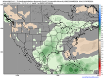
Models are trending warmer for the first full week of May in the Quad Cities region with widespread 70s taking over. This will be accompanied by plentiful sunshine as well as the blocking pattern sets us up for success. Longer term, 80s are likely knocking on the door next week, but that's still a ways out for now for specifics.


What we can say though is that the above-normal pattern looks to persist into mid-May for the Midwest and Great Lakes region. This, with high confidence in drier weather, is likely a welcomed sight for farmers that have been a bit delayed getting the spiring plant underway due to water-logged fields.

The latest USDA Crop Report shows just 16% of the corn crop has been planted in Illinois as of April 27. The five-year average is 26%. Iowa is running ahead of the five year average with 34% compared to the 28% average, but notice the progress from the week prior when it was just 18%.

We did get the latest guidance from the Climate Prediction Center related to the drought outlook for the rest of spring and early summer. Overall, drought is forecast to expand across the Midwest for more of Iowa, Minnesota, Illinois and Wisconsin. This trend will need to be closely watched going forward.

The latest long-term climate models show a rather dry signal for the Midwest June-August.


Unfortunately this is a signal that is repeated through pretty much every major climate model we have access to. For the time being this is likely why we will see official messaging about drought from NOAA/NWS in any upcoming outlooks. We know all too well how just one storm system can make all the difference.

Let's end with a look at the spring tornado season so far now that we are through March and April. I put together this anomaly chart that looks at tornadoes so far in spring compared to the 2013-2023 record. There is noticeably a lack of tornadoes across Iowa and northern Illinois while the Central Mississippi River Valley and Ohio River Valleys have been hit by multiple high-end tornado outbreaks.

Back in February I put together a spring tornado outlook (third year putting these together) based on analog years I have been looking at. Compared to where we stand through May 2, the forecast I created is performing quite well showing a more quiet Iowa (after a record 2024) and a hyper-active Mid-Mississippi River Valley. We will see how the rest of May shakes out.

Have a great weekend, everyone!
-Meteorologist Nick Stewart


Comments