WEEKEND CONCERNS...
- Aug 8, 2025
- 4 min read
Heading into the weekend, confidence continues to grow that impactful weather is likely to found in the central Midwest. At this time, my area appears to situated near the epicenter of the event, which could linger into Monday. Here are some of the potential issues ahead of us.
HEAT AND HUMIDITY
HEAVY RAINS
FLOODING OR FLASH FLOODING
SEVERE STORMS
The first order of business is the heat and humidity that floods the region Friday. While a few stray storms may dot the area Friday morning, they are shown dissipating early. After that, strong heating is expected along with an influx of moisture that sends dew points into the mid 70s. That combined with highs in the upper 80s to near 90 will generate heat index values (how hot it will feel) of 96 to 101. That has prompted the NWS to issue a Heat Advisory for all but my far NW counties from 1:00 to 7:00pm. It may end up being a marginal advisory, especially north of I-80 where a number of models keep HX numbers in the mid to upper 90s, below the 100 degree threshold. Either way, it will be steamy, but not as bad as many other days this summer.

After Friday, convective remnants, outflow boundaries, and even thunderstorms will likely lower highs several degrees in all but the far south, where another tough day is likely with highs near 90 along with a 100 degree heat index. Elsewhere, mid to upper highs 80s are expected. Sunday continues to trend cooler with low to mid 80s anticipated thanks to greater coverage of clouds and perhaps scattered showers and storms. Similar readings are expected Monday. What remains as a problematic issue is the high levels of moisture, with dew points through Monday expected to be in the low to mid 70s. It's going to be muggy.
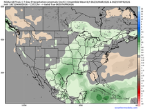
Another concerning element is the extreme amounts of water vapor that will exist Saturday through Monday, with PWATS (precipitable available water) well over 2 inches. The EURO Saturday night show levels approaching 2.50 inches, twice the norm and 3 times the standard deviation from average. In other words, the atmosphere is like a sponge loaded with water. You squeeze it and it comes gushing out. That's exactly what could happen with any thunderstorm that goes up in an environment like that.

Getting down to the nuts and bolts of it, the region will be ripe for heavy rain this weekend. Models have consistently shown the potential for several days, and the latest output is not backing down. Here are 5 models with their interpretation of how much rain could fall. Remember, this is not a forecast, just raw model date that is used to make forecasts. The consistency is quite good, indicating high confidence in a heavy rain event Saturday through Monday. The 3k NAM, GFS, and 10K GEM are extremely bullish on totals. Hopefully they are overdone as they scream flash flooding as well as river flooding with all the rain that's recently fallen keeping river levels high and soils fairly saturated. I expect a flood watch will be issued at some point for a large part of my area, especially my counties from the Quad Cities northwest. Take a look at what models are suggesting for rain totals. The majority of what's shown falls Saturday into Monday.
The EURO

The GFS

The 3k NAM

The 10k CANADIAN GEM

The Weather Prediction Center forecast

So far, we've addressed the potential for heavy rain and flooding due to storms. The final element left on the table is strong to severe storms. Recent models have trended stronger with the severe threat Saturday, especially the 3k NAM. It shows some extreme instability with CAPE values greater than 45000 j/kg

The supercell composite (indicating the potential of rotating storms) is 10-15 from I-80 north late in the afternoon.

The helicity tracks from late afternoon through evening are impressive and show some long tracked intense supercells.

There's potentially enough shear for a tornado threat, greatest in the north.

Around 7:00pm, the simulated radar shows explosive thunderstorm development over my NW counties, moving southeast.

The simulated infra-red satellite shows very cold cloud tops, indicating storm heights well over 50,000 ft.

SPC has increased it's severe weather outlook Saturday to include a slight risk of strong storms for the northern half of my area. This could go up a level if trends persist.

It's important to stress, this is only the second run in a row the 3k NAM has been so bullish on strong storms. Additionally, it is the only CAM that goes out far enough to capture the event. I will want to see more evidence of a severe storm outbreak from other models before I get on the bandwagon, That said, on paper this set-up has significant severe weather potential. It will be interesting to see where trends lead us later Friday.
Additional storms are anticipated Sunday and Monday. However, an MCS like what's shown Saturday can change the location and instability behind it due to a pool of cool air drawn to the surface through downdrafts and outflow. Until this first round of convection passes, there's not much sense in trying to get anymore in depth on what happens Sunday and Monday. I'll have more on the developing situation in my next post. Hopefully, it's better news, but in my opinion the heavy rain threat is a real concern! Roll weather...TS
PLAN A VISIT TO MY 5 STAR GALENA AIRBNB
My 5-STAR AIRBNB just outside of Galena still has some openings this summer. All of our ratings are 5 star! We take pride in the amenities and the cleanliness. If you book now, we'll take off $200, and we can eliminate AIRBNB fees and additional costs that will save you big bucks. Other discounts apply. Call or text Carolyn at 563-676-3320 for our best deal of summer. See more at https://www.littlewhitechurchgalena.com/


Comments