WETTER WEATHER AHEAD
- May 17, 2025
- 3 min read
A big old late spring storm is wound up over the upper Midwest, and it sticks out like a sore thumb on the weather charts. A 540mb upper air low is parked over Minnesota. In the dead of winter, that's a healthy system. On May 17th, it's potent.

One look at the satellite, and you can see it's causing a ruckus as its circulation fuels a severe weather outbreak to the southeast and a cold, raw day in the Dakotas and NW Iowa.

Get a load of these temperatures Friday evening. Mid-30s are found in North Dakota with mid-40s extending into NW Iowa.

Wind chills are flat out ugly for so late in the year, with low 20s near Minot, North Dakota. Upper 30s have snuck into the NW tip of Iowa.

Spokes of vorticity (energy) rotating around the stacked system along with cold air advection have caused pockets of showers to develop and rotate around the circulation. A few of these made their way into my area Friday, but totals locally were no more than a few hundredths of an inch (.01 to .03"). These are likely to shift out of the region Saturday.

Once again, the intensity of the storm fueled powerful west winds that hit 40-45 mph in the afternoon and evening. This cyclonic flow will continue to produce blustery conditions Saturday as the storm grinds slowly off to the east. Additionally, cold air advection continues in earnest and temperatures will steadily cool. The HRRR shows highs Friday only in the upper 50s NE, where clouds could be a factor much of the day. Further south, the clouds should erode in the afternoon allowing readings to reach the low 60s, perhaps 65 in the far south.

By Sunday, the system gets kicked east, bringing sunshine, lighter winds, and warmer temperatures. Highs should range from 70 north to 75 south.
By the way, confluent flow at the base of the 500mb trough along with a sharp dry line created a lethal set-up for a severe weather outbreak over parts of the Ohio and Tennessee Valleys.

SPC anticipated the onslaught and had a significant threat risk in place.

As of Friday night, 901 reports of severe weather had come in to the Storm Prediction Center. Up to 24 tornadoes were reported.

At least 7 deaths were reported, 5 in St Louis, from a tornado that roared through there Friday afternoon, causing extensive damage. This image from the National Park Service was snapped atop the Gateway Arch as the supercell responsible for the tornado advanced on St. Louis.

TERRY'S LITTLE WHITE CHURCH, A GALENA AIRBNB
Check out some of the ways you can save as much as $400 dollars on a stay at my AIRBNB, a renovated church in Galena. It's a most loved guest favorite with perfect 5-star ratings. https://www.littlewhitechurchgalena.com/
A WET PERIOD AHEAD?
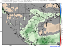
Next week another large slow moving cut-off low is shown impacting a large portion of the central Midwest. The core of the system is expected to track south of the area, which puts my area in a position to receive a welcome soaking rain. A minor concern is that the depth of the cool dry air from our current system is strong enough to force the new system further south. I don't expect a full miss, but it may be that the more substantial rains occur in the southwest half of my area. Just a hunch. For now, here's what guidance is indicating for rain totals. Some light showers might show up Monday, but the bulk of the rain falls Monday night through Tuesday night.
The EURO

The GFS

One thing I'm quite certain about is that we are going back into a cool period of weather for at least a week due to clouds, periods of precipitation, easterly winds, and troughing. These are the mean temperature departures for the next 7 days ending May 24th. A daily departure of 9 to 11 degrees per day for a week is quite significant.

The Climate Prediction Center shows much of the nation from Iowa east with a high chance of below normal temperatures. I don't see anyway around it.

On that note, I conclude another post and hope you all have a sensational weekend. Roll weather...TS


Don’t let people guilt-trip you for outsourcing sometimes. Essay writing services exist for a reason—and https://essaybox.org/ is one of the few that actually delivers high-quality, custom work. If your schedule’s packed and you need to meet a deadline, this is one service that won’t disappoint.
Who knew the best nursing essay writing service could be such a lifesaver? I was buried in shift rotations and had no time for assignments. I gave them a rough outline and got back a well-written paper that hit every requirement. No stress, no late-night writing—just results. Definitely using them again for my next pharmacology essay.