ONE OF THE ALL TIME GREATEST BLIZZARDS...
- Mar 1, 2016
- 1 min read

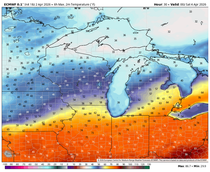
The Midwest is getting set for what should be a prolonged period of above normal temperatures. It looks like the next 2 weeks will see above to much above normal temperatures. Precipitation should also be on the increase as the warmer air allows deeper moisture to enter the pattern. Some thunderstorms (a sure sign of spring) are likely to be seen with CAPE values showing increasing instability in the overall 7-14 day period.
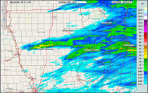
I will eventually get into that deeper in a later post but I did want to pass along some interesting information on the great Dakota’s blizzard of 1966. It was just wrapping up after pounding the northern Plains from March 2-5th. Scott Doering a meteorologist in Aberdeen, SD. alerted me to the 50th anniversary of this exceptional event which produced nearly 40″ of snow and winds approaching 80 mph. Here’s a few pictures from the Grand Forks, Devils Lake, ND area from the Grand Forks Herald.


Scott also sent along some sweet links that document the event. You can also learn about snirt! Thanks for the heads up Scott! Just an FYI… NWS Offices in the Northern Plains will be live tweeting the 50th anniversary of the March 2-4 1966 Blizzard using the #Blizzard66. Here are some of the Top News stories as well. http://tinyurl.com/March-1966-Blizzardhttp://www.weather.gov/bis/March1966Blizzardhttp://www.weather.gov/fgf/blizzardof66http://www.weather.gov/unr/1966-03-02_04https://noaa.maps.arcgis.com/apps/MapSeries/index.html?appid=d4cc8cfbf3944a50b4c3b9f7d22a244d OK, you can go impress your family and friends with your new found knowledge of one of the worst blizzards to ever strike the central U.S. Roll weather…TS


Comments