THE SOI TANKS, DOES THE MIDWEST?
- terryswails1
- Feb 15, 2017
- 3 min read

The weather around the Midwest has been on cruise control the past week. No storms, no cold, no excitement for me. Good as its been, it's only going to get better. Take a look at my forecast temperatures and their respective departures for Cedar Rapids the next 7 days. Blow torch!

These temperatures will also blow away some bench marks for various temperature thresholds. For example, in the graphic below you can see when the first 55, 60, 65, and 70 degree temperatures typically occur. In Cedar Rapids the first 60 usually doesn't show up until March 8th. We should have that in the bag Friday (February 17). 65 is certainly attainable at some point in the next 5 days. If we can do that we'll be more than a month ahead of schedule!

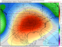
Here's the EURO EPS ensemble temperature forecasts for the next 10 days. It's comprised of 51 members, some lower and some higher. Good grief, that's more typical of mid to late April!

Beyond that period, we do get a reality check. Here's the 15 day version of the EPS and notice the crash day 1-February 25th. Readings in the mid to upper 30s are very close to average. I think they will end up being lower.

That brings me to what I talked about in my post yesterday...the SOI (Southern Oscillation Index). I showed you how pressures were rising in Darwin, Australia and how I expected the SOI to tank. Two days ago the index was positive at 13.98. Today the reading was down to -23.58. That's a dramatic drop of 37.56 in 48 hours.

Looking out to February 24th the pressure anomalies are still positive in the western tropical Pacific indicating the SOI should remain in a negative state for at least 10-14 days. That has not happened since early December.

As I noted yesterday this along with colder phases of the MJO (Madden Julian Oscillation and a negative EPO (Eastern Pacific Oscillation) points strongly to a colder and potentially stormier pattern. The lag time is usually 8-10 days for this to occur in the Midwest so the temperature crash I showed you at day 11 on the EPS coincides with the SOI drop.
Notice the difference in temperature departures between day 5-10 and day 10-15 below.


As you would expect with a plunging SOI the pattern is energized and starting next week a couple decent storms should traverse the Midwest. The first system of note looks very impressive the 24th. Severe weather is even a possibility in the warm sector while heavy snows pounds the cold sector.

Precipitation which has been meager is expected to pick up with this pattern. The EURO EPS 15 totals look like this.

Snow also returns to the Midwest but the EURO EPS keeps most of it over the northern half of the Midwest.

The GFS makes an attempt to push some of the snow further south by day 16.

Total 16 day precip. on the GFS came in this way.

For the next few days while temperatures warm, my focus will be in the SOI and how it behaves. If the index continues to fall and holds in a negative state, winter does have a chance of making some sort of a comeback. In other words, temperatures could tank just like the SOI. Finally, things are starting to look more entertaining in the long range. Roll weather...TS


Comments