


FINALLY SEEING STARS...
- Apr 1, 2017
- 1 min read

It's been pretty gloomy around here lately but I finally got some inspiration Friday night. The clouds broke and I saw the stars for the first time in what seemed like a month! Those clouds were in the skies for much of Friday, though, and played a role in the temperatures. Here were the temperatures as of 5 pm:
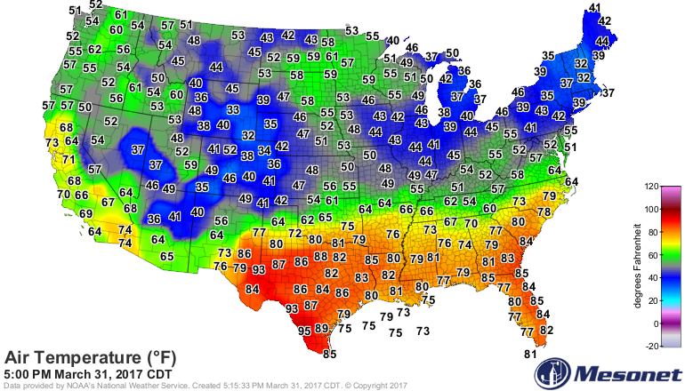
It was 44 in Cedar Rapids, but 59 in Minneapolis! You don't typically see warmer temperatures to your north... until the Spring! The sun is strong and it's going to have an impact Saturday on the recent cloud stricken areas. Check out the highs expected:

FINALLY.... SOME SUN! But... can you spot the cool air out west? Welllll that's another storm heading our way. The clouds thicken up already Saturday night and rain is back on the table by Sunday.

Not a lot of rain, but the clouds and showers will be enough to knock temperatures back down on Sunday afternoon:

The active (and mostly gloomy) pattern continues through the beginning of the work week. A stronger storm arrives in the Midwest midweek. Here's the surface pattern on Wednesday afternoon:

With those two systems, the seven day precipitation totals on the European looks like this:

And like this on the GFS:

The recent rains have helped to improve the drought conditions in much of the Midwest and the active pattern should help to improve the dry conditions even further. Here's the latest drought monitor:

The rain has also been beneficial for the budding plants/flowers and grass. Once we get some sun things will get popping around here. For now.. just looking forward to a brighter day on Saturday.
RK


Comments