WE GOT WHAT WE DESERVE, AND I LIKE IT...
- Apr 9, 2017
- 2 min read

Outside of some gusty winds, it was an outstanding weekend of weather. Here in Cedar Rapids we maxed out at 78 Sunday afternoon, a full 20 degrees above normal (which by the way is the average high for June 7th). For many of you around the Midwest it was the warmest weekend since October 2016. I hope you enjoyed our early summer preview. We earned it!
Even Sunday evening, temperatures are nice and toasty with readings at l east in the 70s from Milwaukee all the way back to Mexico.

There is a front cutting through the Midwest that produced scattered strong storms Sunday night. We'll walk what's left of those out of the area early Monday and start feeling cooler air late in the day. The chillier air will be most pronounced Tuesday when 50s are expected to be widespread. Here's what the EURO has for highs Tuesday afternoon.

On a positive note temperatures are expected to rebound nicely by mid-week and overall it will be mild Wednesday through Easter. One exception is the upper Midwest where Easter looks cooler in parts of Minnesota and NW Wisconsin. Here are some EURO meteograms showing highs the next 10 days.


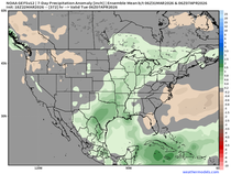
In terms of wet weather there are a couple periods where rain could impact your plans. For my area that looks to be Wednesday night/early Thursday and again later Friday and Saturday. Between the 2 systems the GFS has this for total rainfall.

The EURO came in looking like this.

Of the two systems the Friday/Saturday disturbance looks to be the strongest. There's good moisture and decent dynamic which could lead to heavier rain and potentially some strong storms. In fact, you can see a healthy line of convection crossing Iowa and surrounding states at midnight Saturday.

Timing of the front will be critical to the amount of heating and destabilization. As it stands now CAPE (convective available potential energy) appears strong enough ahead of the front for some strong storms.

If current forecasts hold the rain and storms are gone by Sunday and Easter looks to be dry in many areas. Here's the surface map at 1:00pm Easter. A hopping good day!

That's where things stand as of Sunday night. Hope your week is productive and trouble free. Roll weather...TS


Comments