MOTHER NATURE WAKING UP....
- Dec 18, 2018
- 2 min read
The sun has been shining and the temperatures have been fine. The conditions we should have seen in November are now occurring in December. And, not only has it been mild, it's been dry. Monday was the 15th consecutive day with no measurable rain in Cedar Rapids or much of my area. Today will make it day 16.

This past weekend was phenomenal. Both Saturday and Sunday had highs of 50. That was the first time with back-to-back 50s in 44 days.

Tuesday is going to be another sweet day with highs of 45-50 over many parts of the central Midwest.

Highs like that are a good 15-20 degrees above normal.

While there's nothing very ominous in the next 5-6 days (perhaps a few light showers midweek) there are signs that we are beginning the transition to a colder, stormier pattern. One of the things I've been observing closely for a couple weeks is active convection in the Indian ocean. When it's going great guns you can bet the Midwest is in a warm MJO (Madden Julien Oscillation) phase. We're still in it today.

However, this image late Monday shows the convection shifting east and south indicating the MJO is on the move. That's confirmed by the latest MJO forecast on the EURO. You can see it moving into phase 5 the next few days.

During an El Nino phase 5 tends to be colder than average over much of the nation, especially the Midwest. We do have a weak to moderate El Nino in progress.

Without the influence of the El Nino phase 5 is much warmer in December than with it. See the differences.

Considering the fact the Indian Ocean convection is waning the EURO forecast of a cooler phase 5 look makes sense somewhere in the period December 22-28. To be clear, I'm not talking severe cold initially, just a more seasonal brand than the 15-20 degree departures we've been enjoying.
If the GFS is on the right track (a big if out 13 days) a stout shot of cold air comes in just in time for New Year's Eve. It has this for temperatures the morning of December 31st. 11 below in SE North Dakota.

Wind chills are as low as 33 below around Jamestown, ND.

I don't want to get too far ahead of myself here but there are signs the pattern will be turning colder and more active near Christmas or just beyond. When I say active look at what the GFS shows for total precipitation ending January 1st. Very big numbers for December.

Unfortunately for you snow lovers, not much of it comes as snow. (the cold air comes after much of the precipitation falls). At a 10:1 ratio the 2.7" in Des Moines would come out to 27" of snow. The model only shows 2.6" there.

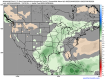
To be fair, here is what the EURO ensemble mean shows for total precipitation through January 1. Not as much but still quite significant by winter standards.

It has this for snowfall ending January 1.

Needless to say there are some things cooking but it won't happen short term and there are many unresolved details. Challenging times ahead for me after 3 weeks of nothing. Mother nature appears to be waking up. Roll weather...TS


Comments