


SNOWFALL TOTALS....AN UPDATE
- Jan 18, 2019
- 1 min read
The new data is down and so are snowfall forecasts from the models. I am working the TV side today and because of my responsibilities there I have very limited time for this site until evening. Many of you questioned why I was not all over the storm yesterday. I was but in a different capacity. That's my job, this I do on the side. I need to clone myself. One for TV, one for Tswails,com, and one for my family!
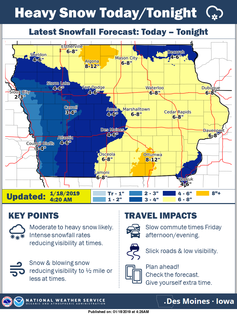
Anyway, the numbers have come in with decent consistency and it appears most of my area will see 5-9" totals, most falling after 5:00 pm. A fluffy powdery snow. Here's the snowfall forecasts. I'll start with the EURO, my preference and choice for guidance in this event.
The EURO.

The regional perspective of the EURO

The GFS

The NAM

The NAM 3K

The GEM (Canadian)

The NWS snowfall forecast.
Some start times. The heavier snow in my area falls this evening through about daybreak Saturday.

All of my region is under winter storm warnings tonight.

That's all I have time for now. It's off to TV land. Roll weather...TS


Comments