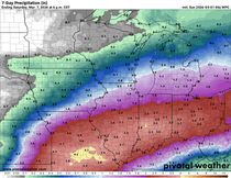
ACTIVE START TO THE WEEK...
- Apr 26, 2020
- 1 min read
We had a nice, mild, mostly dry weekend across the Upper Midwest. Sunday capped it off beautifully with temperatures well above normal and plenty of sunshine...

Temperatures will still be running mild Monday as a warm front starts to lift through the area. Some rain will be possible in the late morning/early afternoon ahead of the front.

Temperatures will then climb up after the rain moves out and there's some clearing of the clouds:

There may be a few scattered showers and storms late Monday night with more storms likely on Tuesday as a cold front sweeps through.

There is the potential for some strong storms Tuesday afternoon, but the question is how much instability and moisture will be present. The Storm Prediction Center has outlined a marginal risk for severe weather in eastern Iowa and into Illinois with a slight risk in parts of Missouri.

I wouldn't be surprised to see the slight raised further north, and we'll keep and eye on Tuesday. A few showers may linger into Wednesday on the backside of the low pressure system that will move through on Tuesday. Temperatures will get knocked back slightly Wednesday, too. Right now the rest of the week appears to be dry.
RK


Comments