


A BIT OF CALM AFTER THE ROLLER COASTER
- Jan 11
- 3 min read

We have had quite the journey in the weather department over the start of January with warmth, severe thunderstorms, bitter cold and bursts of snow. Saturday we had an Arctic Front traverse the region bringing burst of snow across the area with overall limited accumulation. I had the privilege of watching the Bears/Packers game at Soldier Field in Chicago and we had the most beautiful snow pregame. The bitter cold thankfully held off to after the fact.
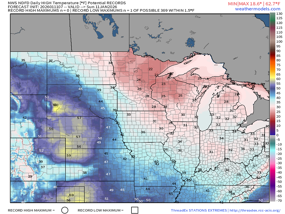
Sunday will be a chilly one across the region with highs near 30 across eastern Iowa into northwest Illinois. This will be accompanied by some nice sunshine at least! Very cold air aloft will be making its impact keeping our temperatures down. However, we will see some warming before yet another strong front looms mid/late week.

By Tuesday highs will run quite a bit above normal locally with a rather large gradient in temperatures from north to south. Northeast Iowa and southern Wisconsin will reach near 40, meanwhile from about Waterloo to Cedar Rapids and the Quad Cities, highs will likely push closer to 50. There is some much more anomalous warmth just to the southwest, however that will not reach the region as a cold front will shut it down.

The upper air pattern becomes quite favorable for a conveyor belt of near-to-below-normal temperatures Wednesday into Thursday with strong northwest flow attributed to a rather robust upper-level low. While this northwest flow will be quite dry, I would not be surprised to see light snow showers in the region Thursday and Friday with pieces of embedded shortwaves in the long wave troughing pattern. A clipper or two is possible that could even bring some accumulating snow Friday and Saturday, but the confidence level in that is quite low at this point.

The 50-member ensemble of the European shows the higher potential for accumulating snow Friday/Saturday with nearly all members showing snow, albeit somewhat light, over the Quad Cities. There are some rather big differences in timing at this point, however. The model average has about 1" of snow by Friday evening. This still does not appear to be a major threat at this point given lackluster moisture content, however these clippers can rapidly intensify in the short term so be mindful of the threat looming late week.
The Euro

The GFS
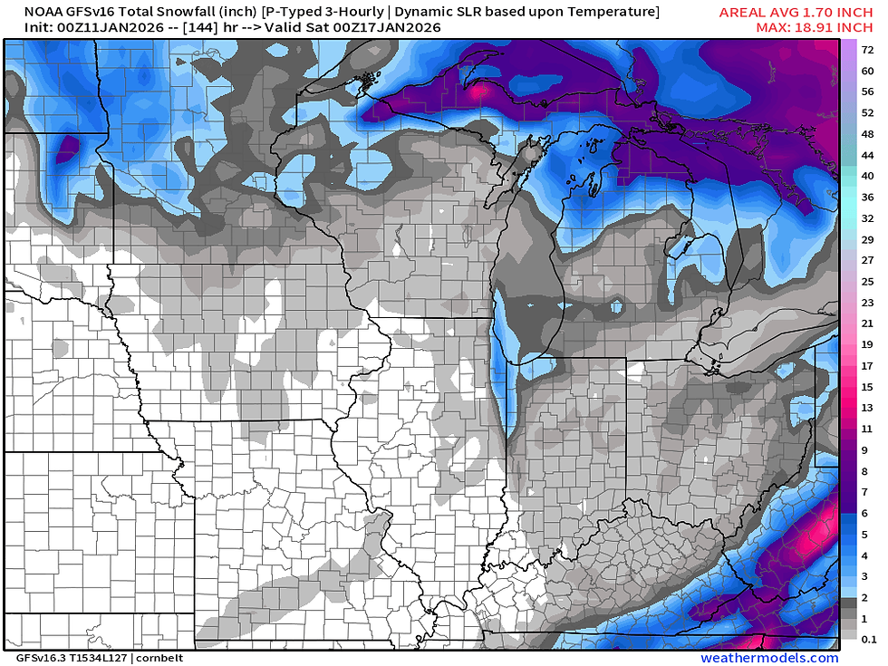
Worth noting the operational European model is well in line with the European Ensemble showing the snow threat late week while the operational GFS is quite different showing not much at all for accumulating snow with a clipper. The Euro has been body slamming the GFS in terms of performance in these system as of late, so I would not be shocked to see the GFS cave to the Euro... again.

In terms of temperatures, notice the big drop Tuesday into Wednesday with that aforementioned cold front. Behind it I would call temperatures seasonal to perhaps slightly on the cooler side of normal. Overall not too bad as we get deeper into January. Without a sufficient snow pack in the region those cold blasts get quite difficult to develop and stick around. We'll need a few big snow systems to really bring a winter shot of cold air, but for now, enjoy it!
Have a great rest of the weekend, friends.
-Meteorologist Nick Stewart


Comments