


A BRIEF BREAK BEFORE MORE STORMS

It has been quite the stretch of active weather across the region and we're finally getting a well-deserved break to start off the week. Aside from a stray shower or storm Sunday, most of your Sunday and Monday will be dry with decreasing humidity behind a cold front. Monday, in fact, will be beautiful with sunshine and seasonal temperatures with low humidity.

Just in the last three days a widespread area of 2-4" extends from eastern Iowa into northern and central Illinois, with some areas easily picking up more than 8" of rainfall. We knew the pattern looked active, and this time last week the models weren't giving us a clear picture but the pattern supported it. That is why you can't, and we can't, just look at models. We use our experience and knowledge of the overall pattern to help. The ingredients were all there it's just hard to know what exactly was going to happen. Unfortunately, flooding rains were the result.

To reiterate, Monday looks lovely across the region. Plenty of sun, lower humidity and highs containted in the low 80s. A great start to the week before we start to turn more active once again. In addition to heavy rain, severe weather may also be on the table.

A Level 2 of 5 Risk, a Sight Risk, is in place across the area with another cold front on approach. Higher resolution models are starting to come in range and are indicating some potent storms in the region Tuesday late afternoon and evening. All hazards are possible at this time including damaging wind, large hail and a few tornadoes. Wind is likely the highest threat at this time in addition to more heavy rainfall.

Instability and wind shear are sufficient for organized storms, and moisture levels are supportive of more heavy rainfall. This does not appear to be on the high end given the early-week cold front takes a lot of moisture away from the region which does limit just how much instability is in place. This also likely starts to weaken after crossing I-35 where there is less instability present.

Northwest flow mid-to-late week likely continues to bring a chance for showers and thunderstorms. Tuesday, Wednesday and Friday all show up as the highest potential days this week, and those rain chances linger into early next week as well. The good news it does does a break possibly developing just in time for the weekend. This will be watched closely.
FRIDAY

SATURDAY
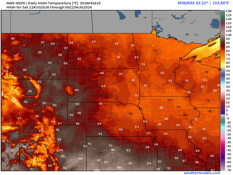
Late this week, some guidance is trending drier while other guidance keeps the rain machine active. After Thursday I would say confidence is quite low, but I'm leaning towards rain chances lingering through Friday, with a potential break next weekend. Cooler-than-normal temperatures are also likely late week into the weekend.

The European Ensemble for example has average temperatures running 2-5° below normal Wednesday through Monday of next week, the highest weighting of that will be late this week into next weekend. Northwest flow will bring some of the cooler temperatures, but still cannot shake the possibility of storm systems tracking along that northwest flow into the region. Will watch this very closely and hope the storm track stays away from our area so we can dry out some.
-Meteorologist Nick Stewart


Comments