


STARTING THE WEEK WITH CHANCE OF STORMS
- 15 hours ago
- 2 min read

An active week of weather is forecast across the Upper Midwest with low confidence on exact timing and placement of storms, but higher confidence in storms in the region.
A Level 1 to 2 of 5 risk of severe weather covers the region Monday and Tuesday with damaging wind gusts and large hail.

MONDAY - Forecast predictions are somewhat nebulous this morning. There will be the possibility of storms popping from eastern Iowa to northern Illinois in the evening hours. Another round of storms will be possible late Monday night into early Tuesday morning with a complex of storms approaching from the west/northwest. Overall heavy rain, strong wind gusts and large hail are likely with any storms that form.

The HRRR does not have much around the Quad Cities, but some other models like the RRFS does. Confidence is quite low as to where exactly storms may form. The HREF ensemble (above) does show some potential locally.

TUESDAY - Storms may be ongoing early in the day from remnant storms crossing through the region. A boundary will likely be kicked off from these storms and set up over the region. This could be the focal point for more storms Tuesday afternoon and evening. Once again heavy rain, damaging wind and large hail are on the table.
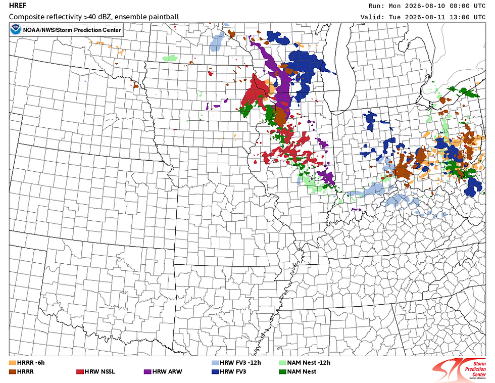
Most models have storms moving through the area towards daybreak Tuesday as a complex makes its way across the corn belt from the Dakotas/Nebraska. Depending on the strength and timing of this overnight complex, this could have rather large implications on the severe threat Thursday potentially pushing it farther south.
I want to stress again, these types of patterns are some of the most difficult to forecast. The ingredients are all there and are on the higher end of things with plentiful moisture and instability. Getting storms to form, however, requires Mother Nature to turn those ingredients into a cake (or in our case a thunderstorm) and we lack the skill to say exactly where and when.
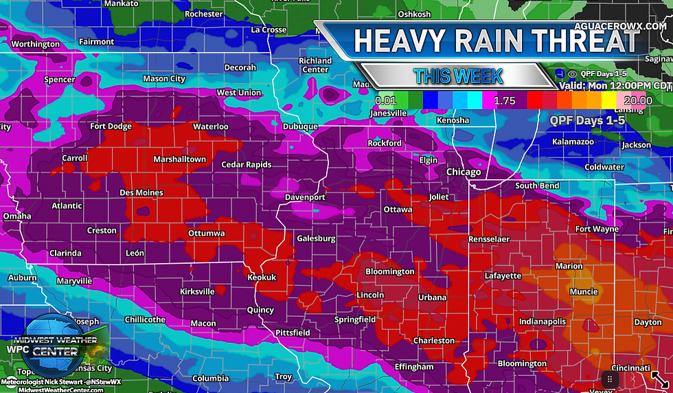
Keep a careful eye on the forecast and have ways to receive severe weather alerts. Things may change quickly. Once storms start to form there should not be much holding them back. Daily storm chances will continue through the week. The latest forecast from the Weather Prediction Center over the next five days has widespread 2-3" across our area. Confidence is low in the specifics, however it's high that there will be storm chances daily in the region.
It appears Tuesday and Thursday are some of the higher probability days at this time in my opinion based on the plethora of model guidance to take in.
Have a great week, friends!
-Meteorologist Nick Stewart


Comments