


A FEBRUARY THAW...
- Feb 2, 2023
- 3 min read

BEST DEAL OF THE MONTH AT THE CHURCH
I still have this coming weekend open at my Airbnb just north of Galena. You can get 2 nights for the price of one. Plus, due to the short notice I will take an extra $100 off the price. The total cost is $400 dollars for Friday and Saturday night, a savings of $600 bucks. With Valentine's day coming up, why not treat that special somebody with a romatic trip to one of the regions most unique destinations. Call Carolyn 563-676-3320 or E-mail Carolyn at carolynswettstone@yahoo.com This is a first come first serve deal. CLICK FOR PICTURES
I
E
ENOUGH WITH THE COLD AREADY...
We've had a winter revival here the past couple of weeks with the return of snow and lately cold. Here's the snow that's fallen over the last 14 days. The are near and north of HWY 20 took the lions share with a lot of reports in the 10-16 inch range.
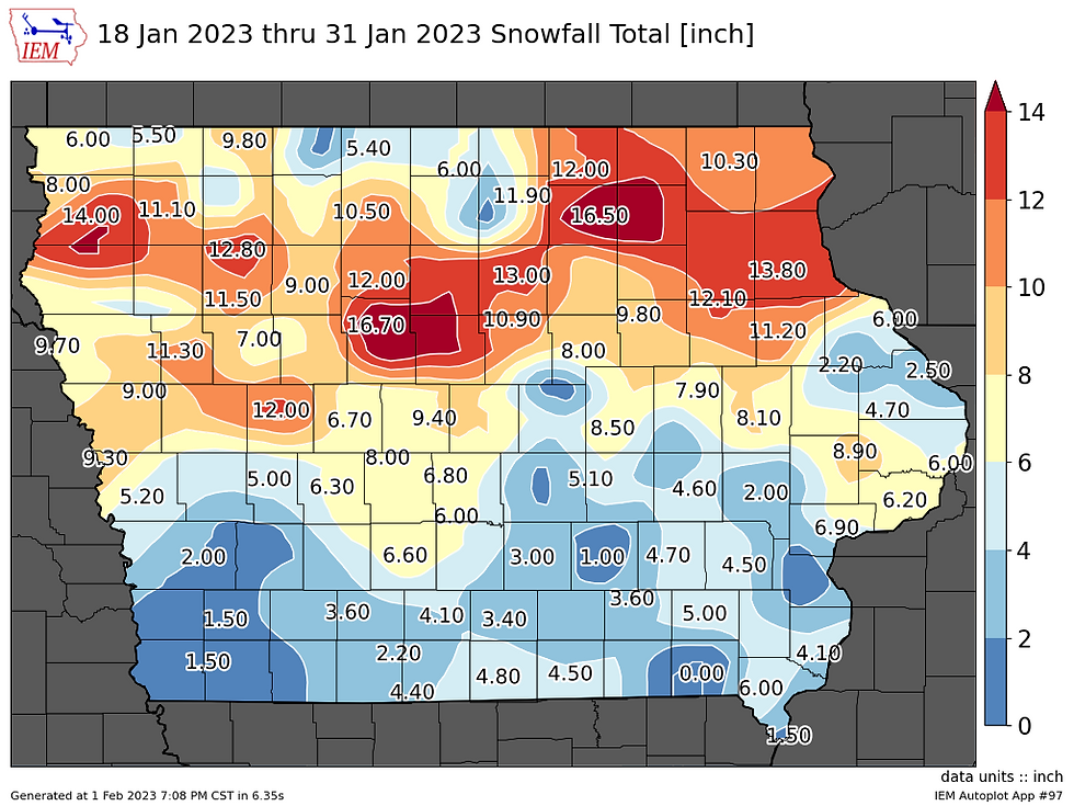
And as you can see, compared to the mean the past week saw snowfall amounts in my area that were 2-3 times what's typical.

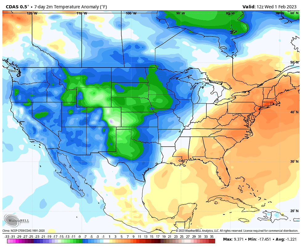
As for temperartures, the past 7 days readings have averaged 3-4 degrees below normal across my region.
ONE MORE DIP AND THEN WE THAW WITH AWE...
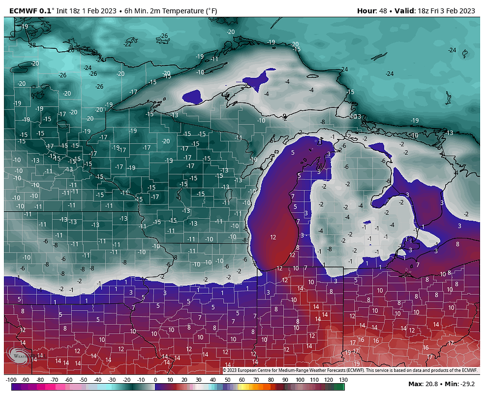
As I write this, another Arctic front is surging our way. It will be in and out of here in a couple days but it will make a noticeable impact, especially Thursday night and Friday. The cold front swings into the north around noon Thursday so temperatures will get a chance to moderate before readings plunge later in the day. Highs will reach the mid 20s north before falling in the early afternoon. The far south with no snow and a later frontal passage could see highs in the low 40s, especially south of HWY 34. Thursday night the cold wastes no time taking hold with lows by Friday morning below zero north of I-80. The EURO shows this for lows.
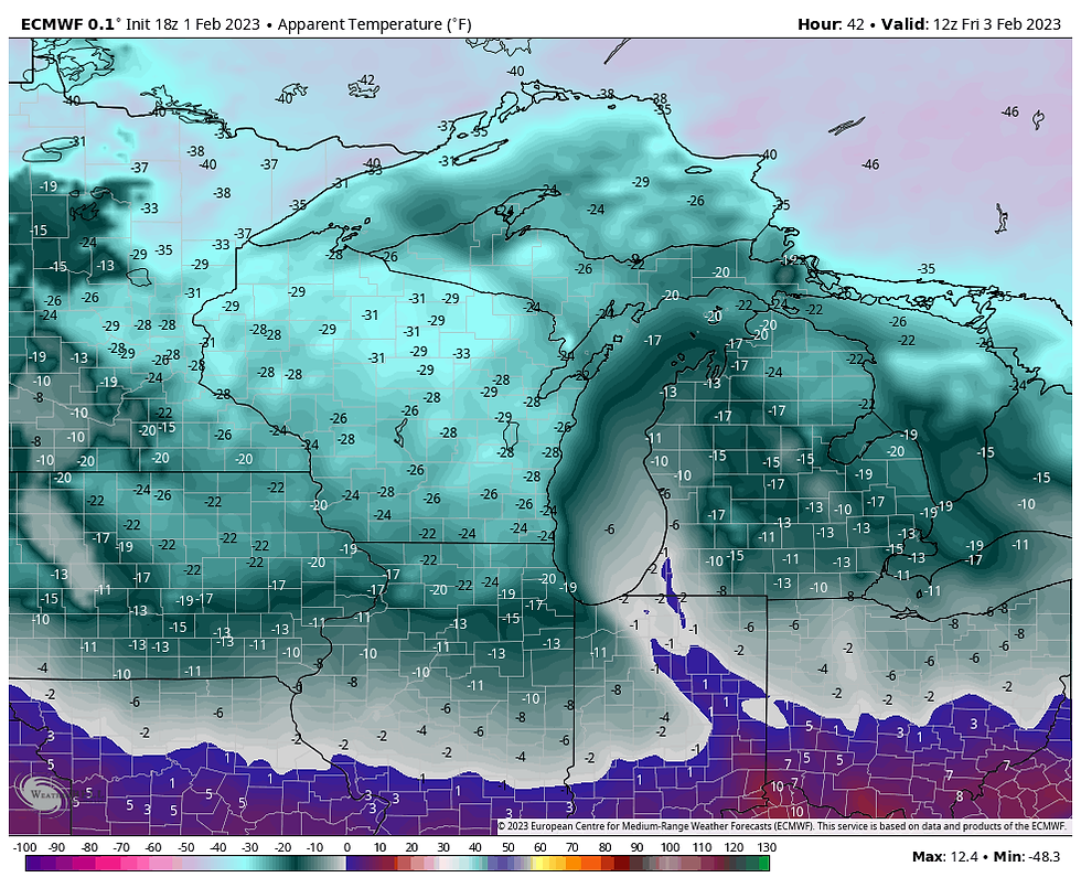
At their worst, wind chills will reach 10-20 below around daybreak Friday, coldest in the north.
Winds will quickly subside Friday as the High pressure ridge axis approaches. That is a good thing as temperatures remain cold with highs of 8 north to about 20 in the snowfree areas of the far south.
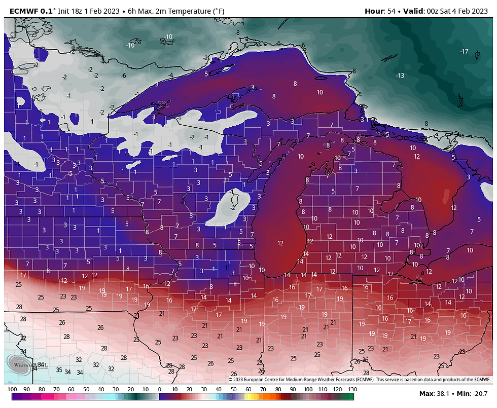
Readings will fall quickly Friday evening and could sink a tad below zero in the north before leveling off and steadily rising towards morning.
Saturday strong warm advection kicks in producing a breezy but warmer day but temperatures heading for the upper 30s north to the upper 40s south. Sunday, a weak front grazes the north and temperatures may cool a couple degrees into the mid 30s. Otherwise, highs of 45-50 prevail south of I-80. No rain or snow is expected through the weekend and into the day Monday.
So lets examine this thaw which looks as though it could last the better part of 2 weeks. What I'm seeing is the MJO (Madden Julien Oscillation) currently in phase 3. That anologs to cold temperatures in February which we are certainly seeing.
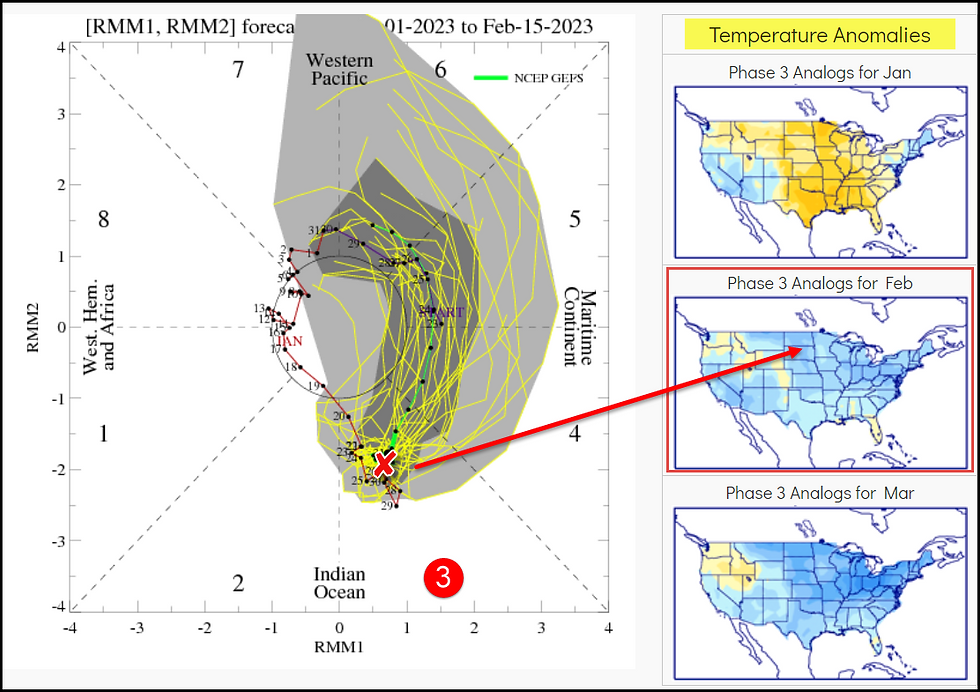
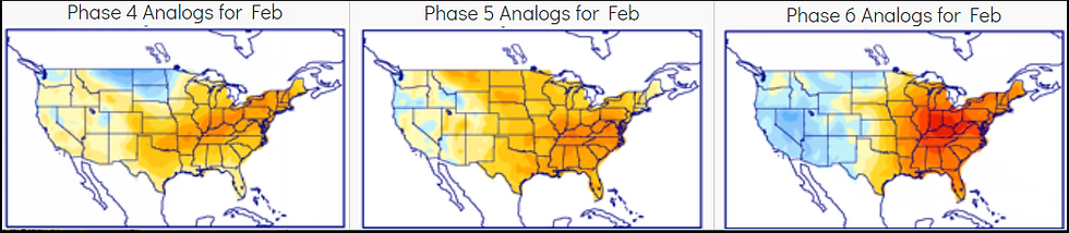
Convection though is firing in the Indian Ocean that correlates to the MJO cycling into phases 4 this weekend and eventually 5 and 6 by February 15th. That is a very warm signal. Take a look at the temperature analogs for 4, 5, and 6 in February.
That has the makings of healthy thaw with a western trough and eastern ridge. That's precisely what the EURO is showing February 13th.
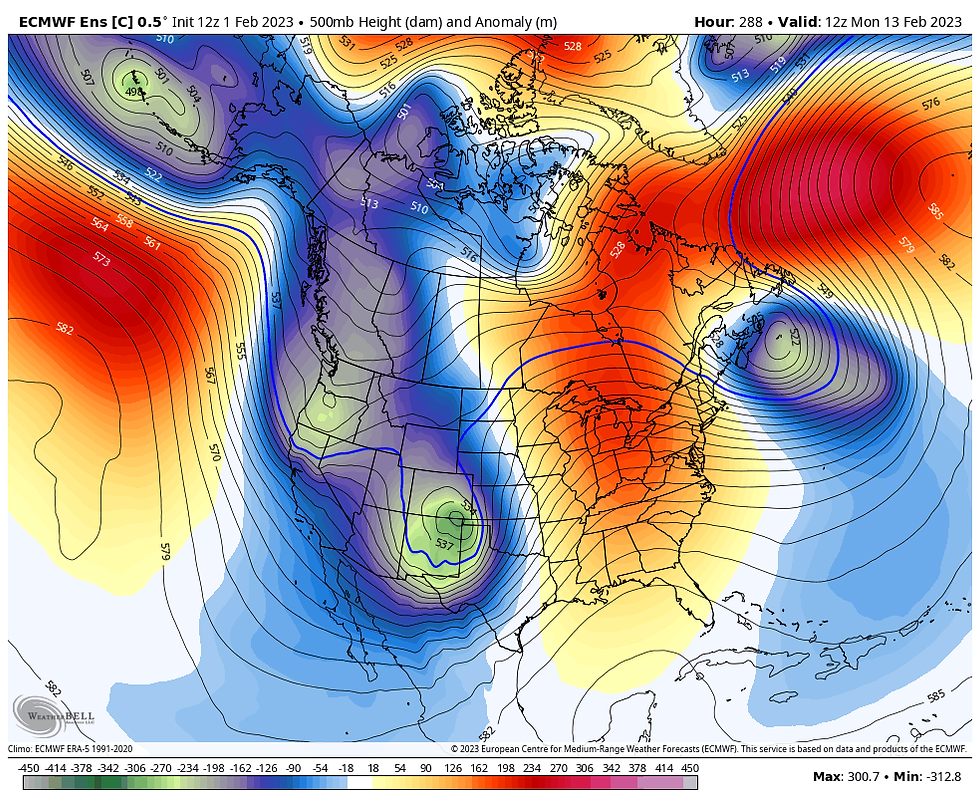
Get a load of the anomalies it shows the 13th.
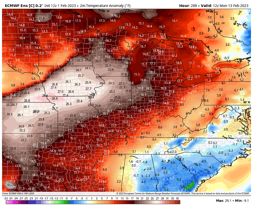
That would easily send highs well into the 50s, perhaps near 60 in the south if the EURO verifies. The Climate Predcition Center is on the bus in the 8-14 day period showing a high chance of above normal temperatures. With the Gulf of Mexico open for business, above normal precipitation is indicated. Something I definately agree with.

That my friends is the good news I will leave you with in this post. Have a strong day and roll weather....TS


Comments