A LATE-NOVEMBER PATTERN FLIP TO WATCH
- Nov 17, 2025
- 3 min read

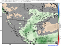
Two weeks ago we discussed late November potential given the signals that, at the time, were just starting to pop in the teleconnections. The North Atlantic Oscillation, Arctic Oscillation and the MJO were all starting to to shift to a colder signal come late November into December. That signal is now starting to enter the range of the longer-range model guidance, and the cold signal is starting to show up in the extended range. The upper air pattern above on Black Friday on the European Ensemble is certainly looking much colder compared to where we are now, and it may be the beginning of a cold start to Meteorological Winter.

The Arctic Oscillation is in the dip now, and it projected to dip again late month which is usually a precursor to a pattern change, not when we see the impact here in North America. These negative standard deviations are favoring a colder pattern in November and December.

The 500mb pattern using Novembers with AOs of or below -1 are rather significantly cooler across the Midwest and Great Lakes region.

The MJO in particular has really started to shift to colder phases over the last 24 hours as well, yet another signal of a colder air come late November/December. Many recent runs and ensemble members are swinging not only into Phase 7, but a somewhat amplified Phase 7.

Analogs in Phase 7 centered on December (above) show that cooler phase when switching from Phase 6 to 7.

Now in weather model land, notice on the European Ensemble the 850mb temperature anomalies start spilling to colder late November right around Thanksgiving. This has been a trend to watch as we start to approach the holiday week.
I want to give a major caveat - at this range specific details are impossible to nail down. I am already seeing weather enthusiasts post some long-range models showing snow and cold on Thanksgiving with doom and gloom. Right now what I can comfortably say is that there are signals of a pattern turning colder and more active late in November, but what that means exactly for eastern Iowa and northern Illinois are impossible to discuss. As always, if you have travel plans around the holiday, watch the forecasts closely as you always should.

By early December, on the extreme long range of the European Ensemble, the pattern continues to look active and colder which would continue to match the pattern of the teleconnections. Again, we are very much on the watch and see with a peculiar interest side of things for now.
SHORT-TERM FORECAST

OK enough of that, let's talk about the short-range forecast. Late Monday into Tuesday a slow-moving boundary will lead to an overrunning rain and wintry mix setup across the region. Rain will be most likely eastern Iowa and northern Illinois with a higher chance of wintry mix and even snow accumulation for southern Minnesota and Wisconsin. A swath of 1-2" will be possible from Rochester, MN to Madison, WI.

Model forecast soundings off the HRRR show a saturated, but near-freezing, profile which indicates a wet snow and wintry mix more than a fluffy white snow. This will keep the total snow accumulation limited, but again I would not be surprised by a 30-50mi wide area of 1-2" of snow.

That transition from rain/wintry mix to snow is projected to occur early morning Tuesday which therefore could have impacts on the morning commute with slick roadways. Certainly a tricky forecast for the region!

The late-week system also continues to look likely later Wednesday into Friday. The seven-day forecast has widespread 0.5" to 1.5" over the region with the heaviest rain continuing to likely miss to the south. I also think these numbers may be on the higher side of what we might actually experience, unfortunately. We need the rain and this continues to not look the best locally.

The probabilities of 0.25" of rain are sitting only about 40% locally on the European Ensemble, again which is why I think the forecast numbers from the Weather Prediction Center are overdone. It would be lovely for this to trend northward, but so far it is a losing battle.
I'll wrap it up there. Have a great week everyone! We'll see you next weekend.
-Meteorologist Nick Stewart


