


A TASTE OF SPRING...
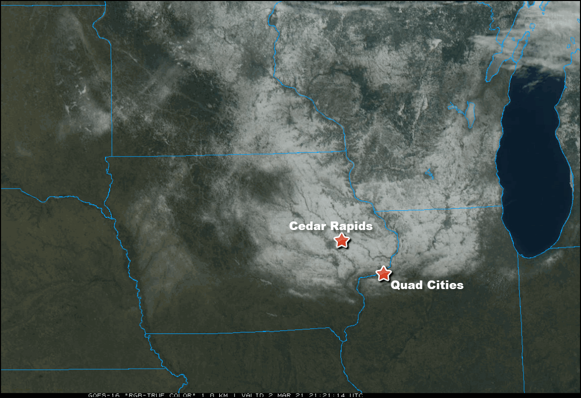
Here's a sweet GOES 16 hi-resolution visible satellite imagery. The detail is exceptional and in this case on a sunny March day you can clearly see the southern edge of the snow cover inching towards I-80. You can also pick out the river valleys of eastern Iowa and northern Illinois. More important from a temperature perspective, bare ground now exists from my southern counties all the way to the Gulf of Mexico. That makes it easier for warm air masses to make a push into the Midwest going forward.
Here you can see the snow depths reported Tuesday morning. Despite the recent thaw and melting snows, 4-9" is still hanging tough near and north of HWY 30.
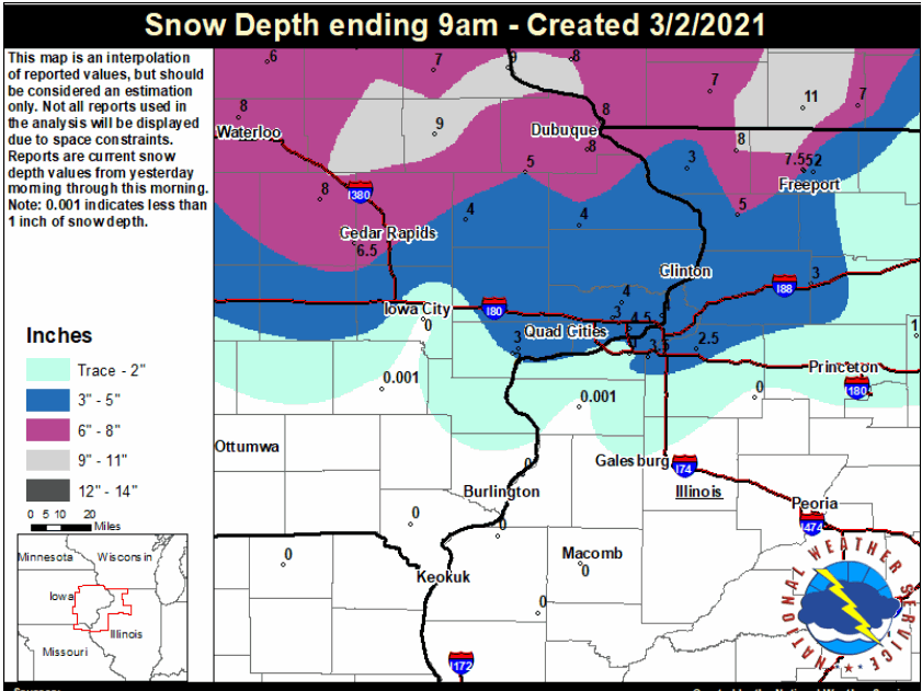
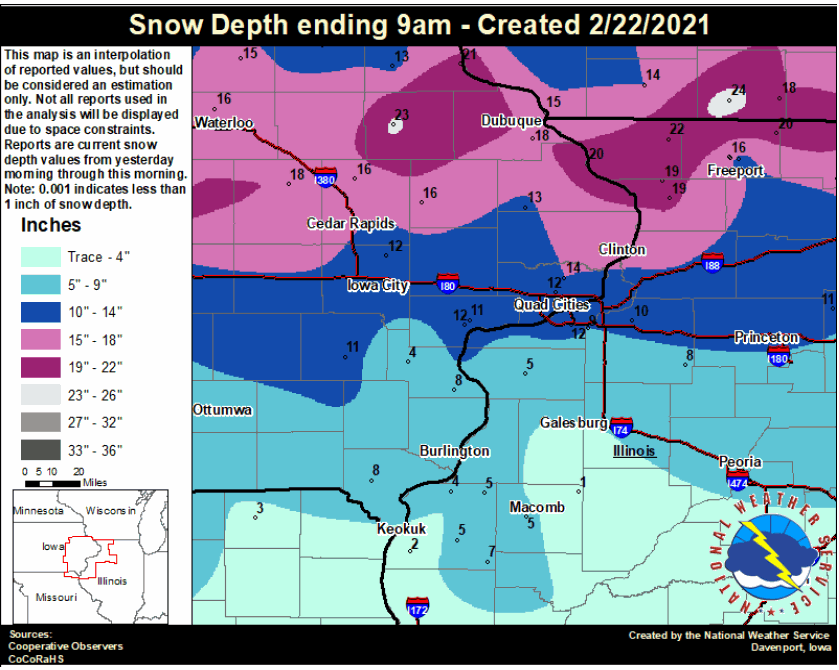
That's a lot better than 10 days ago when Independence was reporting a 23" depth.
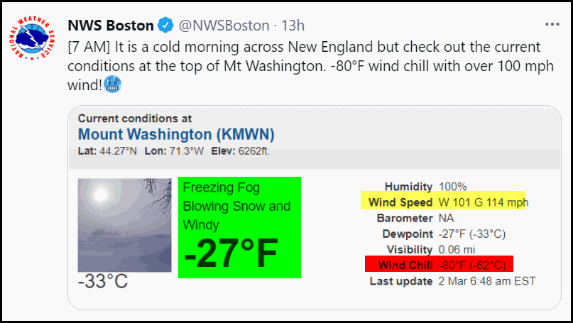
By the way, it was a windy cold day here in New England Tuesday. In my opinion one of the worst days of the winter so far here in Portland, Maine, which isn't saying much. Less than 3 hours away at the 6262 foot peak of Mt. Washington, it was especially vicious. The 7 AM reading of 27 below was accompanied by wind gusts of 114 mph. The wind chill was a refreshing 80 below with near zero visibility. Nice day!
Then there's Los Angeles which just went the entire month of February with no rain. That's only happened 8 times in 144 years. Too much of a good thing.

Then there's the warm-up that's coming to the central U.S. Lots of places showing odds 70-90 percent of temperatures averaging above normal March 7-11th.

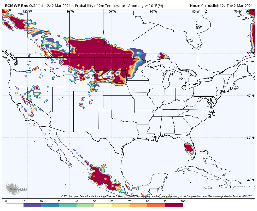
This is kind of interesting too. It's an animation showing the odds of temperatures being at least 10 degrees above normal for each of the next 10 days. Those yellow, orange and red colors indicate 60-90 percent odds. That's where you want to be if you like it mild.
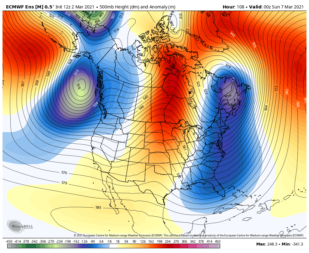
The time that's most likely to see the warmest readings is generally within that period March 7-11th. You can see why in this 500mb jet stream animation which builds a ridge over the east and a trough over the west. That should open the door for some spring like temperatures.
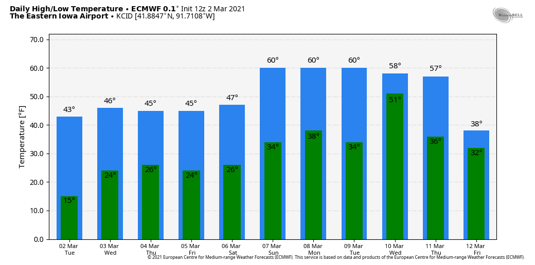
It's worth feasting your eyes on these 10 day temperatures the EURO is projecting for Cedar Rapids. Yea, this is what I'm talking about! We just need to keep melting that snow to get those readings up around 60.
The upper level flow we're going to will eventually get us back in the game as far as storms go next week. Both the EURO and GFS show a wet period with above normal precipitation the 9th through the 18th. Here's what they indicate for total precipitation. At least most of it is rain in my local area.
The EURO

The GFS

Short term, there's not much to say but high, dry, and tolerable. Highs the next few days before the big warm-up will remain in the 40s where there is snow, more than 50 where it's gone. Throw in some sunshine and you've got yourself a nice taste of spring that gets even more pronounced next week. Roll weather...TS
ONLY 42 COPIES LEFT:

I will take this opportunity to mention that I only have 42 copies left of my book on the most expensive thunderstorm in United States history (13 billion dollars in estimated damage). This will be the final printing. If you are interested in having the most authoritative account of this extreme event I would suggest you act now. Don't miss this opportunity to own the weather story of a generation. You can order yours at derechobook.com
BOOK ENDORSEMENT.
*This book has been quite the talk with the Iowa State Library promoting it. I have never seen the State Library promote any books like this unless it was an award winner of particular interest to libraries. Hopefully your sales are through the roof!
Jolene Kronschnabel-Director of Hawkins Memorial Library, La Porte City, Iowa


