A WINTER STORM IS BREWING
- Nov 23, 2025
- 3 min read

Overall confidence in a weekend winter storm is slowly increasing. One thing I want to stress right now is that, yes, we are talking about it quite a bit but that does not necessarily mean it will be a big impact for you or our area. We know there will be impacts potentially in the region, and given the Thanksgiving holiday travel period it is worth watching for all parties.
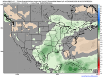
Above you can see the Weather Prediction Center is currently advertising increasing confidence at Day 7 the potential for accumulating wintry precipitation across the region. Right now still a lower confidence at 10-30%.

Following Thanksgiving 2018 a powerful winter storm affected the region. I remember very well how Chief Meteorologist Terry Swails and I were very up front with the forecast about a week in advance and the competition at the time was not particularly fond of us talking about a long-range forecast. What ended up occurring was a major high-impact winter storm that remains one of the most exciting storms I had the opportunity to report in and play in.

The snowflakes with that event were what I called hamsters. This was my view over US218 just south of Iowa City. Massive snowflakes that led to immediate impacts on roadways and led to a travel nightmare on the roadways. I remember several parents commenting to us thankful they had advance warning about getting kids back to University of Iowa ahead of time to beat the snow and the traffic nightmare that developed on I-80 with blizzard conditions.
When done responsibly, I think it is very important to discuss long-range forecasts even when they might have limited confidence during high-impact times. We are here to discuss the forecast, confidence and impacts to you as we see it, and that's what we are going to do.

The upcoming weekend storm is still thousands of miles away across the northern Pacific Ocean. Two areas to watch are likely to "phase" together, or come together into a stronger storm system. Where they phase and when will have major implications as to the impacts and area to watch.

The storm system Saturday through Monday will likely be bimodal with a heavy rain and severe threat down south as well as a snow threat up in the north. The European Ensemble indicates this somewhat well valid early Monday morning (remember still a week out at this point so there will be some changes).
THE GEFS

THE EURO

The mean snowfall through early Monday next week is pretty similar on both the American and European Ensemble forecasts. Remember an ensemble is the same model run numerous times with different initial conditions which will help us give confidence in a forecast. This actually puts our area in a pretty favorable position for at least some accumulating snow, especially with that leading portion Saturday.
THE GFS

The EURO

Both deterministic runs of the GFS and Euro are actually in pretty good agreement valid late Saturday/early Sunday. The placement of the heaviest snow is different though with the GFS farther south and the Euro more north. Given the lack of snowpack across North America as we discussed yesterday and the lack of really cold air ahead of this storm, I do think it's going to be a battle to get heavy snow in our area, so I am more on the European camp at this point in time. With that said both models to produce snow in the area and likely enough to be impactful to travel.

For what it's worth analogs, or historic events that are similar in shape as our upcoming weekend storm, favors farther north with the heaviest snowfall. This does align a general shape though with the ensemble forecasts. While not a perfect tool for forecasting it does give credibility to the snow forecast in our area, so for the snow lovers that's a great sign.
So to recap everything here's where we stand - a storm continues to take shape and looks like it may lead to some travel impacts this upcoming weekend. While timing, severity and exact area remain unknown at this range the general idea is midday Saturday through early Monday being the time frame to watch. The snow threat continues to look along and north of the Iowa/Missouri border. This could push farther south to perhaps US36 (think Kirksville, MO/Quincy, IL).

Following the winter storm a shot of below-normal temperatures moves in and takes over much of next week likely persisting into the following week. It looks like meteorological winter will be off to a fun start! Have a great week and wonderful Thanksgiving everyone!
-Meteorologist Nick Stewart


Comments