


AND NOW, WE PAUSE FOR A BREAK
- Apr 4
- 3 min read
These have been busy times around the region with showers and storms roaming the area since Monday night. Along with the beneficial rain we received, came the unwelcome element of widespread severe weather Thursday. That included 3 reports of tornadoes in my area. Along with that, 35 reports of a hail, much of it concentrated in my local area as supercels developed along a warm front stretched across my central counties. 2 miles east of Martinsburg in Keokuk, County, (and 3 miles north of Thompson, Illinois), 3 inch diamter hail was found. Numerous gusts of 60 mph were reported with a maximum blast of 67 in Prophetstown, Illinois
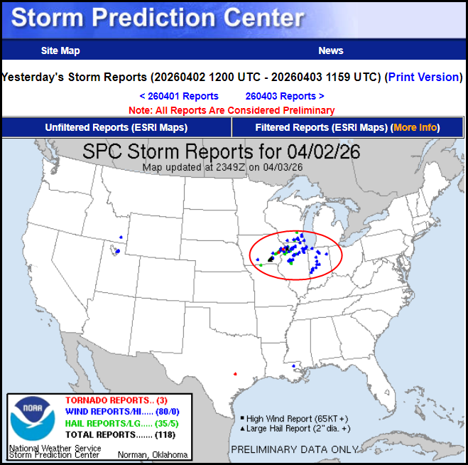
The storngest tornado tracked through much of NW Clinton, County into a small part of SE Jackson, County. It was on the ground for 18 continuous miles and with winds of 105 miles per hour it reached well into EF1 status. The storm raged from 5:25 ro 5:43 reaching a width of 250 yards.
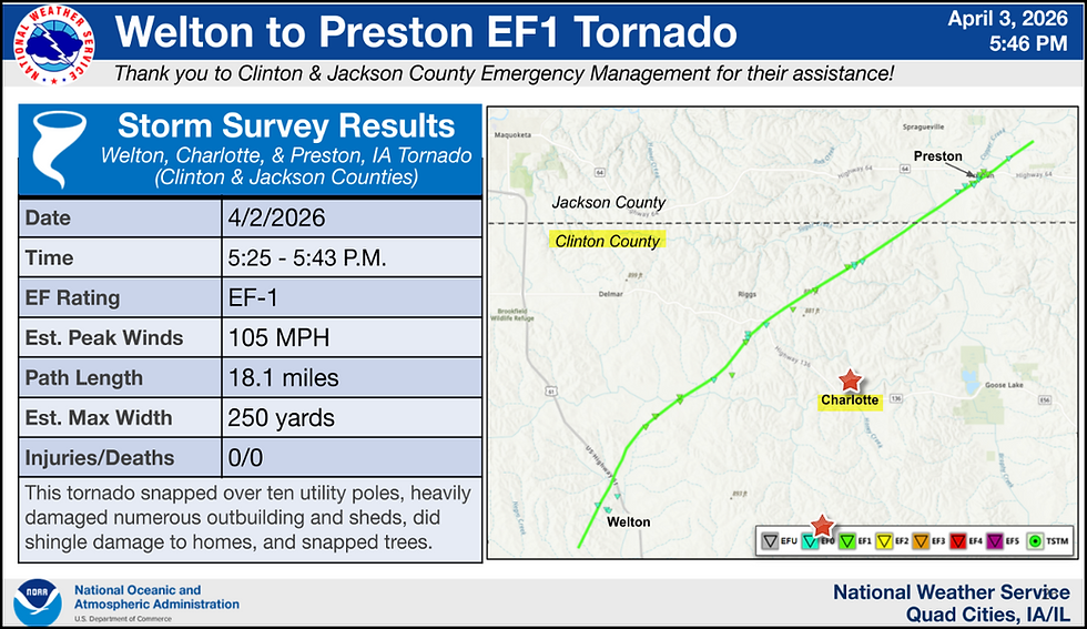
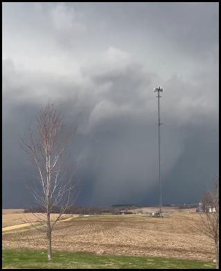
I also want to thank Cheryl O'Conner for this picture she sent me of the the twister tracking NW of Charlotte towards Preston. That will get your attention! I appreciate the picture and we are glad to hear of no injuries, despite plenty of damage to outbuildings, trees, shingles, and snapped utility poles.
Friday the most active weather remained largely to the southeast of my area due to the limited progress of the warm front. I felt that would be the case locally and mentioned I did not expected to see much if any severe weather north of HWY 34. SPC was much further north with a marginal risk into Wisconsin, slight risk to Dubuque, an enhanced risk near and south of I-80. In the end, little if any severe weather was found north of the Missouri border. I won that battle, there just wasn't the necessary instability.
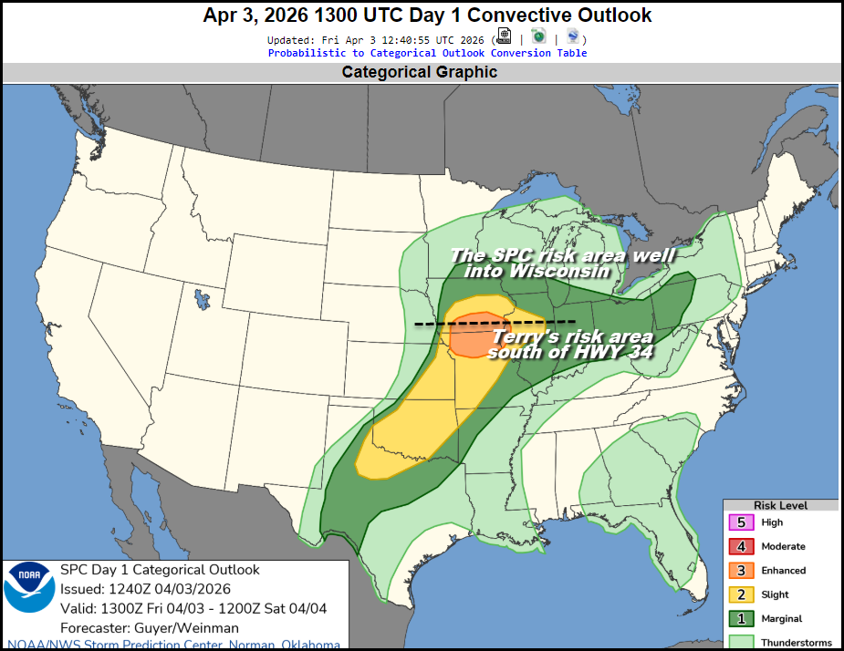
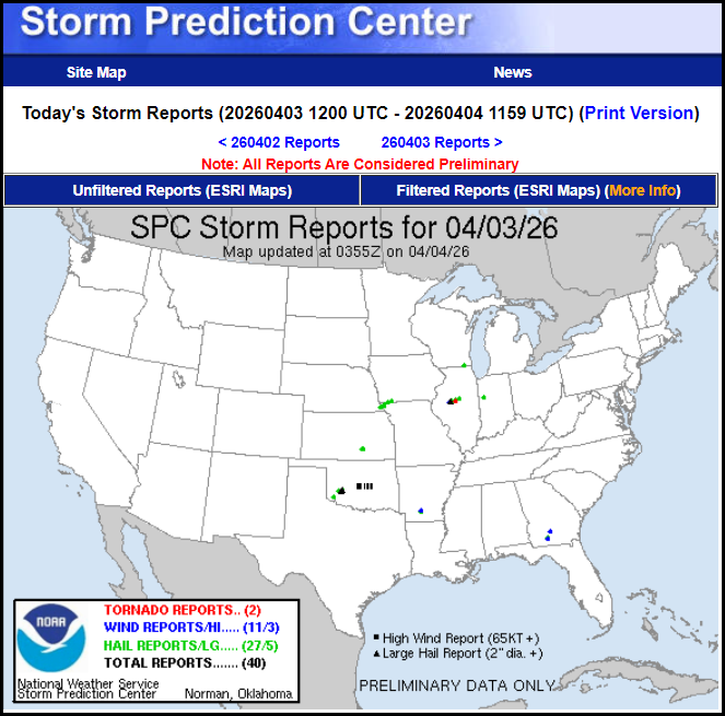
Here's Friday's severe weather reports...look hard. Even the big boys have bad days, thankfully they are few and far between. They typically have plenty of game and certainly my highest respect.
HOW BOUT THAT RAIN!
Final rain totals are not in from the weeks rain awaiting this final line of storms advancing east Friday night along a cold front. This ultimately shuts the wet pattern down for a few days as it cuts off the flow of deep moisture, and finally kicks the rain making trough off to the N/NE. This could add another 1/4 to 1/2 inch of rain to the final tallies.
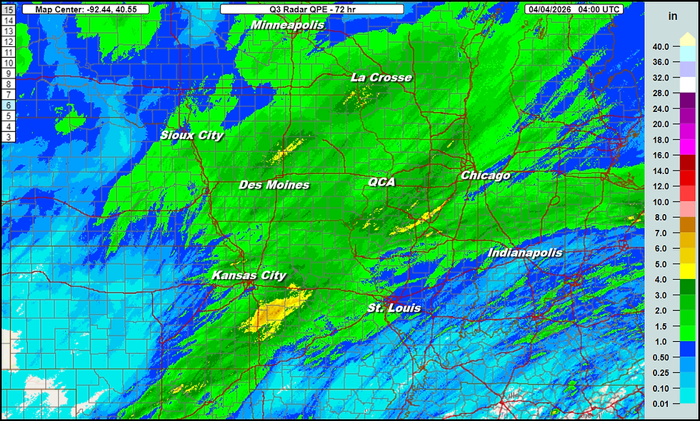
Below are the rain totals compiled over the past 72 hours through 11:00pm Friday. That's what we add to with the final push Friday night. On average, 1-2 inches was common with some local spots up to 3.
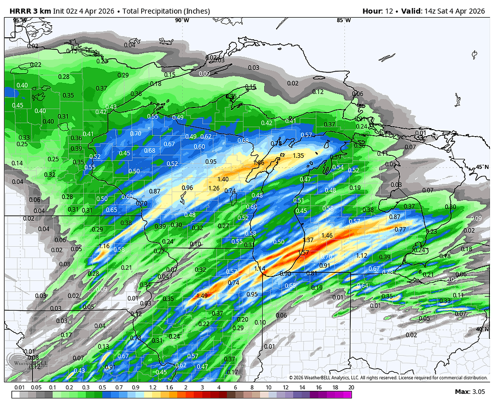
As a guide, this is what the HRRR shows the remainder of Friday night. You can see it could have even been higher for us without our proximity to the dry slot with Friday's storm track through eastern Iowa. You can clearly see the split with a heavier rain band to the NW and another one to the SE.
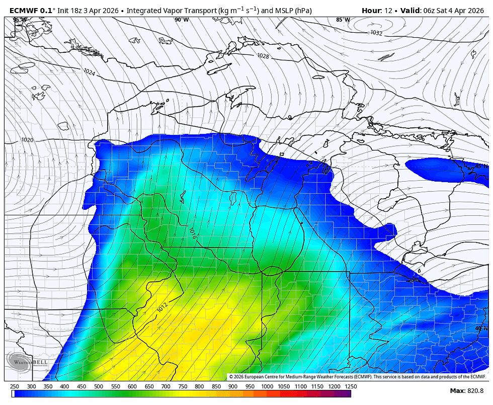
Below on the integrated water vapor transfer, you can watch the low level moisture get scoured out during the period Friday night through Saturday. Hense, a chance to dry out into early next week.
EASTER WITH A SIDE OF CHILL...
This is also going to give us the chance to chill out over easter weekend with brisk NW winds up to 30mph delivering strong cold air advection. Saturday highs will likely range from the mid 40s north to the low 50s south, well below normal. Instability clouds should rule due to steep lapse rates from cold air aloft. A few brief showers or sprinkles/drizzle are also possible in the afternoon. A hangover from the previous 4 days.
Easter Sunday should see some improvement with with at least partly sunny skies. The strong April sunshine should allow highs to climb back into the 50-55 degree range. Winds won't be quite so blustery as Saturday. Nothing special but it will be dry and a noticeable improvent from Saturday. The rabbit says fine jumping conditions. I say jump your heart out. Two eggs and a stale chewy peep for me please.
The next chance of rain should hold off until at least Wednesday. At that point the pattern reverts to a western trough and its back to the races with what looks to be another wet and warmer period. Looks like we'll make up for some lost time in the rainfall department.
Have a special Easter weekend everyone and to my daughter far far away but in mu heart, Your Easter basket is full and ready for you to pick up at your earliest convenince. Gas on me. Roll weather...TS


Comments